GPS Maps Navigation Directions
- 105.00
- 4.3
- Installs
- 500.00K
- Price
- Free
Screenshots
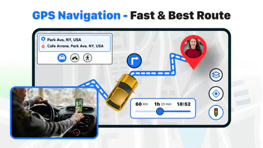
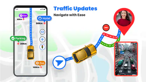
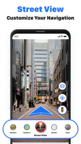
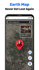
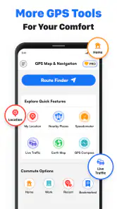
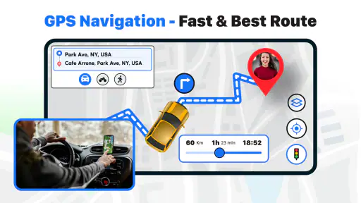
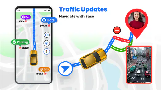
Analysis by Reviewed
I spent time with GPS Maps Navigation Directions as a practical driving and travel companion, paying particular attention to how comfortably it works for people with different abilities and in different everyday situations. It is a free Maps & Navigation app from Quix Technologies LLC, built around GPS maps, spoken guidance, and driving directions. That sounds straightforward, but the real question is whether those tools reduce effort when attention, vision, hearing, movement, or connectivity are already under pressure.
My overall impression is that it is easiest to appreciate when you want a direct route without turning navigation into a complicated project. The app has a 4.3 average from around 4.5 thousand ratings, and its reach has passed 500 thousand installs. Those figures suggest a reasonably established product rather than an obscure experiment, although they do not replace testing it on the roads and routes you use most. It is free to start, rated for Everyone, and currently listed at version 1.69.
How clearly the map and directions communicate
The most important accessibility feature in any navigation app is not a special setting; it is whether the next instruction can be understood quickly. GPS Maps Navigation Directions puts its emphasis on familiar navigation elements: a map view, route guidance, voice navigation, and driving directions. In my use, that combination makes the app more useful than a map that expects you to keep studying the screen while moving.
Voice guidance matters particularly when reading a display is tiring or unsafe. A spoken turn prompt can let me keep my attention closer to the road instead of repeatedly checking the phone. It also helps when glare, rain, low light, or a phone mounted at an awkward angle makes visual details harder to read. I would still treat the screen as a useful confirmation rather than relying on audio alone, because a voice instruction can be easy to miss in a noisy cabin.
The map remains valuable for people who process information visually. A quick glance can show the shape of the route, the next junction, and whether the suggested path broadly matches what I expect. That visual backup is helpful for drivers who hear instructions imperfectly or who prefer to confirm a direction before committing to it. The trade-off is that maps can become visually busy, especially when a route contains several nearby turns or unfamiliar roads.
I found the app most comfortable when I prepared the route before moving. Entering a destination while parked gives me time to check the route and position the phone properly. It also reduces the temptation to make changes while driving. This is a small workflow improvement, but it has a meaningful accessibility benefit: fewer rushed interactions mean less pressure on users who need more time to read, tap, or interpret instructions.
For someone with reduced vision, the app’s usefulness will depend heavily on the phone’s own display and speech settings as well as the environment. A larger screen, stronger system text, and a secure mount can make the map easier to inspect. I would not describe the app as a dedicated low-vision navigation tool, because its core experience remains a conventional map-and-directions interface. Still, spoken directions give it a practical advantage over relying on visual route lines alone.
More From Our News Desk

Clash of Clans Is Won Between the Battles

Android Auto Makes the Case for Quieter Car Software

MobiOffice: Transforming Mobile Productivity with Seamless Integration

EA SPORTS FC™ Mobile Soccer: Redefining Mobile Sports Gaming

How Microsoft OneDrive Became a Mobile Productivity Giant

How Google Translate Breaks Language Barriers Effortlessly
Reading the route without constant screen checking
One of the better ways to use this app is to treat the map as a planning surface and voice guidance as the driving layer. Before leaving, I look at the route long enough to understand the general direction and likely decision points. Once moving, I listen for the next instruction and use brief visual checks only when necessary. This approach is less demanding than trying to read every road label continuously.
That workflow is also useful for passengers who assist the driver. A passenger can inspect the map and help interpret a confusing junction without the driver needing to handle the phone. For older users or anyone who finds small touch targets difficult, assigning route changes to a passenger can turn the app into a calmer shared tool rather than a one-person task.
There is an important limitation here. Spoken navigation is only helpful if the user can hear and understand it, and the app cannot solve every hearing-related challenge by itself. A person who is deaf or hard of hearing may need to depend more on the visual route display, while someone with auditory processing difficulties may benefit from checking the map before complex sections. I would test the app on a familiar route first, rather than making a demanding journey the first trial.
Motor, sensory, and situational access in daily travel
Navigation apps create two different kinds of interaction: setting up a trip and following it. GPS Maps Navigation Directions is most accessible when those tasks are separated. Planning while stationary allows users with limited hand movement, tremors, or slower tapping to work at their own pace. Once the trip begins, the goal should be minimal interaction.
I would avoid treating the phone as something to hold while driving. A stable mount is especially important for users with limited reach or reduced grip, because it removes the need to support the device and makes any necessary glance more predictable. It also helps users who cannot comfortably reposition a phone during a journey. The app itself provides navigation content, but the physical setup determines much of the real-world experience.
For a driver with limited neck movement, a well-positioned display can reduce the need to turn toward a poorly placed phone. The route should be visible with a short glance, not hidden low in a cup holder or placed where it blocks the road. This is not a special feature of the app, but it is a practical condition for using its map safely and comfortably.
People with sensory sensitivities may appreciate a simple, purposeful navigation routine: choose the destination, review the route, start guidance, and avoid unnecessary changes. A navigation app can become overwhelming when the driver is already coping with traffic noise, bright lights, unfamiliar surroundings, and time pressure. Keeping the phone’s role limited to the next useful instruction makes the overall experience less demanding.
A realistic example is a trip to an unfamiliar medical appointment. I would enter the address before leaving, review the route while parked, place the phone where it can be seen without obstructing the view, and rely on voice prompts for most of the journey. If the appointment is stressful, this preparation avoids last-minute typing and leaves more attention for traffic, parking, and finding the entrance. For a passenger with mobility limitations, the same setup lets them participate in route checking without needing to manipulate the phone repeatedly.
Another useful scenario is a family member driving an older relative through an unfamiliar area. The driver can use voice guidance while the passenger watches the route and confirms upcoming turns. That division of attention is often more comfortable than asking one person to manage every visual and auditory cue. GPS Maps Navigation Directions works well in that shared role because it combines the route picture with spoken instructions rather than forcing the passenger to follow a paper map.
When the context changes faster than the route
Navigation becomes more difficult during sudden changes: a missed turn, a road closure, a noisy passenger, or a change in weather. In those moments, users with different abilities may need extra time to recover. My advice is to pull over before making a destination change or studying a confusing route. The app can guide a journey, but it should not encourage rushed phone use in traffic.
This matters for people with limited dexterity in particular. A quick tap that is easy for one driver may require several attempts for another, especially on a moving vehicle. Preparing common destinations in advance, when possible, reduces the number of interactions needed during the trip. I also prefer having a passenger handle adjustments whenever one is available.
For users who become disoriented in unfamiliar places, the map can provide reassurance by showing progress and direction, but it should not be treated as an independent safety system. I would still note the destination’s street name and any obvious landmark before leaving. If a route ends near a large complex, the app may get me to the general destination while the final entrance or accessible drop-off point still requires local judgment.
Walkers and passengers may find the app useful beyond ordinary driving, but its strongest identity is clearly vehicle-oriented. Someone seeking detailed pedestrian accessibility information, step-free routing, transit-specific guidance, or comprehensive information about entrances may be better served by a specialist service. GPS Maps Navigation Directions is a sensible choice for straightforward route guidance, not a complete answer to every mobility-planning problem.
Where the app helps and where barriers remain
The app’s free entry point makes it easy to try without committing money first. That is useful for families testing whether voice-led directions suit an older driver, or for someone comparing it with a familiar navigation app. At the same time, in-app purchases range from $4.99 to $59.99 per item. Because of that, I would review any purchase screen carefully and decide whether the free experience already covers my needs before paying for anything.
The Everyone content rating is reassuring for general household use, but it should not be confused with a guarantee that every interface detail works equally well for every ability. Accessibility is shaped by the phone, the operating system, the user’s settings, the vehicle, and the surrounding conditions. The app runs on Android 7.0 or later, which gives it a broad compatibility range, though older devices may offer a less comfortable screen or slower interaction than newer ones.
There is also a practical distinction between being able to start navigation and being able to depend on it in every environment. GPS positioning can be less comfortable in dense city streets, tunnels, parking structures, or places where the route is hard to interpret visually. Voice prompts may be masked by road noise, conversation, or hearing equipment. A person with low vision may need a larger display, while a person with hearing loss may need stronger visual confirmation. These are not reasons to dismiss the app, but they are reasons to test it honestly.
I would also be cautious about assuming that a destination pin answers every access question. Reaching a building is not the same as finding a step-free entrance, a suitable drop-off location, or a route that avoids difficult surfaces. If those details determine whether a trip is possible, I would verify them separately before setting out. This is especially important for wheelchair users, people with walking limitations, and anyone travelling with a mobility aid.
Compared with a paper map, the app offers a much lower reading burden during a journey because it combines live positioning with voice instructions. Compared with a general-purpose map platform, its appeal is its focused navigation experience rather than a broad information ecosystem. A larger mapping service may be preferable when I need extensive place reviews, detailed business information, transit planning, or rich accessibility notes. GPS Maps Navigation Directions is more appealing when the main job is simply getting clear driving guidance without adding unrelated tasks.
That comparison also reveals the app’s best audience. I would recommend it to drivers who want a direct GPS map, spoken turns, and a simple preparation routine. It can suit families, commuters, occasional travellers, and passengers who help with navigation. I would be less likely to recommend it as the only tool for someone whose trips depend on verified accessible entrances, specialized pedestrian routing, or detailed public transport information.
Small habits that make the experience more inclusive
My first habit is to prepare the route before starting the engine. My second is to use voice guidance as the primary prompt and the map as confirmation. My third is to keep a backup plan for the final part of the journey, especially at hospitals, campuses, shopping areas, and large residential developments. These habits do more for comfortable use than repeatedly changing settings during a trip.
I would also run a short test on a familiar route. That reveals whether the voice volume is adequate, whether the map is readable from the chosen mount, and whether the user can recover comfortably after intentionally taking a wrong turn. Testing recovery is more valuable than testing only a perfect journey, because real accessibility is often decided by what happens after confusion.
For a user with limited hand control, the best arrangement may be a passenger-led setup: the driver focuses on the road while another person handles destination changes when parked. For a user with hearing limitations, the best arrangement may be a larger display and a pre-trip review of complicated intersections. For a user with visual limitations, clear voice output and a predictable vehicle mount may matter more than exploring every map detail. The same app can therefore feel very different depending on the person and the setup.
Quix Technologies LLC has positioned this product as a navigation app rather than a specialized accessibility service, and that distinction helps set realistic expectations. I see its inclusive value in reducing the amount of continuous reading and tapping required during ordinary driving. I do not see it as a replacement for personal route planning when a journey has complex access requirements.
My inclusive verdict after using it
GPS Maps Navigation Directions is a useful, approachable option for everyday driving when I want a free starting point with maps, spoken navigation, and route directions. Its strongest accessibility quality is practical rather than flashy: it can shift some of the navigation workload from constant visual checking to audio prompts, while still leaving the map available for confirmation.
I like it most for prepared journeys, shared navigation, and drivers who benefit from hearing the next instruction instead of reading every turn. It also makes sense for people who want to try a navigation app without paying upfront. The current version, 1.69, and its broad Android compatibility make it easy to consider on a range of devices, while the in-app purchase range means I would stay attentive during any upgrade or optional purchase decision.
I would skip it as my sole navigation solution if I needed dependable information about step-free entrances, accessible parking, transit access, or detailed pedestrian conditions. I would also avoid relying on it without a trial if hearing, vision, dexterity, or sensory needs make a missed instruction especially serious. In those cases, a broader mapping service or a specialized accessibility resource may be a better companion.
For ordinary road trips, errands, and appointments, though, I think it is worth trying. The most inclusive way to use it is to prepare while stationary, mount the phone securely, combine voice prompts with visual confirmation, and verify the final destination details separately when access matters. That approach respects what the app does well while acknowledging the barriers that no general navigation tool can remove on its own.
GPS Maps Navigation Directions Frequently Asked Questions
Who develops GPS Maps Navigation Directions, and is it suitable for all ages?
GPS Maps Navigation Directions is developed by Quix Technologies LLC and is a Maps & Navigation app for people who want GPS-based route guidance. Its content rating is Everyone, so its listed age classification is suitable for a broad audience. As with any navigation tool, children should use it with an adult’s help, particularly when entering destinations or following directions while traveling.
What is GPS Maps Navigation Directions, and what can I use it for?
GPS Maps Navigation Directions is a mobile navigation app designed to help you find locations, plan routes, and receive turn-by-turn guidance while traveling. After entering a destination, you can generally compare available routes, view your position on a map, and follow driving directions. It may also be useful for everyday commuting, road trips, discovering nearby places, and checking estimated travel times before starting a journey.
Does GPS Maps Navigation Directions work without an internet connection?
The app’s main navigation features may depend on an active internet connection because maps, route calculations, traffic information, and place searches often require online data. Availability of offline navigation can vary by version, region, and the map options provided inside the app. Before traveling to an area with weak coverage, open the app and check whether maps or routes can be saved for offline use.
What permissions does GPS Maps Navigation Directions require?
To provide accurate navigation, GPS Maps Navigation Directions will typically request access to your device’s location. Depending on the features you use, it may also request permission for notifications, mobile data, background activity, or Bluetooth connections for in-car use. Review each permission carefully during setup and allow only what is necessary. Disabling location access can prevent live positioning and turn-by-turn guidance from working correctly.
Is GPS Maps Navigation Directions accurate and suitable for driving?
The app can be helpful for everyday driving, but its accuracy depends on GPS signal quality, updated map data, road changes, and the information available in your area. Routes and estimated arrival times should be treated as guidance rather than a guarantee. Always follow traffic signs, local laws, and current road conditions. Avoid interacting with the phone while driving, and set your destination before moving.
Pros
- Clear turn-by-turn guidance for driving
- walking
- and cycling routes.
- Live traffic updates help identify delays and faster alternative roads.
- Voice navigation lets you keep your attention on the road.
- Search tools make it easy to find nearby businesses and services.
- Saved locations provide quick access to frequently visited places.
Cons
- Accurate navigation often requires an active internet connection.
- Background GPS use may noticeably reduce battery life.
- Traffic information can be delayed or inaccurate in some areas.
- Ads or promotional listings may distract from map results.
- Complex intersections can sometimes receive unclear voice instructions.
- Category
- Maps & Navigation
- Version
- 1.69











