GPS Location : Live Tracker
- 4.00
- 3.4
- Installs
- 100.00K
- Price
- Free
Screenshots
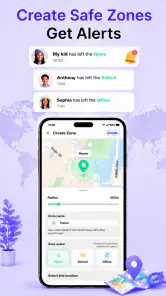
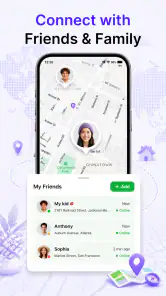
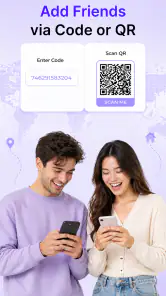
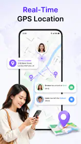
Analysis by Reviewed
I judge a location-sharing app less by how many map details it promises and more by whether a person can understand what is happening when they need help. GPS Location: Live Tracker is aimed at families who want to keep tabs on children and have an SOS option available for emergencies. That makes clarity, trust, and ease of use more important than a long list of navigation extras. My overall impression is that the idea is practical, but this is a tool to assess carefully with the people who will use it—not something I would set up and then assume will solve every safety problem.
Making location information understandable
A focused purpose, with important details to check
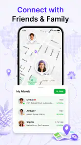
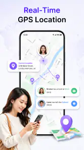
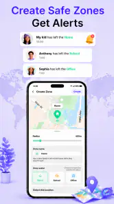
FalconMedia’s app sits in the maps and navigation space, but its role is narrower than a turn-by-turn navigator. Its central use is sharing a child’s location with family and having SOS available for urgent situations. I find that focus helpful: someone checking on a family member is usually looking for a clear answer about location, not a complicated route-planning interface.
The short label, “GPS Location,” is broad, though, so I would not assume the app offers every function associated with a full navigation service. Before relying on it, I would open it together with the child or family member who will use it, look at how the shared location is presented, and make sure everyone understands what the SOS action does in practice. A safety feature is only useful if the person can recognize it and use it under pressure.
In a routine situation, such as a child walking home while a parent is still at work, location sharing can reduce the need for repeated calls or messages. The useful habit is to agree in advance on when checking the app is appropriate. That keeps a safety tool from quietly becoming a source of constant monitoring or anxiety.
Readability matters more than map density
Location apps can become difficult to interpret when a screen is crowded with controls, labels, and small map details. For this app, I would prioritize whether the essential information—the person being followed, their position, and the way to reach SOS—is easy to identify at a glance. If a family member has low vision or is unfamiliar with maps, a calm setup walkthrough is more useful than simply handing over the phone.
I would also test the app on the actual devices the family plans to use. Text scaling, screen brightness, contrast settings, and display size can affect how readable any map-based interface feels, and the experience may differ between phones. Try it in bright daylight as well as indoors: a map that looks clear at home may be harder to scan outside.
One practical tip is to establish a simple verbal routine alongside the app. For example, agree that a caregiver will check the location at a particular point in a journey, while the child knows when to contact them directly. This makes the app one part of a communication plan rather than requiring someone to interpret a map every few minutes.
Motor and sensory needs require a real-world test
An SOS control is meaningful only if the person who may need it can reach and activate it reliably. I would have the intended user try the app while seated, standing, and holding the phone as they normally would. That can reveal whether opening the right screen or tapping a control feels awkward for someone with limited dexterity, tremors, or one-handed use. I would not wait for an emergency to discover that a button is difficult to reach.
Sensory needs deserve the same attention. A family member who finds visual maps overwhelming may prefer a caregiver to handle routine checks, while the person carrying the phone learns only the steps they need for contacting help. Someone sensitive to alerts should review the phone’s notification settings and decide together which interruptions are useful. I would not assume an alert will be noticed in a noisy place, during class, or when a device is muted.
There is a trade-off here: a detailed map can reassure one person and confuse another. Keep the setup conversation focused on a few decisions—who can see the location, when they will check it, and what to do if the app is not available. That is a more inclusive approach than expecting every user to navigate the same interface in the same way.
Where it fits into everyday life
A realistic use case is a family coordinating a child’s trip between school and an after-school activity. A caregiver can use the shared location to get a general sense of progress, while the child can use the agreed safety plan if something changes. I would still set expectations: a location on a screen is not the same as a conversation, and it cannot explain why someone has stopped, changed direction, or taken a different route.
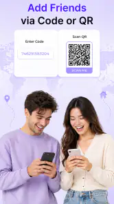
It may also help when relatives have different routines and want a simple way to share location rather than sending updates manually. But the app’s stated focus on children and emergency safety makes it especially important to discuss consent and privacy in age-appropriate language. Children should know who can see their location and why. For older children, involving them in those boundaries can build trust and make the arrangement feel less like secret surveillance.
For a person with limited mobile data, an older phone, or inconsistent connectivity, I would not make any location-sharing app the only safety plan. Test it on the intended route and device, and keep a backup such as an agreed check-in message or a known contact number. Location tools depend on a working phone and usable connection; a family should know what to do when either is unavailable.
How it compares with familiar alternatives
Compared with a general-purpose map, this app is more specifically oriented toward family location sharing and SOS rather than route discovery or navigation. If the main need is finding public transport, comparing routes, or exploring nearby places, a standard maps app is likely the better fit. If the priority is knowing where a child is and having an emergency action in the same family-safety context, GPS Location: Live Tracker is more directly aimed at that job.
It also differs from simply calling or texting. Messages let people explain a situation in their own words, while location sharing can answer the narrower question of where someone appears to be. I would use those methods together rather than treating one as a replacement for the other. A map cannot tell a caregiver whether a child is comfortable, and a message may not be practical when someone needs help quickly.
Because the app’s purpose is sensitive, I would compare not only interfaces but also family comfort. Some households may prefer a less continuous approach, such as agreed check-ins, while others may value having location sharing available. The right choice depends on the child’s age, the journey, and the family’s trust—not on which option sounds most advanced.
Setup, cost, and a sensible trial
The app is free to install, is rated for everyone, and includes optional in-app purchases priced from $2.49 to $9.99 per item. I would check what any purchase unlocks before paying and decide whether it addresses a real need for the household. A safety app should be judged by whether its everyday workflow works for the family, not by the assumption that a paid option automatically makes it more dependable.
It has a 3.4 average from 521 ratings, with 100K+ installs. Those figures suggest it has reached a meaningful group of users, but they do not tell me whether it will work well on a particular phone or suit a particular family. I would treat the rating as one small part of the decision and put more weight on a hands-on trial: can each person find the relevant screen, understand the location display, and use the emergency option without coaching?
The current version is 1.1.3, and the app requires Android 7.0 or later. That makes device compatibility a straightforward first check for Android users. The release date is April 29, 2026, so I would be especially deliberate about testing the app in ordinary conditions before relying on it as part of a safety routine.
Barriers I would take seriously
The most important limitation is not a missing map feature; it is the risk of expecting technology to guarantee safety. A location may not answer what is happening, and an SOS action is not a substitute for emergency services or a trusted adult. Families should decide who responds, how they will communicate, and what to do if the app cannot be used. Practicing that plan calmly is more valuable than testing the emergency feature for the first time during a stressful moment.
There is also a social barrier. Continuous location sharing can feel reassuring to a caregiver but intrusive to the person being tracked. I would avoid installing it without discussing the arrangement, particularly with a child old enough to understand privacy. Agree on a purpose, review the arrangement as circumstances change, and avoid using location checks as a substitute for conversation.
For users who struggle with touchscreens, maps, or time-sensitive actions, the app may not be the best standalone option. A simpler check-in routine, help from a trusted caregiver, or a device and service specifically chosen for the person’s needs could be more suitable. I would rather recommend a familiar approach that someone can use confidently than an app they are expected to operate perfectly in an emergency.
My inclusive verdict
I see GPS Location: Live Tracker as a focused family-safety tool worth considering when location sharing and an SOS option match a household’s needs. Its strongest potential is in reducing uncertainty during ordinary journeys, provided the people involved understand how and when it will be used. Its limits are just as important: it cannot explain a person’s situation, guarantee that a message will be noticed, or replace a backup plan.
I would recommend trying it with the actual users before making it part of a safety routine, paying particular attention to readable screens, comfortable controls, notification preferences, and shared privacy expectations. If the app feels clear to the caregiver but confusing or intrusive to the child, the setup needs work—or another approach may be better. My advice is to treat it as one agreed part of a wider safety plan, not as a substitute for communication and judgment.
GPS Location : Live Tracker Frequently Asked Questions
What is GPS Location : Live Tracker used for?
GPS Location : Live Tracker is designed to help users view and share location information through a mobile device. Depending on the app’s current features and your settings, it may support live location sharing, map-based tracking, or viewing a device’s position. Check the app’s description and on-screen instructions before relying on a specific feature, since availability can vary by version, device, and region.
Does GPS Location : Live Tracker track someone without their knowledge?
A location app should be used transparently and with the consent of anyone whose location is being shared. GPS Location : Live Tracker cannot be assumed to provide covert access to another person’s whereabouts, and a person generally needs to enable sharing or grant the relevant permissions on their device. Do not use location features to monitor someone without their knowledge or permission.
What permissions and settings does the app need?
Live location features commonly require location access, and some functions may need permission to use location while the app is in the background. Your phone may also ask you to enable location services or allow notifications. Grant only the permissions needed for the features you plan to use, review the app’s privacy information, and remember that background access can affect battery use.
Can GPS Location : Live Tracker show a location accurately without internet?
GPS accuracy depends on conditions such as satellite visibility, nearby buildings, device hardware, and whether location services are enabled. An internet connection may be needed to load maps, update shared locations, or send information to other users, even when the phone can determine its position using GPS. Expect delays or reduced functionality indoors, in areas with weak reception, or when the device is offline.
Is GPS Location : Live Tracker free, and what should I check before downloading?
The app’s price, optional purchases, advertising, and feature limits can change, so check its current store listing before installing. Also confirm that it is compatible with your device and operating system, review the developer’s privacy disclosures, and read recent user feedback. Download from an official app store where possible, and avoid sharing sensitive location data unless you understand who can see it and for how long.
Pros
- Shows your current location on a map for quick orientation.
- Live location sharing can help friends and family coordinate meetups.
- Useful for checking routes and nearby places while traveling.
- A map-based interface is easy to understand for most users.
- May provide a convenient way to keep track of shared trips.
Cons
- Live tracking requires location access
- which can affect privacy.
- GPS accuracy can decrease indoors or in areas with weak signals.
- Frequent location updates may drain your phone's battery.
- Location features depend on an active internet connection in many cases.
- Sharing your whereabouts can expose sensitive routine or travel details.
- Category
- Maps & Navigation
- Version
- 1.1.3











