GPS Earth Maps Live Navigation
- 221.00
- 4.1
- Installs
- 10.00M
- Price
- Free

Screenshots

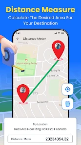

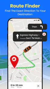
Analysis by Reviewed
I use GPS Earth Maps Live Navigation as a flexible companion for finding places and orienting myself, rather than as a substitute for careful trip planning. It is a free Maps & Navigation app from Cloud Park, and its mix of GPS guidance, nearby-place discovery, a digital compass and weather information gives it a broader role than simply drawing a route. That variety can be handy when I am already out and need to make a quick decision, though I would still check important details before relying on any navigation app for a time-sensitive journey.
Where it fits in a navigation routine
The app makes the most sense when I want several basic travel aids together: guidance while moving, a way to get my bearings, and a glance at nearby places or local weather. For example, arriving in an unfamiliar part of town, I can look for somewhere close by, then use navigation to get there instead of switching between separate tools. The compass is also useful when I have stepped out of a station or building and need to work out which direction to walk before setting off.
That combination is not automatically better than a dedicated mapping service. If I need carefully detailed route planning, extensive local business information or a familiar ecosystem of saved places, the map app I already use may be more convenient. I would treat GPS Earth Maps as an additional option for quick orientation and nearby discovery, then compare the suggested route with my usual tool when the trip matters.
Practical habits that make it more useful
A small but useful habit is to decide what you need before you begin moving. Search for the destination while stopped, check that it is the intended place, and only then follow the route. This reduces the temptation to handle the phone while walking or driving, and it is particularly helpful when several businesses or entrances have similar names. For a short errand, nearby-place search can help narrow down choices; for a longer outing, checking the weather before leaving can influence what to pack or whether to change plans.
The compass is best treated as an orientation aid, not a replacement for route guidance. Around tall buildings or in places where it is hard to establish direction, I would use visible landmarks and the map together rather than trusting a single pointer. Likewise, nearby results are a starting point, not a guarantee that a place is open or suitable. I would verify the destination before making a detour, especially when timing or accessibility matters.
Getting to Know GPS Earth Maps Live Navigation
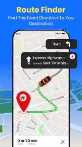
First things first, let's talk about what GPS Earth Maps Live Navigation brings to the table. This app isn't just about getting you from point A to point B. It offers a plethora of features that make traveling a breeze. You'll find real-time navigation, live traffic updates, and even street views to help you visualize your destination before you get there. It’s like having a crystal ball but way cooler!
Features That Stand Out
One of the first things I noticed was how intuitive the interface is. The app is designed to be user-friendly, even for those who aren’t tech-savvy. You can easily search for locations, set your destination, and choose from various route options. And if you’re like me, who loves to avoid tolls, you’ll appreciate the feature that lets you customize your route preferences.
You May Like

Clash of Clans Is Won Between the Battles

Android Auto Makes the Case for Quieter Car Software

MobiOffice: Transforming Mobile Productivity with Seamless Integration

EA SPORTS FC™ Mobile Soccer: Redefining Mobile Sports Gaming

How Microsoft OneDrive Became a Mobile Productivity Giant

How Google Translate Breaks Language Barriers Effortlessly
Now, let's talk about the live traffic updates. This feature is a lifesaver, especially during rush hour. The app provides real-time traffic conditions, helping you dodge those frustrating traffic jams. Plus, with the street view, you can get a sneak peek of your destination, making it easier to recognize landmarks and avoid missing your turn.
Why I Love Using This App
Honestly, what really sold me on this app is its reliability. Whether I'm navigating through a bustling city or exploring rural areas, GPS Earth Maps Live Navigation has consistently provided accurate directions. It’s like having a trusty old friend who knows all the shortcuts and hidden gems in town.
Another aspect worth mentioning is the offline maps feature. Yes, you heard that right! You can download maps and use them even when you’re off the grid. This is perfect for those adventurous road trips where cell service might be spotty.
Its current place among navigation apps
In the crowded world of navigation apps, I see this one as a broad toolkit rather than the obvious first choice for every driver. Its published version is 3.7.7, and the app has been available since October 25, 2017. That long-running presence offers context, but it does not by itself tell me how every route or map detail will behave today. I would judge it by a test trip in my own area, especially if I plan to depend on it for unfamiliar roads.
Its audience is substantial: it has more than 10 million installs and a 4.1 average from around 12,000 ratings, with 221 written reviews. Those figures suggest plenty of people have tried it, but they cannot promise a perfect experience in every location. I would use the app’s route guidance as a practical aid and keep a second navigation option available for a complicated journey or a place where directions are especially important.
A realistic day out, and where I would draw the line
Picture a weekend visit to a neighborhood I do not know. Before leaving, I check the weather, search for a nearby café, and use the compass to orient myself after parking. Once I have chosen a destination, navigation can guide the walk or drive. If the area is busy, I would check the route before moving and avoid making changes while driving. This is where the app’s assortment of tools feels useful: the value is not one remarkable feature, but having several small decisions supported in one place.
I would be more cautious on a long, tightly scheduled drive. Traffic and route information can help me make choices, but conditions change, and I would not assume that a suggested shortcut is always the best one. Someone who needs dependable, detailed planning for frequent commuting may prefer a navigation service they already know well. Someone who mainly wants nearby discovery and quick orientation may appreciate having this extra option. The app is rated for Everyone, though adults should still supervise younger users whenever a phone is used around roads.
What I would check before relying on it
For a first outing, I would try a familiar destination and compare the directions with a route I already understand. That is a low-stakes way to see whether the interface suits me and whether the available route choices match my preferences. I would also prepare before entering an area with weak service: the existing review describes offline maps as useful, but I would check that the needed map is actually available for the places I plan to visit instead of assuming every destination is covered.
The app is free to download, with in-app purchases listed at $8.99 per item. I would start with the free experience and only consider a purchase if I understand what it adds and expect to use it. It supports Android 7.0 and later, which makes compatibility worth checking on an older device. Those practical details matter more than a feature checklist: a navigation app is only helpful if it works on your phone, covers your route and fits the way you travel.
How I would fit it into a real trip
For an unfamiliar appointment, I would use the app in two stages rather than waiting until I am already late. At home, I would look up the destination and inspect the approach, especially if the address sits in a large complex or beside a busy road. Once nearby, the map and compass can help me orient myself, while a quick check of nearby places may give me a practical fallback if I arrive early. I would still confirm the exact entrance with the venue when getting that detail wrong could cost me time.
On a day with several stops, I would treat nearby search as a decision aid, not an itinerary builder. I might use it to find a convenient place to pause between errands, then check each destination individually before setting off. This is a useful trade-off: having discovery and guidance together saves some app-switching, but it does not replace the planning and verification that a multi-stop route needs. For a short, flexible outing, that balance feels sensible; for a delivery schedule or a chain of timed appointments, I would use a navigation tool designed around that workflow.
Choosing between this and a familiar map
Compared with the large, established mapping apps many people already rely on, GPS Earth Maps Live Navigation appeals to me as a bundle of everyday aids rather than as an automatic replacement. If my priority is a well-established record of saved locations, business details or carefully managed routes, I would stay with the service that already handles those jobs for me. If I want to combine a quick search for somewhere nearby with compass-based orientation and a weather glance, this app has a more distinct reason to sit alongside it.
That distinction also affects how I would judge it. I would not install it expecting every result or route to outperform my regular map. I would ask whether its particular mix helps in the situations where I tend to switch between navigation, a compass and a weather app. If it does, it earns a place as a useful secondary tool. If I only need turn-by-turn directions and my current app already gives me that comfortably, adding another map may create more clutter than value.
Small checks that prevent avoidable frustration
Before a trip where reception may be unreliable, I would prepare while connected rather than assume that every feature will behave the same way offline. Since offline maps are part of the experience described here, the sensible move is to check the intended area in advance and make sure the map is ready on the device. I would also keep the phone charged and avoid depending on a map as my only source of directions in a place where getting lost would have serious consequences.
There is a similar distinction between a feature being present and it being sufficient for a particular need. Traffic information can inform a route choice, but I would recheck it before leaving and keep flexibility in the schedule. A street-level preview can help me recognize an approach, but I would not use it as proof that a doorway, parking space or entrance is available. These are not reasons to avoid the app; they are reminders to use its tools for what they can reasonably support.
Who is likely to appreciate it
I think the app suits people who like having a few practical location tools together and do not mind comparing routes for important journeys. It may be especially handy for occasional travelers, people exploring an unfamiliar neighborhood on foot, or anyone who often needs a quick sense of direction after leaving a station or parking area. Its Everyone age rating makes it broadly accessible, although using a phone safely around traffic still calls for adult guidance for children.
I would skip it as my main navigation choice if I depended on highly detailed trip organization, wanted a single trusted source for every saved place, or could not afford to check an unfamiliar route before relying on it. I would also be cautious if I had an older phone: the minimum system requirement is Android 7.0, so compatibility is a simple first check. And while the download is free, I would look carefully at what an optional purchase offers before paying; the listed in-app purchases are $8.99 per item, so there is no reason to buy one without a clear personal use for it.
What I would watch as it evolves
The current version is 3.7.7, while the app’s release history reaches back to October 25, 2017. Those facts show that it has had a life beyond a brief launch, but they do not tell me which features changed or how current map coverage performs in a particular town. For an existing user, the practical question is whether the version on their phone continues to handle the routes and nearby searches they actually use. I would judge any future changes by that everyday reliability, not by a version number alone.
As a user, I would keep an eye on whether the app remains useful across the different parts of its promise: navigation, local discovery, compass orientation and weather. Improvements to any one part matter most when they make a real task easier without making the rest harder to use. Until I see that in practice, I would keep expectations grounded and continue to test it on familiar trips before depending on it in a new or time-sensitive setting.
Wrapping It Up
In a nutshell, if you're looking for a reliable, feature-packed navigation app, GPS Earth Maps Live Navigation is definitely worth checking out. It's got everything you need to make your travels smoother and more enjoyable. So, next time you're planning a trip or just trying to get across town, give this app a try. Who knows, it might just become your new favorite travel companion!
My recommendation is a measured one: try it for a familiar trip, explore how its nearby-place and orientation tools fit your routine, and keep your preferred backup for journeys where precision matters most. That lets you decide from experience whether its particular blend of features works for you, rather than treating a high install count or a promising feature list as a guarantee.
GPS Earth Maps Live Navigation Frequently Asked Questions
Who develops GPS Earth Maps Live Navigation, and what kind of app is it?
GPS Earth Maps Live Navigation is a Maps & Navigation app developed by Cloud Park. Its focus is helping users find routes and explore places, with features such as GPS navigation, nearby-place information, voice navigation, a digital compass, and weather. It may suit people who want several travel-oriented tools in one app rather than using a navigation tool alone.
Is GPS Earth Maps Live Navigation free to download, and does it offer paid purchases?
The app is free to download, so you can try its navigation and related tools without paying an upfront price. It also offers in-app purchases priced at $8.99 per item. Before making a purchase, check the purchase details shown in the app so you understand what the selected item includes and whether it is relevant to the features you want to use.
What features does GPS Earth Maps Live Navigation offer?
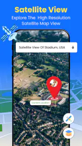
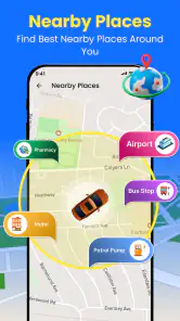
GPS Earth Maps Live Navigation offers a comprehensive suite of features designed to enhance your travel experience. It includes real-time GPS navigation, live traffic updates, satellite and 3D street views, and route planning for driving, walking, or biking. Additionally, it provides information on nearby places of interest, such as restaurants, gas stations, and landmarks, making it a versatile tool for both urban and rural navigation.
Is GPS Earth Maps Live Navigation available offline?
Yes, GPS Earth Maps Live Navigation offers offline functionality. Users can download maps of specific areas for use without an internet connection. This feature is particularly useful for travelers in areas with poor network coverage or those looking to save on data usage. However, certain features like live traffic updates and real-time navigation may require an internet connection to function optimally.
How user-friendly is GPS Earth Maps Live Navigation?
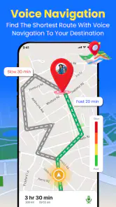
GPS Earth Maps Live Navigation is designed with user-friendliness in mind. The app features an intuitive interface that is easy to navigate for users of all ages. It offers clear and concise directions with voice guidance, ensuring a smooth navigation experience. The app also allows for customization, enabling users to set route preferences, avoid tolls, or choose specific modes of transport.
Pros
- Accurate real-time GPS tracking
- Comprehensive global map coverage
- User-friendly interface
- Offline maps feature
- Voice-guided navigation
Cons
- Frequent ads disrupt experience
- Battery consumption is high
- Some maps require in-app purchases
- Occasional app crashes reported
- Limited customization options

- Category
- Maps & Navigation
- Version
- 3.7.7











