GOHUNT / Hunt Research & Maps
- 267.00
- 3.4
- Installs
- 100.00K
- Price
- Free

Screenshots
Analysis by Reviewed
I approached GOHUNT as a practical field companion rather than another general-purpose map app. Its focus is clear: helping hunters research opportunities, understand draw odds, inspect unit information, and work with hunting maps when a signal may not be available. After spending time with that combination, my main impression is that it is most useful before a hunt and during careful preparation, not as a replacement for every navigation tool you already use.
The app sits in the Maps & Navigation category, but that label only tells part of the story. Its real value comes from bringing planning information and location awareness into the same hunting workflow. Instead of opening a regular map, searching separately for regulations, and keeping notes in another place, I can use one hunting-oriented workspace to narrow down possibilities and think through a trip.
That specialization is also the reason I would not recommend it automatically to every outdoor user. Someone who only needs a simple trail map may find the hunting research tools unnecessary. A serious hunter comparing units, preparing for a draw, or planning around remote terrain is far more likely to appreciate what it is trying to do.
Where the app earns its place in a hunting workflow
Research is more useful when it leads to a decision
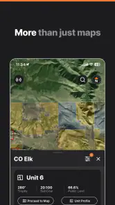
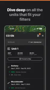
The strongest part of the experience is the way GOHUNT encourages a hunter to move from vague interest to a more deliberate plan. Draw odds are not merely interesting numbers to glance at; they can help shape a realistic application strategy. Unit profiles add another layer to that process by giving a place more context than a boundary line alone.
I find this especially helpful when I am comparing several possible destinations. A normal map can show distance, roads, terrain, and nearby landmarks, but it does not naturally answer the hunting question: “Is this unit worth the time and application effort for my situation?” The research side of the app is designed around that decision, which makes it more focused than a standard navigation product.
My preferred workflow is to begin with broad research at home, identify a small group of units, and then use the map to think about access and movement. That order matters. Jumping straight into a map can create the illusion that a place is promising simply because it looks remote or large. Research first helps me avoid treating a visually appealing area as an automatic choice.
A useful habit is to compare units for trade-offs rather than searching for a single “best” option. One area may look attractive for opportunity, while another may be more practical because the trip is easier to organize. GOHUNT is most valuable when I use its information to ask better questions rather than expecting it to make the final decision for me.
More From Our News Desk

Clash of Clans Is Won Between the Battles

Android Auto Makes the Case for Quieter Car Software

MobiOffice: Transforming Mobile Productivity with Seamless Integration

EA SPORTS FC™ Mobile Soccer: Redefining Mobile Sports Gaming

How Microsoft OneDrive Became a Mobile Productivity Giant

How Google Translate Breaks Language Barriers Effortlessly
Offline maps change how I prepare for remote days
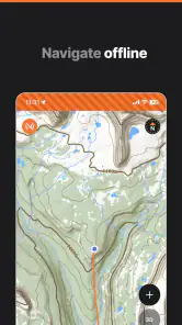
The offline GPS hunting maps are the feature I would care about most once I leave reliable coverage behind. Downloading map information before heading out can make a major difference in remote country, where depending on a live connection is a poor plan. I would treat the download step as part of trip preparation, not something to attempt at the trailhead.
There is a practical trade-off here. Offline access is reassuring, but it only helps if I prepare the relevant area in advance and understand what I am looking at. I would zoom around the intended hunting unit, inspect the likely approach routes, and make sure the map covers the areas I may actually need. A map that was never prepared for the right location is no help when a phone shows no service.
I also would not use the app as my only safety measure. A phone can lose power, become damaged, or be difficult to read in poor weather. The sensible approach is to combine the app with basic navigation judgment, a charged device, and a backup plan. GOHUNT can improve situational awareness, but it does not remove the responsibility to know where I am and how I will return.
One less obvious benefit of offline planning is that it encourages me to make decisions before the pressure of the field. I can identify likely access points, mark the general areas I want to examine, and think about alternate routes while sitting at home. That reduces the temptation to improvise blindly when conditions change.
Unit profiles are most valuable when read critically
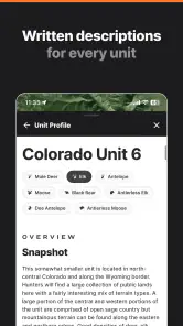
Unit profiles can save time during the early research stage because they give me a hunting-specific starting point. Instead of treating every unit as an empty shape on a map, I can use the profile as a prompt for further investigation. It helps organize my attention, especially when I am unfamiliar with a region.
Still, I would not mistake a profile for a guarantee. Conditions in the field vary, and a unit that appears attractive during planning may be less suitable once access, weather, timing, or personal ability enters the picture. The best use is comparative: I look at the profile, then test the idea against the map and my own practical constraints.
This is where the app feels more mature than a simple pin-and-route tool. It is not only helping me answer “where is this?” It is helping me consider “why would I choose this place, and what would make that choice difficult?” That is a better question for hunting preparation than navigation alone can provide.
A realistic use case: preparing for a limited trip
Imagine I have only a few days available and am deciding between several possible units. I would first use the draw-odds information to avoid building a plan around an unrealistic application outcome. Then I would read the unit profiles, compare the areas that fit my goals, and inspect the hunting maps for access and remoteness.
After selecting a short list, I would download the relevant map coverage before leaving home. I would review the approach, identify places where I might need to slow down or change direction, and keep an alternate area in mind. In the field, I could use the offline map to maintain orientation while treating the research as background guidance rather than a promise of success.
That workflow shows why the app is more than a map viewer. Its pieces become useful when they are used in sequence: research, comparison, preparation, then field reference. If I only open one feature occasionally, the overall experience feels less compelling. If I use the app as a planning system, its purpose becomes much clearer.
What feels less convenient
The biggest limitation is that a specialized hunting app can feel demanding for casual users. There is more to consider than simply entering a destination and following a route. Draw odds, unit research, map preparation, and offline use all reward advance planning. If I want instant directions with minimal setup, a mainstream navigation app is likely easier.
The average rating is 3.4 from around 1.3 thousand ratings, which suggests the experience is not universally smooth for everyone. I would read that as a reason to set expectations carefully rather than as a dismissal. A research-heavy product has more opportunities for friction than a simple map, particularly when I am trying to move between planning information and field use.
The purchase model may also affect how I judge the app. It is free to install, but in-app purchases range from $74.99 to $499.99 per item. Those are substantial amounts, so I would not commit casually. Before paying for anything, I would make sure the specific research or mapping needs justify the expense and that the app fits the way I hunt.
This is an important distinction: “free” makes it easy to try, but it does not mean the complete experience has no financial consideration. I appreciate being able to assess the interface and general workflow first, yet anyone comparing it with free map tools should look at the long-term cost of the functions they actually need.
How it compares with ordinary map alternatives
Google Maps and Apple Maps are better for roads, addresses, businesses, and everyday travel. I would choose them for driving to a town, finding fuel, or navigating a normal trip. They are familiar and efficient, but they are not built around hunting-unit research or draw planning.
Dedicated outdoor mapping alternatives may be stronger for users whose priority is broad recreation, trail discovery, or general backcountry navigation. If hunting research is secondary, a wider outdoor app could be a better fit. GOHUNT makes more sense when hunting decisions are the center of the task and map work supports those decisions.
Paper maps and official information remain important alternatives too. A paper map does not run out of battery, and official sources should still be part of responsible preparation. I see GOHUNT as a way to organize and connect research, not as permission to ignore current rules, local conditions, or information from the relevant authorities.
The app’s advantage is therefore not that it wins every mapping comparison. Its advantage is specialization. It brings together hunting research and GPS-oriented map preparation in a way that ordinary navigation tools generally do not. The compromise is that I need to spend more time learning the workflow and deciding whether the paid options are worthwhile.
Who will get the most from it
I would recommend GOHUNT to hunters who regularly compare units, think seriously about draw applications, or travel into areas where offline map access matters. It is also a good match for someone who prefers to prepare thoroughly instead of making every decision after arriving in the field.
It can be particularly useful for a hunter who is expanding into unfamiliar areas. The combination of unit profiles, draw-odds research, and maps gives that person a structured way to begin. It does not replace local knowledge, but it can make the first stage of research less scattered.
I would be more cautious about recommending it to someone who hunts only occasionally and already has a simple system that works. If the main need is a basic route, a free general map may be enough. Likewise, a user who dislikes advance preparation may find the offline workflow more effort than it is worth.
The app is rated for Everyone, and it is available for devices running Android 9 or later. The current version is 12.1.0, so compatibility is worth checking before planning around it, especially if the phone is older. It has passed the 100K-plus installs mark, which indicates that it is not an obscure experiment, though popularity alone should not decide whether its tools suit a particular hunting style.
Small habits that make the experience better
I would start by creating a short research list rather than browsing endlessly. Pick a few realistic units, compare them, and write down why each one remains in consideration. This keeps the app from becoming a collection of interesting information with no clear decision at the end.
Before an offline trip, I would prepare maps while connected to a dependable network and inspect the downloaded area at multiple zoom levels. That simple check can reveal whether I selected the right region. I would also charge the phone fully and avoid assuming that offline access means every possible detail will be available exactly as it would be online.
Another useful habit is separating “possible” from “practical.” A unit may fit a research goal but still be a poor choice because of travel time, physical demands, or limited flexibility. The app can support the comparison, but I still need to apply my own limits. That is where honest planning beats optimistic map browsing.
Finally, I would use the map as a reference throughout the day rather than staring at it continuously. Checking position at sensible moments preserves battery and keeps attention on the surroundings. The best digital tool is one that supports awareness without becoming the only thing I trust.
My verdict after weighing the trade-offs
GOHUNT is a focused Maps & Navigation app from goHUNT LLC that makes the most sense as a hunting preparation tool with offline mapping at its core. I like the way it connects draw-odds research, unit profiles, and map planning, because those tasks naturally belong together when I am deciding where and how to hunt.
My praise comes with a clear condition: I would use it as part of a broader system, not as a complete substitute for official information, physical navigation skills, or backup planning. The paid items are expensive enough to require careful consideration, and casual users may find the specialized workflow unnecessary.
For the right person, the free download is worth exploring. A hunter who needs structured unit research and wants to prepare offline maps can get meaningful value from it. A person looking only for everyday directions should choose a simpler alternative. My recommendation is strongest for deliberate hunters who plan ahead and weakest for anyone seeking effortless, general-purpose navigation.
Overall, I see GOHUNT as a useful specialist rather than an all-purpose winner. It earns its place when hunting research drives the trip, and its limitations become much easier to accept once I understand that its purpose is not to do everything a map app can do, but to make hunting decisions and remote preparation more organized.
GOHUNT / Hunt Research & Maps Frequently Asked Questions
What does GOHUNT’s Draw Odds and Unit Profiles research help me plan?
GOHUNT brings hunting research and maps together, with tools such as Draw Odds and Unit Profiles alongside offline GPS hunting maps. These resources can help you compare units, explore hunting opportunities, and organize trip research in one app. They are most useful as part of a broader plan: check current agency guidance and make sure you understand the rules and conditions for the area you intend to hunt.
What should I know about the app’s cost before downloading it?
GOHUNT is free to download, but some features are offered through in-app purchases. The available options range from $74.99 to $499.99 per item, so the total cost depends on what you choose to access. Before purchasing, review the purchase details and any subscription terms shown in the app store, and decide whether the research and mapping tools included in that option fit your needs.
What is GOHUNT / Hunt Research & Maps used for?
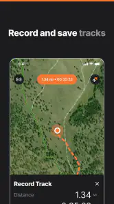
GOHUNT is a hunting research and mapping app designed to help hunters plan trips, study hunting units, and manage information in the field. It combines interactive maps, public-land details, unit boundaries, season information, draw and license research, and tools for saving waypoints or notes. The exact features available can depend on your location, subscription level, and the species or state you are researching.
Does GOHUNT provide accurate hunting regulations and season dates?
GOHUNT can make researching seasons, hunt units, draw odds, and regulations much easier, but it should not be treated as the only official source. Hunting rules may change, and details can vary by state, species, weapon, license type, or special permit. Before hunting, compare the information in the app with the latest regulations and notices published by the relevant state wildlife agency.
Is GOHUNT free to download, or does it require a subscription?
The app can generally be downloaded without paying an installation fee, but many of its more advanced research and mapping features may require a paid membership or subscription. Free access may provide limited tools, while premium plans can unlock additional map layers, species research, draw analysis, offline capabilities, or specialized planning features. Review the current pricing and renewal terms in your app store before subscribing.
Pros
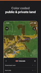
- Detailed hunting-unit maps with public and private land boundaries.
- Strong tools for comparing tags
- seasons
- draw odds
- and application deadlines.
- Offline map access is useful in areas with weak or no mobile coverage.
- Community reports can provide timely updates on conditions and animal activity.
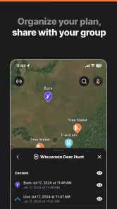
- Trip planning tools help organize waypoints
- notes
- and scouting information.
Cons
- Many advanced features require a paid membership or additional subscription cost.
- Map data and boundary details may vary in accuracy by state or hunting unit.
- The large amount of information can feel overwhelming for first-time users.
- Offline downloads can consume substantial storage space on a phone.
- Some features depend on regional availability and supported state data.
- Category
- Maps & Navigation
- Version
- 12.1.0











