Fleety - Subway & Bus Tracker
- 26.00
- 4.3
- Installs
- 10.00K
- Price
- Free

Screenshots

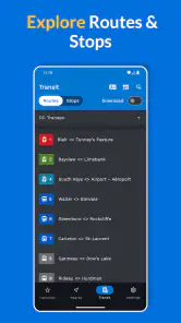
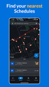
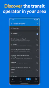
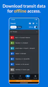
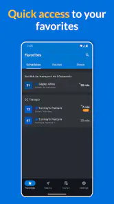
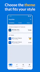
Analysis by Reviewed
When I test a transit app, I care less about how polished the map looks than about whether it helps me make a decision before the bus or train disappears around the corner. Fleety takes a focused approach: it brings live transit maps, arrival times, and schedules for MTA, CTA, LA Metro, and UTA into one place. That makes it much more useful for people who regularly move around one of those networks than for someone looking for a universal travel planner.
Developed by Global Transit Inc., this free Maps & Navigation app is aimed at a practical problem: checking public transportation without jumping between agency pages or trying to interpret a static timetable while standing at a stop. I found its strongest idea to be the combination of a moving network view and time information. A schedule tells me what should happen; a live map gives me a better sense of what is happening now.
That distinction matters during ordinary travel. If I am leaving work, I do not only want to know that a route runs frequently. I want to know whether the vehicle I can catch is approaching, whether I should walk to another stop, and whether waiting a few minutes is likely to be worthwhile. Fleety is built around that moment of uncertainty.
Why the live map is the app’s most useful capability
The central strength here is not simply showing transit lines on a map. Most mapping tools can draw a route. Fleety is more appealing when I need a quick operational view of selected public transportation systems, with live positions or timing information presented alongside schedules. In practice, that can reduce the mental work involved in turning an agency’s information into a decision.
I see this as a different job from ordinary navigation apps. A general map service is usually best when I need directions from an address to another address, especially if walking, driving, cycling, and public transit all need to be compared. Fleety is more specialized. It makes sense when the transit network itself is the thing I want to watch, rather than merely one step in a larger route calculation.
The supported systems are a major part of the decision. The app covers MTA, CTA, LA Metro, and UTA, so its usefulness depends heavily on whether I travel within those networks. For a commuter who relies on one of them, a dedicated tracker can feel more direct than a broad navigation app. For someone who travels across many cities, the narrower coverage becomes an immediate limitation.
I also appreciate the difference between a live view and a timetable. A printed or static schedule is still helpful for planning a journey later in the day, but it cannot show the same immediate context as a tracker. When service is uneven, the ability to look at the network and then check times is more actionable than reading a list of departures in isolation.
More From Our News Desk

Weather by Xiaomi Review: Clear at a Glance, Less Clear Up Close

X Under Pressure: Can It Recover When Posting Goes Wrong?

Clash of Clans Is Won Between the Battles

Android Auto Makes the Case for Quieter Car Software

MobiOffice: Transforming Mobile Productivity with Seamless Integration

EA SPORTS FC™ Mobile Soccer: Redefining Mobile Sports Gaming
There is a subtle benefit for people who already know their route. Experienced riders often do not need turn-by-turn directions. They need confirmation that the next train or bus is close enough to catch, or that a different departure may be safer. Fleety’s focused presentation is better suited to that quick check than a full route-planning workflow that asks me to enter every detail of my trip.
What I would check before relying on it
I would first confirm that my everyday agency is one of the four supported systems. This is not a minor detail; it determines whether the app is a daily tool or an occasional curiosity. I would also spend a few minutes learning how the map, route selection, and timing views relate to each other before using it during a rushed transfer. A tracker is most helpful when I can read it quickly, not when I am still searching for the right line.
Because live transit information is inherently dependent on the underlying agency feed, I would treat the display as decision support rather than a guarantee. If a vehicle appears close, I would still leave enough time to reach the platform or stop. The app can make uncertainty smaller, but it cannot remove delays, crowded vehicles, station access issues, or the few seconds lost while crossing a street.
The practical tip I found most valuable is to use the live map before leaving, not only after arriving at the stop. Checking from home or from the office can help me decide whether to walk immediately, wait briefly, or choose a different departure. That turns the map into a planning tool instead of an emergency screen opened only when I am already late.
How the experience fits into a real trip
Imagine I finish work in the evening and need to take a familiar bus connection. I open Fleety before leaving the building and look at the relevant network view. The schedule gives me the planned departures, while the live information helps me judge whether the next option is realistically worth pursuing. If the vehicle is already near the stop, I can leave promptly. If the next useful departure is farther away, I may avoid rushing and use the extra time to gather my things.
That workflow sounds simple, but it is exactly where a focused tracker can save attention. I am not asking the app to design an entire trip from scratch. I am using it to answer a narrow question: which departure should I act on right now? The narrower the question, the more sensible Fleety becomes compared with a general-purpose map.
For a transfer, the same approach can be even more useful. I can check the next part of the journey while approaching the connection instead of waiting until I reach the station. That does not guarantee a successful transfer, but it gives me an opportunity to adjust my pace or prepare for another departure. The important advantage is not that the app makes the decision for me; it gives me current context early enough to make my own decision.
I would not use a live map as my only source for a complicated first-time journey. If I need exact walking directions through an unfamiliar neighborhood, accessible entrances, or a comparison between several transport modes, a broader navigation app may be more suitable. Fleety’s value appears after I understand the network I am using and want a fast way to monitor it.
The schedule view also has a different role from live tracking. For a trip tomorrow morning, I would start with the schedule to understand the available departures. On the day itself, I would return to the live map to see whether the expected service is moving as planned. Separating those two tasks is a useful habit: schedules help me organize, while live information helps me react.
A better routine for commuters
My suggested routine is to check the app twice, with different goals. The first check is before walking to the stop, when I decide whether the next departure is worth targeting. The second is shortly before boarding, when I verify that I am watching the correct route or direction. This avoids the common mistake of seeing a vehicle on the map and assuming it is automatically the one I need.
For people who use more than one line, I would compare the timing of the alternatives instead of following the first route that appears familiar. A slightly longer walk may be sensible if it leads to a departure that is actually closer or more dependable at that moment. That is one of the less obvious ways a live network view can change behavior: it encourages me to think in terms of current options rather than fixed habits.
I would also avoid refreshing constantly. Transit information is most useful when it answers a decision I am about to make. Repeatedly watching a vehicle move without a clear plan can create false confidence or unnecessary stress. A quick check before leaving, followed by a confirmation near the stop, is a more realistic use pattern.
The best setting for Fleety
The app makes the most sense for a regular rider in a supported city who already knows the basic shape of their commute. That person can benefit from live awareness without needing a long explanation of every station or route. A daily bus rider, a subway commuter, or someone who frequently changes between services may find the focused view especially convenient.
It can also help someone who has flexible departure times. If I can leave work at slightly different moments, live information lets me choose between waiting, walking, or taking the next practical service. The app is less transformative for a person whose schedule is fixed and who must board one specific vehicle regardless of conditions.
Visitors can benefit too, but only under the right circumstances. A traveler staying in an MTA, CTA, LA Metro, or UTA service area may appreciate having transit activity and schedules close at hand. However, a visitor who needs complete door-to-door instructions may find a general map easier. Fleety is strongest as a network companion, not necessarily as the only travel assistant for an unfamiliar city.
Another good use is checking conditions before committing to a walk. If the next departure is not close, I may choose to leave later or walk toward another stop. That is a small decision, but it can make a meaningful difference during bad weather, with luggage, or when I am trying to avoid an unnecessary wait outside.
Parents, students, and shift workers may also appreciate the same control. Their travel times are often less predictable, and a live view can help them decide when to begin a trip rather than relying entirely on a memorized timetable. The benefit is greatest when a few minutes of information can change the choice between a comfortable connection and a long wait.
Where the focused design creates trade-offs
The first trade-off is coverage. Fleety is not a universal transit tracker. Its support for four named systems gives it a clear identity, but it also means I would not install it expecting nationwide or worldwide coverage. If my routine crosses unsupported agencies, I would need another app alongside it, which reduces the convenience of having one central travel tool.
The second trade-off is specialization. A general navigation service may combine transit with walking directions, driving alternatives, cycling, addresses, and broader place information. Fleety’s transit-first approach can be cleaner when I already know what I want, but less helpful when I am comparing an entire journey from beginning to end.
There is also a learning curve in interpreting live information responsibly. A dot or arrival estimate can look precise, yet a rider still needs to confirm route direction, stop location, and boarding point. New users should resist treating the visual map as self-explanatory. The most useful habit is to pair what the map shows with the schedule and the physical signs at the station or stop.
Free access makes the app easy to try, but it includes in-app purchases ranging from $2.99 to $19.99 per item. That does not automatically make it poor value, yet I would examine what each optional purchase changes before paying. For a casual rider, the free experience may be enough. A frequent commuter should decide based on whether the paid elements remove a real daily inconvenience rather than assuming every upgrade is necessary.
The app is rated for Everyone, which fits its straightforward transportation purpose. Its average rating is 4.3 from around 335 ratings, with around 26 written reviews, and it has passed 10K+ installs. Those figures suggest a modest but established user base rather than a dominant mainstream platform. I would read that as a reason to judge the app by my own supported city and routine, not by popularity alone.
The current version is 0.49.1, and the app runs on Android 7.0 or later. That broad device compatibility is helpful for people who keep an older phone for travel or prefer not to upgrade hardware just to use a transit tool. Still, anyone using an older device should test map responsiveness and battery behavior during a normal commute instead of assuming every phone will feel equally quick.
When I would choose another option
I would choose a broader navigation app when I am starting from an exact address in an unfamiliar area and need detailed walking instructions. I would also prefer an agency’s own official tool when I need service notices, policy details, or information specific to a station or route that goes beyond tracking and schedules. Fleety is not a replacement for every source of transit information.
I would skip it if my city is outside its supported network or if I rarely use public transportation. In that case, installing a dedicated tracker adds another app without solving a frequent problem. I would also hesitate to make it my only travel app for a multi-city trip, since its usefulness is tied closely to the named transit systems.
Finally, I would not recommend paying for optional items until I had used the free version during several real journeys. Transit apps are judged by small moments: whether I can find the right line quickly, whether the timing is understandable, and whether the information changes a decision. Those details matter more than a long feature list.
Who will get the most from this tracker
Fleety is best for people who want a dedicated window into supported transit networks rather than another all-purpose map. Its live maps and timing information are most valuable to regular riders who already understand their routes but need current context before leaving, transferring, or deciding whether to wait.
It is also a good fit for flexible commuters. If I can choose between departures, the app gives me a practical way to compare the situation now with the schedule I expected. That is the app’s real effect in use: it turns a fixed plan into a more informed choice without forcing me through a full route-planning process.
New riders should approach it as a companion to basic route knowledge. I would learn the line names, directions, and stop layout from an official source or a general map first, then use Fleety to monitor the service. That combination is more reliable than expecting a live map alone to explain every detail of an unfamiliar journey.
The developer, Global Transit Inc., has positioned this as a transit tracker rather than a broad travel platform, and I think that focus is sensible. The app does not need to replace every navigation tool to be useful. It only needs to make the supported networks easier to watch at the moment when a departure decision matters.
My final view is positive but specific. I would recommend Fleety to a commuter who uses MTA, CTA, LA Metro, or UTA and wants a faster way to check live movement alongside schedules. I would not recommend it as a universal replacement for agency apps or full navigation services. Its strongest case is simple: when I already know where I am going, Fleety helps me decide when and how to start moving.
Fleety - Subway & Bus Tracker Frequently Asked Questions
Who develops Fleety - Subway & Bus Tracker, and what devices can run it?
Fleety - Subway & Bus Tracker is made by Global Transit Inc. It is a Maps & Navigation app for checking public transit information, and its listed minimum operating system is Android 7.0. Before downloading, check that your device meets this requirement and that the app is available for your platform and region.
What is Fleety - Subway & Bus Tracker used for?
Fleety - Subway & Bus Tracker is designed to help you plan and monitor public transportation journeys. It can provide information about subway and bus routes, nearby stops or stations, schedules, and possible arrival times, depending on the supported city. The app is useful for checking a route before leaving, comparing transportation options, and following your trip while traveling.
Does Fleety provide real-time bus and subway information?
Fleety may offer real-time arrival updates for supported transportation networks, but the accuracy and availability depend on the data supplied by each local transit authority. Some lines or stops may show live vehicle positions and delays, while others may only provide scheduled times. Users should check the last update and remember that service disruptions can change quickly.
Which cities and transportation systems are supported by Fleety?
Coverage is one of the most important details to verify before downloading Fleety. The app’s available cities, subway systems, bus operators, and features can vary by region and may change as new networks are added. Its transit coverage includes MTA, CTA, LA Metro, and UTA. Before relying on it for daily travel, search for your city inside the app or review its current store listing to confirm that your local transit system is included.
Can I use Fleety without an internet connection?
Fleety generally works best with an active internet connection because route searches, live arrivals, service alerts, and vehicle locations often require updated online data. Previously viewed information may remain temporarily available, but it should not be treated as a complete offline mode. If you are traveling through areas with weak reception, save important route details and station information in advance.
Pros
- Real-time arrivals help reduce waiting at stops.
- Supports route planning for both subway and bus journeys.
- Useful service alerts can highlight delays and disruptions.
- Clean interface makes frequent trips quick to check.
- Location access can find nearby stops and stations easily.
Cons
- Coverage and accuracy may vary between cities and transit agencies.
- Some live updates may require a stable internet connection.
- Battery use can increase when location tracking stays enabled.
- Crowded routes may be harder to interpret during peak hours.
- Certain features or transit data may depend on regional availability.
- Category
- Maps & Navigation
- Version
- 0.49.1











