ETA SPOT
- 610.00
- 3.3
- Installs
- 100.00K
- Price
- Free

Screenshots


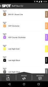
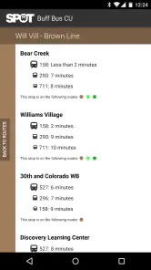
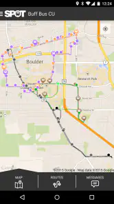
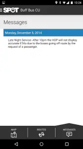
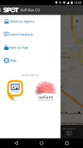

Analysis by Reviewed
When I first opened ETA SPOT, I understood its appeal quickly: it is a focused Maps & Navigation app for people who travel by public transportation and want a clearer idea of when they will arrive. Instead of treating a trip as only a line on a map, it puts attention on the practical question I usually care about most before leaving: “When should I expect to get there?”
The app is developed by ETA Inc. and is available free of charge for everyone. It has passed one hundred thousand installs and holds an average rating of 3.3 from around one thousand two hundred ratings, with roughly six hundred ten written reviews. Those figures suggest a useful but not universally smooth experience, which matches my impression: SPOT can be handy when its transit information fits the journey, but it is not the kind of app I would rely on blindly for every route or every city.
What to expect before planning a trip
SPOT is best understood as a transit-focused arrival and route-planning tool, rather than a complete replacement for every map app on a phone. Its main job is to help riders make sense of public transportation timing and choose a workable route. That narrow purpose is a strength when I already know I am taking transit and want an arrival prediction without digging through unrelated map features.
The store summary describes accurate arrival predictions and route planning for transit riders. In everyday use, that means I would open it before leaving, enter or select the journey I need, and use the resulting timing as a decision aid. The useful result is not just seeing a route drawn between two places. It is being able to judge whether I should leave now, wait for a later service, or allow more time for the trip.
I would recommend it most readily to commuters, students, visitors using buses or trains, and anyone who regularly compares transit options. It is also a reasonable lightweight choice for someone who does not want a large all-purpose navigation app taking over the entire planning process. On the other hand, drivers, cyclists, and pedestrians will find little reason to choose a transit-centered tool when their main journeys do not involve public transportation.
One important expectation to set is that an arrival prediction is still a prediction. Even when the timing is accurate, traffic, delays, crowded platforms, missed connections, and walking time can change the real result. I treat the displayed arrival as a planning reference, not a promise. That habit makes the app more useful and prevents a small timing change from turning into a stressful surprise.
Where it fits beside familiar alternatives
Large map applications usually offer a broader package: driving directions, walking routes, businesses, live location sharing, and transit planning in the same place. Their advantage is convenience when I am combining several travel modes or exploring an unfamiliar neighborhood. SPOT’s advantage is concentration. If my only question is how to travel by transit and when I might arrive, a dedicated interface can feel less distracting.
More From Our News Desk

Clash of Clans Is Won Between the Battles

Android Auto Makes the Case for Quieter Car Software

MobiOffice: Transforming Mobile Productivity with Seamless Integration

EA SPORTS FC™ Mobile Soccer: Redefining Mobile Sports Gaming

How Microsoft OneDrive Became a Mobile Productivity Giant

How Google Translate Breaks Language Barriers Effortlessly
The trade-off is that a focused app may not replace the wider context I get from a general map. I may still want another map for the final walk, checking a landmark, or comparing a transit journey with driving. For a first-time user, I would therefore keep SPOT as a practical transit companion rather than assuming it must become the only navigation app on the phone.
Its age is also worth keeping in mind. The app was released on February 16, 2015, and the current version is 1.17. That does not automatically make it unsuitable, but it does encourage me to judge it by the quality of the route information available on my device and in my area, not by expectations built around newer, more elaborate navigation products.
From installation to a useful first trip
Start with a simple journey
For a first test, I would not begin with a complicated trip involving several transfers, a late-night departure, or an unfamiliar terminal. I would choose a route I already know reasonably well. That gives me a way to compare the app’s suggested timing with my own experience and makes it easier to recognize whether the result is sensible.
After installing the app, I would begin by looking for the basic route-planning flow rather than exploring every screen. A familiar origin and destination are ideal. If the app presents more than one choice, I would compare the arrival times and transfers instead of automatically selecting the first result. The fastest-looking option is not always the most comfortable one; a slightly later arrival with fewer changes can be a better real-world decision.
This is one of the less obvious ways to use a transit planner: I do not use it only to find a route. I use it to compare the cost of uncertainty. A route with a tight connection may look efficient on paper, but a route with an extra cushion can be preferable when I have an appointment, luggage, or a poor tolerance for rushing. SPOT becomes more helpful when I read its timing as part of that decision rather than as a single answer.
Make the first successful action concrete
A meaningful first success is not simply opening the app or viewing a map. It is planning one real journey and deciding what I will do next. For example, before leaving for an appointment, I can check the route, note the predicted arrival, and choose whether to depart immediately or use a later option. Once I have made that decision, the app has completed a useful job.
I recommend testing the result against a trip that has a clear endpoint. A journey to work, a campus, a station, or a regular shopping area is easier to evaluate than an aimless search. After the trip, I can remember whether the arrival estimate was close enough to be useful and whether the route made practical sense. That personal comparison is more valuable than judging the app from a single glance at its interface.
If the first result looks unexpected, I would check the starting point carefully. Transit tools can produce an unhelpful route when the origin is slightly wrong, especially if I am planning from a nearby street, station entrance, or neighborhood rather than from my exact position. A small correction can change the suggested connection and the estimated arrival. This is a simple troubleshooting step, but it is easy to overlook when I am in a hurry.
Use timing as a buffer, not a deadline
My preferred workflow is to add a personal buffer after reading the predicted arrival. If the trip is important, I plan to arrive early instead of treating the estimate as the exact moment I should walk through the door. This is particularly important when the route includes a transfer, because a small delay on the first part can affect everything afterward.
Another useful habit is checking the route shortly before departure rather than planning once and assuming the result will remain unchanged. Transit conditions can move quickly. A route that looked sensible earlier may be less attractive later, and a new comparison can reveal that waiting briefly or leaving immediately is the better choice.
The most reliable way to use SPOT is to combine its prediction with a little human judgment. I look at the arrival time, the number of changes, the amount of walking I am comfortable with, and the consequences of being late. That approach makes the app feel like a decision tool instead of an authority that must always be obeyed.
A realistic everyday scenario
Imagine I am leaving work for an appointment across town. I know two possible transit routes: one appears quicker but requires a close connection, while the other takes longer but is simpler. I open SPOT, plan the journey, and compare the predicted arrivals. If the quicker option leaves almost no room for a missed connection, I may choose the slower route and arrive with less stress.
That scenario shows where the app can offer more value than a basic “how do I get there?” search. It helps me think about the trip as a schedule. I can decide whether speed, simplicity, or a wider margin matters most on that particular day. The same method works for a student deciding when to leave for class or a visitor trying to reach a station without guessing at transit intervals.
Common points of confusion
The first source of confusion is the difference between route planning and guaranteed live control of a journey. SPOT can help estimate arrival and organize a transit route, but I would not assume that every displayed time removes the need to watch the actual service. If I am already at a stop, I still pay attention to announcements, platform signs, and what arrives in front of me.
A second issue is interpreting the arrival prediction too literally. “Arriving” can mean reaching the planned destination according to the route calculation, not necessarily standing at the exact entrance I need. A station can have multiple exits, and a final walk can be more complicated than the line on a screen suggests. For unfamiliar places, I leave time to orient myself after the transit portion ends.
A third point concerns route choice. The shortest predicted journey is not automatically the best journey. It might involve more transfers, a less convenient walk, or a connection that is difficult with luggage or mobility limitations. I compare the whole experience, not just the earliest arrival. This is especially important for first-time users who may assume the app’s top suggestion is a recommendation that fits every personal need.
There is also a practical limitation in depending on a single transit application. If a route seems incomplete, unusually indirect, or inconsistent with what I know locally, I verify it with another trusted source before committing to an important trip. That is not a criticism unique to SPOT; transit coverage and service conditions can vary by place. Still, the moderate 3.3 average rating is a reminder to keep expectations realistic and test the app in ordinary situations before making it central to high-stakes travel.
Who should use it, and who should skip it?
I think SPOT is a good fit for someone who wants a direct way to plan transit journeys and think about arrival time. It suits riders who prefer a dedicated tool, people who regularly compare connections, and newcomers who want a straightforward first step into public transportation planning. Because it is free and rated for Everyone, there is little financial or age-related barrier to trying it.
I would skip it as a primary navigation choice if I mainly drive, walk, or cycle. I would also look elsewhere if I need a broad travel workspace that combines many map layers, detailed place discovery, or a rich set of non-transit tools. A general navigation app may be more convenient for a trip that begins on foot, continues by train, and ends with a long walk through an unfamiliar area.
For users on older devices, the minimum operating system requirement is Android 5.0 or later. That makes the app accessible to a wide range of Android phones, although compatibility alone does not guarantee that the experience will feel equally comfortable on every screen or device. I would install it, try one familiar route, and decide from that hands-on test whether it fits my daily routine.
Small habits that improve the experience
My first tip is to save mental notes about routes that work well, even if the app does not turn them into a permanent personal system. After trying a journey, remember which option offered the best balance of time and simplicity. On the next trip, SPOT can then be used to check whether that familiar plan still makes sense rather than starting from zero.
My second tip is to test both a routine trip and a slightly more demanding one. A regular commute shows whether the timing is useful in normal conditions. A journey with one transfer shows whether I understand the app’s presentation and whether the predicted arrival gives me enough confidence to plan around it. This two-stage test is more revealing than judging the app on a single short ride.
My third tip is to plan around the consequence of failure. If missing a connection would make me late for an exam, interview, or appointment, I choose a route with more breathing room and verify the result again near departure. If I am taking a casual trip with no fixed arrival time, I can be more flexible. The app provides the timing information, but I decide how much risk is acceptable.
My next step after the first trip
Once I have completed one successful route, I would use SPOT for comparison rather than only confirmation. I might check the same journey at a different time of day, compare a direct service with a transfer, or see whether a later departure gives me a more comfortable arrival. This turns the app from a one-time lookup into a way of learning how my regular transit network behaves.
I would also keep a backup habit for important journeys. That can be as simple as knowing the name of the departure station and the destination before leaving, rather than relying on continuous attention to the screen. If the app’s result changes or the trip becomes confusing, I still have enough context to ask for help or switch to another navigation option.
Overall, ETA SPOT is a modest, focused transit app from ETA Inc. It is free, supports Android devices running version 5.0 or later, and its current version is 1.17. I like it most when I use it for a clear question: which public transportation route should I take, and when might I arrive? Its limitations matter, but they are manageable when I compare routes thoughtfully, allow a buffer, and verify important journeys.
My recommendation is therefore practical rather than enthusiastic across the board. If you regularly ride transit and want a dedicated arrival-prediction tool, it is worth trying with a familiar route first. If you need an all-purpose map, detailed local discovery, or a single app for every form of travel, a broader alternative may serve you better. For the right rider, though, ETA SPOT can make the first planning decision of a journey noticeably easier.
ETA SPOT Frequently Asked Questions
What devices can run ETA SPOT?
ETA SPOT is an app in the Maps & Navigation category, and it requires Android 5.0 or later. Before downloading, check your device’s operating-system version and make sure you have enough space for the installation. The app is also available for iOS, so iPhone users should check its App Store page for compatibility with their device.
What does ETA SPOT offer for transit riders?
SPOT® focuses on accurate arrival predictions and route planning for transit riders. It may be useful when you want to plan a journey and communicate an expected arrival time, rather than rely only on a destination address. As with any navigation app, the usefulness of the results depends on having the relevant location and connectivity settings enabled.
What is ETA SPOT and what can I use it for?
ETA SPOT is designed to help users check and share estimated times of arrival for trips, meetings, or destinations. It can be useful when coordinating with friends, family, or colleagues because it provides a simple way to communicate when you expect to arrive. Before downloading, check whether its available features match your preferred navigation and location-sharing needs.
Does ETA SPOT require access to my location?
The app may need location permission to calculate or update your estimated arrival time accurately. Depending on how you use it, location access could be required only while the app is open or may work in the background. Review the permission request carefully, and use your device settings to limit access if continuous location sharing is not necessary for your situation.
Can I share my ETA with other people?
ETA SPOT is intended to make arrival information easier to share, but the exact sharing options can depend on the current app version and your device. Users should check whether sharing works through links, messages, or other supported services. Remember that sending an ETA may reveal travel details, so share it only with people you trust.
Pros
- Shows estimated arrival times for public transport trips.
- Helps compare routes and identify faster travel options.
- Useful for planning journeys around daily schedules.
- Provides practical stop and station information.
- Can reduce waiting time by using live travel updates.
Cons
- Coverage may be limited to supported cities and transport networks.
- Arrival estimates can be inaccurate during delays or disruptions.
- Some features may require location access to work properly.
- Interface usefulness depends on the availability of transit data.
- Background location use may affect battery life and privacy.
- Category
- Maps & Navigation
- Version
- 1.17











