EarthVista: Live Satellite Map
- 0.00
- 0.0
- Installs
- 100.00K
- Price
- Free
Screenshots
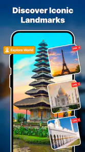
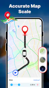
Analysis by Reviewed
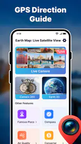
I approached EarthVista: Live Satellite Map as a practical navigation companion rather than a novelty globe. Its appeal is the way it brings several map-oriented ideas into one place: a three-dimensional view of Earth, live camera access, GPS mapping, a speedometer, and landmark-focused exploration. That combination makes it more interesting than a basic map viewer, although it also means the app is best understood as a broad visual toolkit rather than a complete replacement for every specialist navigation service.
Developed by Qzee Games, this free Maps & Navigation app is aimed at anyone who enjoys looking around the planet, checking a route context, or using location information while moving. It is suitable for Everyone, supports devices running Android 7.0 or later, and has reached over one hundred thousand installs. The current version is 1.2, and it was released on July 13, 2026. Those details matter because the app is accessible to a wide range of Android users, including people with older compatible phones.
How I use EarthVista in a normal day
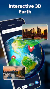
My baseline workflow begins with the map rather than the camera or speedometer. I open the Earth view, orient myself, and then move toward the place or landmark I want to understand. The three-dimensional presentation is useful here because it gives more visual context than a flat map. I can think about a city, coastline, road approach, or famous site as part of a larger landscape instead of seeing it as an isolated pin.
This is especially handy before a trip. I might look at the surrounding area of a destination, identify nearby landmarks, and then switch to the GPS view when I need a more immediate sense of my position. I would not treat that preparation as a substitute for checking a route carefully, but it helps me build a mental picture before leaving home. That small habit can make an unfamiliar area feel less confusing when I arrive.
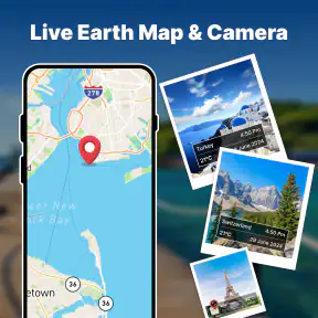
The live camera section changes the experience from planning to observation. I use it when I want a quick visual look at a location or when I am curious about what is happening in a place that offers a camera view. It is not the same as physically being there, and the usefulness depends on which camera is available and how clear or current the view is. Still, having live views beside satellite-style exploration gives the app a more immediate character than a standard atlas.
The speedometer is another practical part of the basic workflow. I see it as a quick reference while travelling, not as a replacement for the vehicle’s built-in instruments. A phone can be affected by positioning conditions, placement, and movement, so I would keep the display secondary and avoid interacting with it while driving. Used responsibly, it can be convenient for passengers, cyclists, or people checking movement during a journey.
For a realistic everyday example, imagine that I am visiting a new town for the afternoon. Before setting off, I use the three-dimensional map to understand the district and look at notable landmarks. Once I am moving, I check the GPS map when stopped, and I use the speedometer only as an additional reference. If I have spare time, I explore a suitable live camera or landmark view. This sequence keeps each tool focused on one task instead of forcing the app to do everything at once.
More From Our News Desk

Clash of Clans Is Won Between the Battles

Android Auto Makes the Case for Quieter Car Software

MobiOffice: Transforming Mobile Productivity with Seamless Integration

EA SPORTS FC™ Mobile Soccer: Redefining Mobile Sports Gaming

How Microsoft OneDrive Became a Mobile Productivity Giant

How Google Translate Breaks Language Barriers Effortlessly
What makes the combined approach useful
The strongest idea here is not any single feature. It is the ability to move between broad geographic context and immediate location awareness. A conventional navigation app is usually better when I already know where I am going and need direct directions. EarthVista is more enjoyable when I want to understand a place, preview its surroundings, inspect landmarks, and then connect that visual exploration with my own position.
I also find the combination useful for teaching and casual discovery. Someone learning geography can rotate around Earth and connect landmarks with their wider region. A family can use it to explore a destination before a holiday. A traveller can use it to decide which areas deserve more attention. These are modest uses, but they are more engaging than simply searching for an address and closing the app.
Settings and preparation that deserve attention
Experienced use starts with preparation. Before relying on the GPS view, I make sure the phone has a clear enough view of the sky and that the device is positioned safely. I also check the display before moving, because a map that is comfortable to inspect at home may be distracting on the road. The most important setting is often not inside the app at all: it is choosing the right moment and place to interact with it.
I would also review the phone’s general location controls and display behavior before a longer session. If the screen dims too quickly, the speedometer or map becomes inconvenient. If the display stays bright for too long, battery use can become a concern. I avoid assuming that every phone will behave identically, especially when using an older compatible device. A short test at home is a better approach than discovering a visibility problem during a journey.
For live camera exploration, I treat loading time and image quality as part of the experience. A camera view can be compelling when it is clear and current, but it can be less useful when the image is delayed, unavailable, or difficult to interpret. I therefore use live cameras as an optional layer rather than as the foundation of a trip plan. That expectation prevents disappointment and keeps the app useful even when one visual source is not ideal.
The three-dimensional map also benefits from deliberate viewing. I do not simply spin the globe randomly. I first locate the broad region, then narrow my attention to a city, coast, landmark, or route area. This reduces the time spent searching and makes the visual perspective more meaningful. When I am showing the app to another person, I use the same sequence: world view, regional view, then landmark. It is a simple repeatable habit, but it makes the app feel much easier to control.
Shortcuts in thinking rather than hidden buttons
EarthVista does not need imaginary secret controls to become faster. My most useful shortcut is deciding the purpose of the session before opening it. If I want geographic context, I begin with the three-dimensional Earth view. If I need immediate orientation, I go directly to GPS mapping. If I am exploring from home, I choose landmarks or cameras. This avoids jumping between sections without a clear reason.
Another efficient pattern is to separate planning from movement. I explore destinations while stationary, make a simple mental note of the area, and only then use the navigation-related view during the trip. This is safer and more efficient than trying to investigate landmarks, rotate the globe, and monitor a speedometer while walking or driving. The app becomes more useful when each session has a narrow job.
I also recommend comparing the visual map with familiar references. A landmark view can help me recognize a place, while the GPS map helps me relate it to my current position. If the two views do not immediately make sense together, I pause and reorient instead of guessing. This is particularly valuable in dense urban areas, where a visually impressive landmark may be close on the map but separated by roads, buildings, or restricted access.
For repeat trips, I use the same order every time: check the broader area, inspect the destination, confirm my position, and then use the speedometer only when it is safe and appropriate. Repetition reduces friction. It also makes it easier to notice when the app is behaving differently because of signal conditions, device performance, or an unusual location.
Where it compares well with familiar alternatives
Compared with a traditional turn-by-turn navigation app, EarthVista feels more exploratory and visual. A dedicated navigation service is usually the better choice for detailed directions, traffic-focused decisions, and route management. I would choose that kind of tool when arriving on time matters more than understanding the surrounding geography.
Compared with a standard digital globe, EarthVista has a more practical travel angle because it combines Earth exploration with GPS mapping and a speedometer. The trade-off is that a dedicated globe may feel more focused for pure geographic study, while EarthVista spreads its attention across several functions. I like that variety, but users who want one exceptionally deep feature may prefer a specialist app.
Compared with a camera-only service, its live views are part of a wider experience rather than the whole product. That is helpful when I want to move from a camera to a map or landmark, but it also means I would not install EarthVista solely to monitor live imagery. Its value comes from the transition between features.
The app is also a better fit for visual orientation than for professional navigation. Hikers, delivery workers, drivers, and field teams may need tools built around route accuracy, saved places, offline operation, or specialized mapping information. I would not make EarthVista my only navigation aid for remote travel or an important appointment. It works best as a companion for context and discovery.
Limits that become clearer with regular use
The broad feature set can create a mild lack of focus. When an app includes a globe, cameras, GPS maps, speed information, and landmarks, I sometimes need an extra moment to decide which view is relevant. That is not a serious flaw, but it means the experience rewards users who follow a routine instead of opening every section at once.
Live information also deserves realistic expectations. A camera labeled as live does not automatically mean that it offers perfect continuity, ideal image quality, or the exact viewpoint I want. I regard it as an opportunity to inspect a place, not as a guarantee of a complete real-time picture. The same cautious attitude applies to the speedometer: it is a useful phone-based reference, but I would not treat it as a precision instrument.
There is a practical difference between exploring at home and using the app during travel. At home, I can take time to rotate the globe, inspect landmarks, and compare views. On the move, safe interaction becomes the priority, and some of the app’s visual appeal matters less than a clear, glanceable map. Users who want a minimal interface with immediate directions may find the broader design less efficient than a dedicated navigation tool.
Device age can matter too. Android 7.0 compatibility makes the app available to many users, but older hardware may not feel as smooth as a newer phone when handling visually rich map views. I would test it before a long trip, particularly if the device has limited storage, an older processor, or a screen that is difficult to read outdoors. That is a sensible precaution for any map application with visual content.
Who should install it
I recommend EarthVista to curious travellers, students, families, casual geography fans, and anyone who likes to understand a destination before visiting. It is also appealing to users who want a single app for visual Earth exploration, landmark browsing, GPS orientation, and occasional speed checking. The free price removes the need to make a financial commitment before deciding whether that mix suits your habits.
I would be more cautious about recommending it to someone who wants only the fastest route from one address to another. That person may find a conventional navigation app more direct. I would also suggest looking elsewhere if offline access, professional-grade route planning, or specialist outdoor mapping is essential. EarthVista is not the right tool simply because it contains a map; its strength is the way it connects navigation with visual exploration.
The Everyone age rating makes it approachable for shared use, and I can easily imagine a parent and child exploring landmarks together. Even then, I would guide younger users toward stationary exploration rather than letting them handle the phone during travel. The app can encourage curiosity, but good device habits still matter more than any map feature.
My verdict after building a repeatable routine
After using EarthVista as a sequence of focused tools, I find it more useful than its compact description might suggest. The three-dimensional Earth view gives the app personality, while GPS maps, live cameras, landmark views, and the speedometer add practical variety. I especially like it for preparing to visit a place, checking the relationship between a landmark and its surroundings, and turning a simple map search into a more visual learning experience.
My recommendation comes with a clear boundary: I would keep a dedicated navigation option available for serious route guidance, and I would never rely on the phone speedometer in place of attentive driving or the vehicle’s instruments. Those limits do not undermine the app; they define the role in which it performs best.
EarthVista is at its best when I use it deliberately: explore while stationary, orient myself before travelling, and treat live imagery and speed information as supporting tools. For people who enjoy seeing where a destination fits into the wider world, that is a satisfying and accessible approach. Qzee Games has created a free navigation-oriented app with enough variety to reward regular use, provided users understand that its broad visual toolkit complements specialist navigation services rather than replacing them.
EarthVista: Live Satellite Map Frequently Asked Questions
Is EarthVista: Live Satellite Map compatible with my device?
EarthVista: Live Satellite Map is listed for devices running Android 7.0 or later. Before downloading, check your device’s operating-system version and make sure you have enough available storage for the app. Compatibility can also depend on the device and the app store you use, so confirm that EarthVista is offered for your device before installing.
Who develops EarthVista, and what is its age rating?
EarthVista: Live Satellite Map is developed by Qzee Games and is rated Everyone. It is a Maps & Navigation app for exploring Earth in 3D, viewing live cameras and landmarks, and using GPS maps and a speedometer. The age rating makes it suitable for a broad audience, while parents can still review the app and its permissions before a child uses it.
What is EarthVista: Live Satellite Map used for?
EarthVista: Live Satellite Map is designed for exploring locations through satellite imagery, map views, and geographic information. After opening the app, users can search for places, inspect areas from above, and switch between available map styles. It can be useful for trip planning, studying landscapes, checking nearby landmarks, or simply discovering cities and natural areas around the world.
Does EarthVista provide real-time satellite images?
Despite the “Live Satellite Map” name, users should not assume that every image is a live, continuously updated view. Satellite and aerial imagery is normally supplied through mapping services and may have been captured days, months, or even years earlier. Weather, location, and provider availability can affect image quality and update frequency, so the app should not be used for real-time monitoring or emergency decisions.
Does EarthVista: Live Satellite Map require an internet connection?
Yes, an internet connection is generally required to load map tiles, satellite imagery, searches, and location data. The app may display limited information that has already been cached, but offline functionality should not be treated as a primary feature unless clearly stated in its current store description. Mobile users should also consider data usage, especially when zooming into detailed satellite views for extended periods.
Pros
- Live satellite imagery offers a realistic view of locations worldwide.
- Smooth map controls make zooming
- panning
- and exploring easy.
- Useful for checking terrain
- coastlines
- landmarks
- and remote areas.
- Clean interface helps users start exploring without a complicated setup.
- A fun educational tool for geography and virtual sightseeing.
Cons
- Image quality and update frequency vary significantly by location.
- Some areas may show outdated imagery or limited satellite detail.
- Advanced map layers and features may require in-app purchases.
- Satellite imagery can load slowly on weak or unstable connections.
- The app may use considerable data and battery during extended browsing.
- Category
- Maps & Navigation
- Version
- 1.2











