Earth Map Satellite Live View
- 177.00
- 3.9
- Installs
- 1.00M
- Price
- Free
Screenshots


Analysis by Reviewed
I find a map app most useful when I know what I want to inspect: the shape of a coastline, the layout of a neighborhood, or how a landmark sits within the surrounding landscape. Earth Map Satellite Live View is aimed at that kind of visual exploration. It is a free maps and navigation app from Synlox Studio, and I would treat it as a way to browse places rather than assume it can replace a dedicated route planner for every trip.
Start with a place, not a promise
Before opening a map, I find it helps to decide what question I want it to answer. Am I trying to understand how a park fits between nearby streets, get a broad sense of a coastline, or simply explore somewhere I have never visited? That small choice makes browsing more purposeful and helps me avoid expecting one view to explain every detail of a place.
For example, if I am checking a neighborhood before meeting someone, I would look at the wider area first, then compare the destination with nearby landmarks and major roads. I would use that view to build a mental picture, not to decide which turn to take while driving. Satellite maps are strongest when I have time to look around; a dedicated navigation app is usually the better companion once I am moving.
Where a map can feel confusing
The first thing I would keep in mind is that satellite imagery is not the same as a live camera feed. A view from above can be absorbing, but it is best used to get a visual sense of a location, not to judge what is happening there at this moment. If a street looks quiet on the map, that does not tell you whether it is quiet now, and imagery may not show the detail you hoped to find at a close zoom.
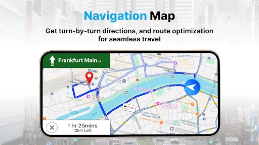
That distinction also helps set expectations around navigation. For a simple look around, panning and zooming are the main draw. For turn-by-turn directions, traffic decisions, or a route you need to follow under time pressure, I would check that the app offers the specific guidance you need before relying on it. A familiar navigation app may be the safer choice when arrival time and road conditions matter more than exploring the map visually.
Checks before you start exploring
If the screen seems blank or a place is slow to appear, I would start with ordinary checks rather than assume the map itself is broken: confirm the device has a working internet connection, wait briefly for imagery to load, and try zooming out before moving back toward the area. A very tight view can be harder to interpret than a broader one, especially when you are still orienting yourself.
It is also worth checking the app’s basic compatibility before installing. The current version is 1.1.0.34 and it requires Android 10 or later. The app is rated for Everyone, has a 3.9 average from around 5,100 ratings, and has been installed over a million times. It is free to download, with optional in-app purchases listed at $6.99 to $14.99 per item. I would look carefully at any purchase screen and make sure it matches what I actually want before confirming.
More From Our News Desk

Clash of Clans Is Won Between the Battles

Android Auto Makes the Case for Quieter Car Software

MobiOffice: Transforming Mobile Productivity with Seamless Integration

EA SPORTS FC™ Mobile Soccer: Redefining Mobile Sports Gaming

How Microsoft OneDrive Became a Mobile Productivity Giant

How Google Translate Breaks Language Barriers Effortlessly
Exploring places and getting unstuck
Have you ever found yourself daydreaming about exploring the world from the comfort of your couch? Well, I recently stumbled upon an app that makes this dream a virtual reality. Allow me to introduce you to Earth Map Satellite Live View, an app that turns your device into a window to the globe.
Discover the World in Real-Time
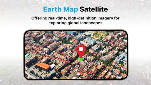
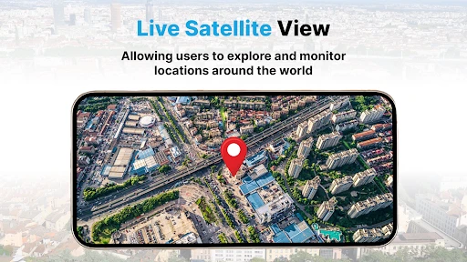
One of the coolest features of Earth Map Satellite Live View is its ability to provide real-time satellite views of any location on Earth. Imagine being able to zoom into the bustling streets of Tokyo or the serene landscapes of the Swiss Alps, all in real-time. It’s like having a magic globe at your fingertips. I found myself getting lost in the endless possibilities of places to explore.
User-Friendly Interface
Now, I’ve got to admit, when I first downloaded the app, I was a bit apprehensive about its usability. But to my pleasant surprise, the interface is incredibly user-friendly. The menu is intuitive, and finding your way around the app is as smooth as butter. Whether you’re a tech guru or someone who struggles with tech, you’ll find it easy to navigate.
Zoom and Pan with Ease
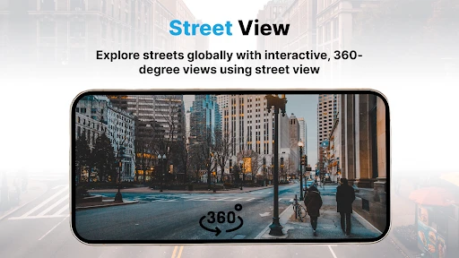
One aspect that really stood out to me was the seamless zoom and pan functionality. You can zoom in to see details like never before, or pan across continents without any lag. It’s as if you’re gliding over the earth, taking in every detail. The app offers various viewing modes, so you can toggle between satellite and street views to get different perspectives.
Making a short browse useful
For a practical everyday use, I would open the map before leaving to meet a friend and inspect the area around the destination: the nearby blocks, the shape of a park, or whether the place sits close to a major road. That gives me a visual preview, but I would still use a conventional route app for the actual journey. Keeping those jobs separate is a useful trade-off: this app invites exploration, while a dedicated navigator is generally better when I need clear directions.
A small workflow tip is to begin with a wide view, identify a landmark or coastline, and then zoom in gradually. If the imagery becomes hard to read, backing out can restore context instead of endlessly dragging around at maximum zoom. If loading stalls, I would check connectivity and reopen the view before drawing conclusions; when several areas remain unavailable, switching to another mapping option may be more practical than repeatedly retrying the same spot.
A useful companion for planning, not a substitute
I can see this being especially handy before a day trip. Suppose I am visiting a town I do not know and want to understand whether the waterfront is close to the center, or how a large park relates to the surrounding streets. A brief look from above can help me picture the layout before I arrive. I would then switch to a standard navigation tool for live instructions, because visual familiarity and turn-by-turn guidance solve different problems.
There is also a nice low-pressure way to use it with children or anyone curious about geography: pick a place from a book, a conversation, or a travel plan and explore the surrounding landscape together. Rather than zooming straight to a tiny point, I would trace a river, coast, or city edge first. That gives the session a clear purpose and makes it easier to notice how individual landmarks fit into a bigger area.
Small habits that prevent wasted taps
When I am comparing two possible destinations, I would keep the same zoom level and look at both areas in turn. This is a simple way to avoid being misled by scale: a neighborhood can seem much larger or smaller if the views are not comparable. I would also note a recognizable feature before panning away, such as a bend in a river or the shape of a park, so I can reorient myself if the screen stops feeling familiar.
If a specific place is difficult to recognize, I would try searching or navigating to a nearby well-known landmark first, then move toward the intended area in stages. That is often less frustrating than repeatedly entering a narrow location and hoping the image resolves exactly as expected. The trade-off is that this kind of visual exploration rewards patience; it is not the quickest way to answer a time-sensitive question about the best route right now.
When another tool is the better fit
People who enjoy geography, want to preview a place visually, or simply like browsing the planet from home are the audience I would recommend it to. Travelers can use it as a companion for familiarizing themselves with a destination, but not as their sole source for time-sensitive directions. If you need dependable route instructions, current road conditions, or a map you can consult without a connection, a navigation app designed around those needs is the more sensible choice.
Compared with a conventional navigation app, the emphasis here is on looking at places rather than getting from one place to another efficiently. A route planner is the obvious choice for a commute, detour, or arrival deadline; this app is more appealing when the map itself is the activity. Compared with a plain paper map, the ability to zoom and pan makes it easier to inspect changing scales, but it also means the experience depends on a screen and a working connection when imagery needs to load.
Who is likely to enjoy it
I would recommend giving it a try if you like browsing landscapes, want a visual preview of an area, or enjoy connecting geography with places you have heard about. It can also suit someone who already has a favorite navigation app and wants a separate tool for casual exploration. That division is sensible: use this for context and curiosity, then use the navigator you trust for the actual journey.
I would skip it as a primary travel tool if my main requirement were reliable, immediate directions, current traffic awareness, or offline access. Likewise, anyone expecting imagery to show what is happening on a street at this moment may be disappointed. The app makes more sense when the goal is to explore the map at your own pace, with another option ready for practical navigation.
Educational and Fun
Besides being a fantastic tool for virtual travel, Earth Map Satellite Live View serves as an educational platform. I found it incredibly useful for learning about geography, understanding global landmarks, and even planning future trips. It’s an app that’s as educational as it is entertaining, making it a win-win in my book.
For a more useful learning session, I would choose one feature to follow rather than jumping randomly between cities: a river from its source toward the coast, the outline of an island, or the relationship between a mountain range and nearby settlements. The map becomes a prompt for questions instead of just a string of zoom gestures. It is still a visual aid, not a guarantee that every detail will be clear at every scale, so I would treat uncertain shapes as a reason to zoom out and regain context.
What to do when the view will not cooperate
If reopening a location does not help, I would make one change at a time: check the connection, wait for the view, then zoom out and approach the area again. That makes it easier to tell whether the problem is temporary loading or simply an awkward view. If the same issue occurs across different places, restarting the app or checking that the device can access the internet are reasonable general steps before deciding the map itself is at fault.
Sometimes the device or connection is the practical obstacle, not the location you are trying to inspect. A slow or unstable connection can make image loading feel inconsistent, and a small screen can make detailed satellite views harder to read. In those cases, I would try a broader view, use a steadier connection if one is available, or return to the task later. For urgent directions, I would not spend time troubleshooting a visual map; I would open a navigation app that is built for that immediate job.
What the audience figures tell me
Earth Map Satellite Live View is published by Synlox Studio and was released on September 11, 2021. Its 1M+ installs and 177 reviews suggest that many people have tried it, though popularity alone does not guarantee that every location will look equally detailed or load equally smoothly. I would judge it by the places I actually want to explore and by whether its viewing experience feels useful on my device.
The rating gives a potential installer one broad signal, not a promise about their own experience. I would use the free download to see whether the places I care about are clear enough for my needs, and I would treat any optional purchase as a separate decision rather than something required to enjoy a basic browse. Since purchases are offered within the app, checking the amount and purpose on the confirmation screen is a sensible pause before paying.
Final Thoughts
In conclusion, if you’re someone who loves exploring and learning about new places, Earth Map Satellite Live View is a must-have app. It combines the thrill of discovery with the convenience of technology. So, next time you’re feeling adventurous, why not embark on a virtual journey around the world? Trust me, you won’t regret it.
My more measured recommendation is to think of it as a visual companion: open it when you want to understand the shape and setting of a place, and keep a dedicated route planner for getting there. That expectation makes its strengths easier to appreciate and its limits easier to work around. If casual map exploration is what you want, it is worth trying; if navigation reliability is the priority, choose the tool designed around that need.
Earth Map Satellite Live View Frequently Asked Questions
Does Earth Map Satellite Live View need GPS permission, and what is it used for?
Earth Map Satellite Live View is a Maps & Navigation app whose short description is “Earth Map.” Its summary highlights virtual travel and accurate GPS Navigation, so location access is relevant when you want to see your position on a map or use navigation features. Before granting permission, consider whether you want location-based functions; you can also explore map locations without relying on your current position.
What features does Earth Map Satellite Live View offer?
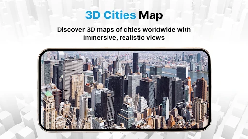
Earth Map Satellite Live View provides users with real-time satellite imagery, street views, and detailed maps. Users can explore various global locations, track their position using GPS, and enjoy 3D views of terrains. The app also offers search functionalities to find specific places and landmarks easily, making it a versatile tool for both casual exploration and navigation.
Is Earth Map Satellite Live View free to use?
Earth Map Satellite Live View is available for free download on both Android and iOS platforms, offering basic features without any cost. However, the app may offer in-app purchases or subscriptions to access premium features such as ad-free experience, enhanced map layers, or offline map downloads. Users should check the app store for pricing details. In-app purchases are listed at $6.99 to $14.99 per item, so review the purchase options before buying.
Can I use Earth Map Satellite Live View offline?
Currently, Earth Map Satellite Live View requires an internet connection to access its real-time satellite imagery and map services. Some features, such as offline map downloads, may be available through in-app purchases, allowing users to access maps without an active internet connection. It's advisable to check the app's settings or documentation for more details on offline usage.
Is Earth Map Satellite Live View compatible with all devices?
Earth Map Satellite Live View is compatible with most modern Android and iOS devices. Users should ensure their device meets the minimum system requirements, such as operating system version and available storage space, as specified in the app store. Older devices may experience performance issues, so it's recommended to use updated devices for the best experience. The Android version requires Android 10 or later.
Pros
- High-resolution satellite images.
- Real-time location tracking.
- Easy-to-navigate interface.
- Street view feature.
- Offline maps available.
Cons
- Ads can be intrusive.
- Limited feature in free version.
- Slow loading times occasionally.
- Drains battery quickly.
- Requires internet for live updates.
- Category
- Maps & Navigation
- Version
- 1.1.0.34











