Earth Map: Live Satellite View
- 4.00
- 2.9
- Installs
- 100.00K
- Price
- Free

Screenshots

Analysis by Reviewed
Earth Map: Live Satellite View is the kind of navigation app that immediately appeals to curious travelers, map enthusiasts, and anyone who enjoys seeing places from above. I spent time looking at it not just as a route planner, but as a visual map tool built around satellite imagery, GPS positioning, voice guidance, three-dimensional views, and a camera-oriented map experience. That combination gives it a broader feel than a basic street-navigation app, although it also creates a few expectations that the app cannot always satisfy as cleanly as a dedicated navigation service.
It is developed by PerfectSolution and sits in the Maps & Navigation category. The app is free to install, with optional in-app purchases ranging from $5.99 to $49.99 per item. That distinction matters: you can try the core experience without paying upfront, but the most useful question is whether the free access is enough for your habits or whether the paid options become necessary once you use the more advanced parts regularly.
How Earth Map: Live Satellite View feels in everyday use
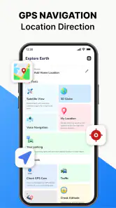
The first thing I noticed is that this is not trying to be only a conventional turn-by-turn navigator. Its identity comes from combining a global earth map with live satellite viewing and GPS tools. In practical terms, I found myself using it in two different ways: first, to inspect an area visually, and second, to use my current position and voice directions when moving around.
That split is important. A normal navigation app usually starts with a destination and quickly pushes you toward the fastest or most convenient route. Earth Map: Live Satellite View encourages a little more exploration before you travel. You can examine the surrounding landscape, look at the shape of roads and open areas, and build a mental picture of a place before relying on directions. For unfamiliar neighborhoods, a large venue, or a rural destination, that visual preparation can be genuinely useful.
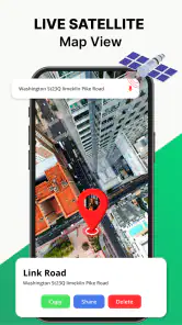
The satellite perspective is particularly helpful when standard map lines feel too abstract. A road may appear to end near a field, a shoreline, or a cluster of buildings, while the satellite view gives you a better sense of the physical setting. I would not treat the imagery as a guarantee that every entrance, path, or recent construction is represented perfectly, but it adds context that ordinary map tiles often lack.
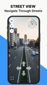
The three-dimensional map view also changes how I read an area. Instead of seeing every location as a flat diagram, I can use the perspective to understand the shape of a district or the relationship between roads and nearby landmarks. This is most valuable when I am orienting myself rather than when I am already driving. While moving, clarity and timing matter more than visual drama, so I tend to switch my attention back to the route and voice instructions.
A useful workflow before leaving home
One of the better ways to use this app is as a short planning tool rather than opening it only after getting lost. Before visiting somewhere unfamiliar, I would search the destination, switch to the satellite or three-dimensional perspective, and inspect the final approach. That extra look can reveal whether the destination appears to sit behind a larger building, near an open lot, beside a narrow road, or close to a confusing junction.
More From Our News Desk

Clash of Clans Is Won Between the Battles

Android Auto Makes the Case for Quieter Car Software

MobiOffice: Transforming Mobile Productivity with Seamless Integration

EA SPORTS FC™ Mobile Soccer: Redefining Mobile Sports Gaming

How Microsoft OneDrive Became a Mobile Productivity Giant

How Google Translate Breaks Language Barriers Effortlessly
This is a small habit, but it solves a common navigation problem: arriving in the right general area while still not knowing which entrance or side of a property makes sense. Voice navigation can guide the route, but the aerial view helps answer the human question of what the place should look like when I get there.
I also found the workflow useful for planning walks and short drives where the obvious route is not necessarily the most comfortable one. A satellite view can help me notice broad green spaces, water, large parking areas, or road layouts that are easy to miss on a simplified map. I would still verify the route with local signs and common sense, especially in places where imagery may not reflect recent changes.
GPS, voice guidance, and the camera angle
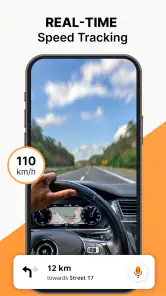
The GPS function gives the app a practical purpose beyond browsing the planet. When I use it while moving, the current-position view helps connect the map to where I actually am. Voice navigation is also valuable because it lets me keep my eyes away from the screen more often. That is the right approach for driving: set the route before moving, listen for instructions, and use the visual map only when it is safe to do so.
The GPS camera element is more distinctive than what I expect from a standard map application. It can make the experience feel more immediate because the map is not limited to a flat screen view. I see the appeal for orientation, sightseeing, and checking how a mapped direction relates to the scene around me. At the same time, I would not confuse this with a complete replacement for careful visual navigation. A camera-based view can be engaging, but it may be less useful than a simple route line when I need an instruction quickly.
My practical advice is to treat the camera feature as an orientation aid, not as the sole source of driving decisions. It is better suited to understanding direction and surroundings than to handling every complicated junction. On foot, it may be easier to pause and compare the view with the environment. Behind the wheel, voice instructions and a simple map position should remain the priority.
What the free access means for value
The app’s free price makes experimentation straightforward. I can install it, explore the earth map, test the satellite view, and decide whether its style suits me without committing money at the beginning. For occasional users, that may already be enough value. Someone who wants to inspect a holiday destination, check a property’s surroundings, or enjoy a visual map of a city can get a useful experience before considering any purchase.
There are also optional purchases priced from $5.99 to $49.99 per item. I would approach those carefully rather than assuming that paying automatically makes the app a better navigation choice. The sensible test is whether a paid option removes a limitation that affects my own routine. If I only open the app a few times a month, the free experience may be the better financial decision. If I use its visual tools frequently and the paid features materially improve that use, the cost becomes easier to justify.
The strongest value is available before spending anything: try the map, satellite perspective, GPS behavior, and voice guidance first. That approach keeps the decision grounded in actual use instead of the promise of a longer feature list. Since the app has a free entry point, I do not see a reason to buy immediately after installation.
The app is rated 2.9 on average from 212 ratings, which suggests a mixed experience among users. I would not read that number as proof that the app is unusable, but I would take it as a reason to test it in the exact situation that matters to me. Navigation apps can feel excellent on one phone and frustrating on another because of screen size, location accuracy, network conditions, or personal expectations about map detail.
Where it differs from familiar map alternatives
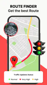
Compared with a typical navigation app, Earth Map: Live Satellite View puts more emphasis on visual discovery. The usual alternatives are often better when I need mature route planning, transit information, traffic-aware decisions, business details, or a highly familiar interface. They tend to be designed around getting from point A to point B with as little thought as possible.
This app makes more sense when the map itself is part of the reason I am opening it. Satellite imagery, three-dimensional perspective, and the camera-oriented feature give it a more exploratory personality. I can look at a destination before traveling and understand the area in a way that a basic route screen may not encourage.
That difference creates a clear trade-off. If my only requirement is dependable daily commuting, I would usually favor an established navigation service that specializes in live route decisions. If I want to inspect an unfamiliar location, compare the visual layout of an area, or combine exploration with GPS guidance, this app offers a more interesting alternative.
Limitations I would consider before relying on it
The broad feature mix can make the experience feel less focused than a purpose-built navigation app. Satellite viewing, three-dimensional maps, GPS positioning, voice directions, and camera interaction all serve different needs. I appreciate having them together, but I also have to decide which view is actually helping at a given moment. A visually rich screen is not automatically the clearest screen.
Satellite imagery also has a natural limitation: it is excellent for showing physical layout, but it is not the same as live knowledge of every road condition or recent change. A newly altered entrance, temporary closure, construction zone, or private access point may not be obvious from an aerial image. I would use the imagery to prepare and orient myself, then rely on signs and current conditions when I am physically there.
Voice navigation is useful, but I would not judge it by the same standard as a navigation service whose entire design is centered on driving. The app’s wider visual focus means that users who want highly polished commuting support may prefer a more specialized alternative. For a short trip in a familiar city, the difference may not matter. For a complicated journey where timing, traffic, and route changes are critical, it matters much more.
Another point is device compatibility. The app requires Android 8.0 or later, so anyone using an older Android phone should check compatibility before planning around it. On supported devices, the experience will still depend on how comfortably the phone handles map movement, satellite imagery, and the camera-related view. A larger screen can make exploration easier, while a smaller one may make detailed inspection feel cramped.
Who will get the most from it?
I think the best match is someone who wants more than a route line. Travelers can use it to preview a destination and understand the surrounding area before arriving. Hikers and outdoor-minded users may appreciate the aerial context, although I would not treat it as a substitute for dedicated trail information or local safety preparation. Students, geography enthusiasts, and curious map browsers may enjoy the earth-focused presentation even when they are not planning a trip.
It can also help people who regularly visit large or confusing locations. Before going to a venue, campus, industrial area, or spread-out property, I can use the satellite perspective to understand the approach and identify visual reference points. That does not guarantee perfect wayfinding, but it reduces the feeling of arriving somewhere with no mental map.
The app is available with an Everyone content rating, which makes it suitable for a broad audience from a content-classification perspective. That does not remove the need for responsible use: children and passengers can explore maps safely, while drivers should never interact with the screen in a way that distracts them from the road.
I would be less enthusiastic about recommending it to someone who wants one dependable tool for every transport situation. Daily commuters, delivery drivers, and people who depend on highly detailed live routing may be happier with an app built specifically around traffic, road alerts, and efficient navigation. Likewise, anyone who dislikes experimenting with multiple map styles may find the extra visual options unnecessary.
My decision on the optional purchases
I would keep using the free version long enough to answer three practical questions. Does the GPS position remain useful in the places I visit? Do the voice instructions feel clear enough for my normal trips? And do I return to the satellite, three-dimensional, or camera views often enough that they add real value rather than novelty?
If the answer to the first two questions is no, paying would not solve the basic mismatch. I would choose a more established navigation alternative instead. If the answer is yes, and the visual tools have become part of how I prepare for trips, an optional purchase may be reasonable. The important distinction is that I would be paying for a better fit with my personal workflow, not simply for a higher number of features.
The wide range between $5.99 and $49.99 per item also makes it especially important to pause before choosing a purchase. A light user should not assume that the most expensive option is necessary. I would select only the option whose benefit I can identify clearly, and I would continue with free access if my use remains occasional.
Final verdict after using it as a map and navigator
Earth Map: Live Satellite View is most appealing when I want to see a place, not merely reach it. Its satellite imagery, three-dimensional map presentation, GPS tools, voice guidance, and camera-oriented view create a more visual experience than the standard navigation routine. I found its best use in preparing for unfamiliar locations, understanding the shape of an area, and combining exploration with basic route guidance.
Its weaknesses come from the same design choice. It is broader and more visually ambitious than a simple map, but that does not automatically make it the best tool for demanding everyday navigation. I would remain cautious about relying on aerial imagery for current road conditions, and I would compare its guidance with a specialized alternative when a journey is important or time-sensitive.
For me, the free entry point makes it worth trying, especially for travelers, map explorers, and people who enjoy checking a destination from above before visiting. The mixed average rating means I would test it patiently rather than assume it will replace my current navigation app. My recommendation is to keep it if the visual map experience changes how you plan and understand places; skip the paid options if you only need routine turn-by-turn directions. With PerfectSolution’s current version 2.2.9, it is a worthwhile free experiment, but its real value depends on whether you want an exploratory earth map or simply the fastest route home.
Earth Map: Live Satellite View Frequently Asked Questions
Who develops Earth Map: Live Satellite View, and what devices can run it?
Earth Map: Live Satellite View is developed by PerfectSolution and is a Maps & Navigation app. The listed minimum operating system is Android 8.0, so check your device’s software version before downloading. The app is rated for Everyone. Compatibility and availability can vary by platform and device, so review the app-store page on the device you plan to use.
What features does Earth Map: Live Satellite View offer?
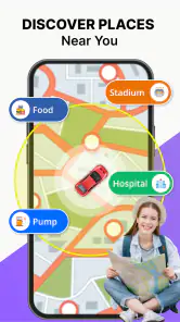
The app’s description highlights an Earth map, live satellite view, GPS voice navigation, a 3D map, and a GPS camera. These tools are intended to help users view locations and use map-related features from a mobile device. The exact experience may depend on the feature you choose and your device, so it is sensible to check the app’s permissions and explore its options after installation.
What is Earth Map: Live Satellite View?
Earth Map: Live Satellite View is a map and satellite-imagery application designed for exploring locations around the world from a mobile device. It typically combines satellite-style map layers with standard mapping tools, allowing you to search for places, inspect terrain, view landmarks, and understand an area from an overhead perspective. It is best treated as an exploration and reference tool rather than a guaranteed real-time camera feed of Earth.
Does Earth Map: Live Satellite View show images in real time?
Despite the “live” wording often used in the app’s presentation, satellite and aerial imagery is generally not a continuous live broadcast. Images may come from previously captured map data and can vary in age depending on the location and imagery provider. Roads, buildings, construction sites, and natural areas may therefore look different from what you see today. Users should not rely on the app for live traffic, emergency monitoring, or up-to-the-minute changes.
Can I use the app to search addresses and explore specific places?
The app is mainly useful for browsing the globe, zooming into regions, and examining locations through map or satellite views. Search availability and accuracy can depend on the underlying map service, internet connection, and the country being viewed. It may help you identify landmarks, neighborhoods, coastlines, and general geographic features, but it should not replace an official navigation service when you need turn-by-turn directions, verified addresses, or precise travel information.
Pros
- High-resolution satellite imagery makes it easy to explore remote locations.
- Simple map controls are accessible for both beginners and experienced users.
- Useful for checking terrain
- coastlines
- landmarks
- and geographic surroundings.
- Location search helps you quickly find cities
- addresses
- and points of interest.
- A practical visual tool for trip planning and outdoor exploration.
Cons
- Image quality and update frequency vary significantly by location.
- Some advanced map features may require a paid subscription.
- Satellite imagery can consume considerable mobile data during extended use.
- The app may feel slow when loading detailed views on older devices.
- Live imagery should not be expected; satellite photos may be outdated.
- Category
- Maps & Navigation
- Version
- 2.2.9











