Earth 3D Map-StreetView Camera
- 446.00
- 4.3
- Installs
- 10.00M
- Price
- Free

Screenshots
Analysis by Reviewed
I judge a map app by what I reach for it to do once the initial novelty wears off. With Earth 3D Map-StreetView Camera, that question is less about navigating every trip and more about whether seeing a place from several perspectives helps me understand it. I find it most rewarding when I have a particular destination, neighborhood, or travel question in mind; casual browsing can be fun, but it does not automatically become a daily routine.
Who gets the most from opening it
I would recommend trying it if you are planning a visit to an unfamiliar area and want more context than a pin on a standard map can offer. A traveler deciding where to stay, someone checking the surroundings of a meeting location, or a curious person exploring a city from home can all get a clear purpose from its mix of 3D views and street-level imagery. The key is to treat it as a way to build a picture of a place, not as proof that every detail is current.
It can also be useful when you are helping someone else prepare. If a friend is nervous about finding a venue, I can use the visual views to describe the surrounding streets and give them landmarks to look for. That is a more practical use than aimless browsing, because it turns the imagery into a shared orientation aid. I would still pass along the address and check directions separately rather than assume a screenshot or remembered view is enough to get them there.
A small planning routine that pays off
For a first visit, I would start broad, identify the destination’s position in the surrounding area, then zoom in to inspect the immediate approach. After that, I would switch to a standard navigation service to check the route and any time-sensitive travel details. This order helps prevent a common mistake: confusing an attractive visual perspective with a usable route. Aerial context can make two places look close together even when the practical journey between them is less straightforward.
For example, before meeting a friend at a café in an unfamiliar part of town, I might inspect the blocks around the address and look for a recognizable corner or nearby landmark. I would then confirm the actual route in my everyday maps app and keep that app open while travelling. Earth 3D Map-StreetView Camera is useful here because it helps me picture the destination; the other tool handles the live journey. That division of work makes the app easier to keep without asking it to replace something it is not designed to be.
Where it fits beside other maps
Compared with a conventional road map, this app puts visual exploration first. A familiar navigation app is usually the better choice when I need a route, current travel guidance, or a quick answer while already on the move. A satellite view can show the broad layout, while street-level imagery gives a more grounded impression of a road or neighborhood. Neither view alone answers every practical question, so I see this app as a complement rather than a direct replacement for the tools I use to travel.
That distinction is especially useful when comparing places before a trip. A basic map may make it easier to compare locations at a glance, but it can leave me with little sense of what the surrounding streets look like. Here, the visual detail can help me decide what I want to investigate next. It cannot tell me whether a venue is open today or whether a particular approach is convenient now, so I would verify those details elsewhere before making plans that depend on them.
You May Like

Clash of Clans Is Won Between the Battles

Android Auto Makes the Case for Quieter Car Software

MobiOffice: Transforming Mobile Productivity with Seamless Integration

EA SPORTS FC™ Mobile Soccer: Redefining Mobile Sports Gaming

How Microsoft OneDrive Became a Mobile Productivity Giant

How Google Translate Breaks Language Barriers Effortlessly
When the visual approach becomes tiring
The same emphasis on views that makes the app engaging can also make it feel like the wrong tool for a quick lookup. If I only need to confirm a street name or get across town, extra visual exploration is unnecessary friction. The app is a better fit for questions that benefit from looking around than for tasks where speed and current directions are the whole point. If those quick navigation tasks make up nearly all your map use, a regular route-focused app is likely to earn more frequent attention.
There is also a risk of overconfidence: detailed imagery feels persuasive, even when it may not reflect present-day conditions. I would not use an old-looking scene to judge whether a path is accessible, whether a storefront is still there, or which entrance is currently in use. The sensible habit is to treat imagery as a preview, then check recent local information for anything that could change. That small extra step keeps the app helpful without letting a convincing view stand in for confirmation.
Explore the World in 3D
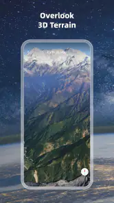
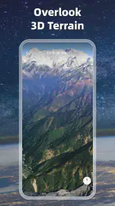
One of the standout features of the Earth 3D Map-StreetView Camera is its stunning 3D maps. The app transforms flat, boring maps into vibrant, lifelike landscapes that make you feel like you're actually there. Whether you're checking out the bustling streets of New York City or the serene beaches of Bali, the app's 3D rendering brings each location to life in a way that's both engaging and informative.
A satisfying first week of exploring
In its first few days, the appeal is easy to understand. This is a free maps and navigation app from Foxpoi, and its mix of globe-scale views, 3D terrain and street-level imagery encourages me to browse without a particular destination in mind. I might look around a neighborhood I have heard about, compare its surroundings from above, then switch to a street view to get a more human sense of the area. That change in perspective is more engaging than simply reading place names on a flat map.
A practical way to get more from that first session is to start with a real question instead of spinning the globe at random. If I am choosing between two areas to stay in, for instance, I can inspect the broader layout first, then use street imagery to see what the nearby streets feel like. I treat that as visual context, not a guarantee of current conditions: imagery can be older than what I would see by visiting, so I would still check recent local information before making a decision.
Street View Magic
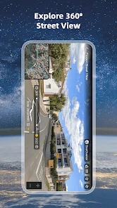
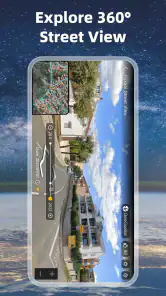
If you've ever used Street View before, you know how amazing it is to drop into a random street halfway around the world and explore. This app takes that experience to the next level by integrating Street View with its 3D maps. You can seamlessly switch between aerial views and street-level perspectives, making it easier than ever to plan your next vacation or simply satisfy your wanderlust.
The Street View feature is particularly handy for those who love to travel but can't always get away. It allows you to virtually "walk" through neighborhoods, check out tourist hotspots, and even peek inside some of the world's most famous landmarks. It's like having a passport to the world, without the hassle of airport security.
Putting the views to work
I get the most practical value when I use the views in sequence. Before meeting someone at an unfamiliar address, I can inspect the surrounding blocks from above, then use street-level imagery to recognize the approach. That does not replace checking live directions or transit details in a dedicated navigation service, but it can reduce the uncertainty of arriving somewhere new. For travel planning, looking beyond a hotel pin is useful too: the shape of nearby streets and the distance to larger roads can give me questions to investigate before booking.
There is a small but important trade-off in that workflow. A striking 3D view can make a location feel more understandable than it really is; perspective and imagery are not the same as knowing whether a route is walkable, open, or convenient today. I use the app to form a mental picture, then switch to a conventional map or local source when timing, current access, or turn-by-turn guidance matters.
Easy Navigation and User-Friendly Interface
One of the things I love most about this app is its user-friendly interface. The developers have clearly put a lot of thought into making navigation as intuitive as possible. Everything you need is right at your fingertips, from searching for specific locations to switching between views. Plus, the app runs smoothly, with minimal lag, even when displaying heavy 3D graphics.
The search function is particularly impressive. It allows you to find locations by name or by simply dropping a pin on the map. Whether you're planning a trip or just exploring for fun, the app makes it easy to find exactly what you're looking for.
When a regular map is the better tool
For a routine commute, I would still reach first for a navigation app built around live route decisions. This one is better when the question is “What does this place look like?” than “Which turn should I take right now?” That distinction matters if you are driving, managing a tight schedule, or need reliable updates while moving. I would also skip it if I only want a lightweight way to check a street name; the 3D and imagery-led approach is more rewarding when visual exploration is the point.
It suits curious travelers, people comparing unfamiliar neighborhoods, and anyone who enjoys learning a city’s layout before arriving. It is less compelling for someone who rarely explores maps and already has a trusted everyday navigator. A useful habit is to open it when planning a visit, inspect the destination and its surroundings, then keep your regular navigation tool for the actual trip. That gives each app a clear job instead of expecting one to do everything.
Month-to-month value and upkeep
After the initial novelty fades, the app’s lasting value depends on whether visual exploration becomes part of how I prepare for places. I can imagine returning before a holiday, while helping a friend understand where a meeting point is, or simply when curiosity sends me to a part of the world I do not know. Those are recurring but occasional reasons to open it; I would not expect it to become a daily habit for everyone.
The app is rated 4.3 on average, with around 35,000 ratings and 10 million-plus installs. It is free to download, rated for Everyone, and its current version is 2.3.7.7; optional in-app purchases range from $2.99 to $25.33 per item. I would try the basic experience before spending, especially if I am unsure how often I will use it. Its release on September 1, 2021, also makes it sensible to judge the current app by how it works on your device rather than by first impressions alone. It supports Android 7.0 and above.
For maintenance, I would keep expectations modest: use the search and view controls when a specific need comes up, and do not turn browsing into a chore. The main friction is not a complicated setup but the possibility of opening it for a quick practical answer and finding that a visual map cannot settle a time-sensitive question. Before depending on any imagery for a visit, I would cross-check details that can change, such as access or the exact route.
Does it earn a lasting place?
My honest verdict is that Earth 3D Map-StreetView Camera earns a place for people who enjoy seeing destinations rather than just locating them. Its most useful role is as a low-pressure way to build familiarity: explore the area before a trip, orient yourself around a meeting point, or satisfy a burst of curiosity from home. I would not make it my sole navigation tool, but I can see myself keeping it available for those moments when a flat route line is not enough and I want a better sense of the place.
Earth 3D Map-StreetView Camera Frequently Asked Questions
Is Earth 3D Map-StreetView Camera free to download, and are purchases optional?
Earth 3D Map-StreetView Camera is free to download, so you can install it without paying upfront. The app also offers in-app purchases, priced from $2.99 to $25.33 per item. Those purchases are separate from the initial download, so consider whether you want to spend on optional extras before buying anything.
What can I explore with Earth 3D Map-StreetView Camera?
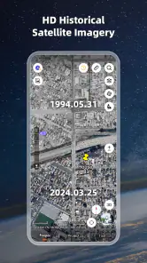
The app is designed for exploring places through 3D map views, street-level imagery, and satellite visuals. That mix can help you browse locations from different perspectives, whether you are curious about a destination or want to look around an area virtually. Its focus is visual exploration, making it useful for travel enthusiasts and people interested in geography.
Is Earth 3D Map-StreetView Camera suitable for children?
Earth 3D Map-StreetView Camera has an Everyone content rating, making it suitable for a broad audience. Its mapping and exploration focus can appeal to people of different ages, although parents may still want to review the app and its purchase options with younger users. In-app purchases are available, so device-level purchase controls may be useful for families.
Who develops Earth 3D Map-StreetView Camera, and what kind of app is it?
Earth 3D Map-StreetView Camera is a Maps & Navigation app developed by Foxpoi. Its focus is exploring places through 3D map views, street-level imagery, and satellite visuals, making it suited to users who want to browse the world as well as look up locations. It is free to download and is rated for Everyone.
What is Earth 3D Map-StreetView Camera?
Earth 3D Map-StreetView Camera is a dynamic application that allows users to explore the world in stunning 3D visuals. It provides an interactive platform for virtual tourism, letting users dive into street-level views and panoramic vistas of different locations globally. The app is perfect for travel enthusiasts and geography aficionados who want to experience the world from their device.
Pros
- Interactive 3D maps enhance exploration.
- Street view offers real-time navigation.
- User-friendly interface simplifies use.
- Supports offline maps for remote areas.
- Frequent updates with new locations.
Cons
- High data usage for live street view.
- Occasional lag in 3D rendering.
- Limited customization options.
- Ads can be intrusive at times.
- Some areas lack street view coverage.

- Category
- Maps & Navigation
- Version
- 2.3.7.7











