DroidEFB: EFB for Pilots (US)
- 348.00
- 4.0
- Installs
- 100.00K
- Price
- Free

Screenshots
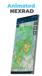
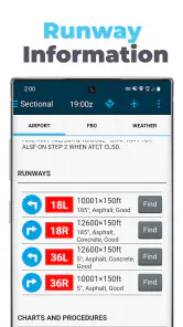
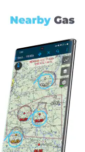
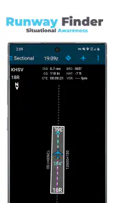
Analysis by Reviewed
When I look at an aviation app, I care less about how impressive the feature list sounds and more about whether it helps me make a calmer, better-organized decision before and during a flight. DroidEFB: EFB for Pilots (US) is built around that practical idea. It is a free Maps & Navigation app from DroidEFB, LLC - Aviation GPS, designed for pilots who want charts, airport information, flight planning, and in-flight reference tools in one place.
The capability that stands out most is its combination of VFR and IFR charts with geo-referenced approach plates. In plain language, the app is not limited to showing a static aviation document. It is intended to connect the chart or plate with your position, giving you a more immediate picture of where the aircraft is in relation to the information on screen. That can make a real difference when I am trying to keep the big picture in mind instead of switching between unrelated tools.
It also brings ADS-B support and flight plan filing into the same pilot-focused environment. Those additions matter because preparation, navigation, and situational awareness are rarely separate tasks in real flying. I would not treat any tablet application as a replacement for proper training, aircraft instruments, or required procedures, but I can see the value in having a dedicated electronic flight bag available as a supporting tool.
Why geo-referenced charts are the app’s most useful idea
A conventional chart viewer is helpful, but it still leaves me to interpret my position manually. With a geo-referenced chart or plate, the useful question becomes more direct: where am I in relation to the route, airport, runway, or procedure shown on the page? That reduces one layer of mental translation, especially when the screen contains a lot of information.
This is particularly relevant during the transition from planning to execution. Before departure, I might review a route on a chart and then examine the relevant airport material. Once airborne, I want the same information to remain understandable without repeatedly reconstructing my location from memory. The value is not that the app makes decisions for me; the value is that it can present the information in a way that is easier to connect with the flight I am actually conducting.
For VFR flying, that can support route awareness near unfamiliar airports or along a planned trip. For IFR work, a geo-referenced plate can help me relate the procedure to the aircraft’s movement while I continue to follow clearances, instruments, and established operating practices. I see this as a workload aid, not an invitation to stare at a tablet when attention belongs outside or on the panel.
One practical habit I would recommend is reviewing the chart away from the aircraft first, then using the moving position as confirmation rather than as the only source of understanding. That approach makes the feature more useful. If I already know the route and the important landmarks, the position display helps me maintain orientation. If I open a plate for the first time under pressure, no electronic overlay can replace preparation.
More From Our News Desk

Clash of Clans Is Won Between the Battles

Android Auto Makes the Case for Quieter Car Software

MobiOffice: Transforming Mobile Productivity with Seamless Integration

EA SPORTS FC™ Mobile Soccer: Redefining Mobile Sports Gaming

How Microsoft OneDrive Became a Mobile Productivity Giant

How Google Translate Breaks Language Barriers Effortlessly
From planning screen to cockpit reference
The app’s other aviation functions support that same workflow. I can think of it as a chain: select or build a flight plan, examine the relevant charts, review airport material, and then use the electronic flight bag as a reference during the trip. Having those steps in one aviation-specific app is more coherent than assembling a general map application, a document viewer, and a separate planning tool.
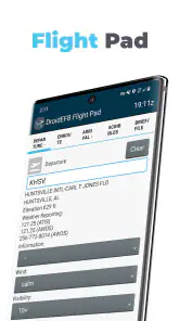
Flight plan filing is useful for pilots who want to move from route preparation toward an operational task without leaving the same environment. I would still check every entry carefully before submitting anything. A convenient filing screen is not a substitute for verifying the route, aircraft details, alternates, fuel planning, weather, and the rest of the information that belongs to a responsible preflight process.
ADS-B support adds another layer to the picture. Its benefit depends on the equipment and setup used with it, so I would not judge the app by assuming that the feature alone creates complete traffic awareness. When the necessary source is available, however, bringing traffic-related information alongside charts and planning material can make the tablet more useful as a single cockpit reference. The key trade-off is that more information can also mean more screen management, so I would configure the display around the flight rather than leave every possible layer visible.
That is one of the less obvious lessons with an EFB: the best screen is not necessarily the busiest one. If I am navigating visually, I want the chart and position to remain readable. If I am preparing an instrument procedure, I want the plate and essential route context to be easy to find. If I am checking traffic information, I need enough attention left for lookout and aircraft control. The app’s usefulness depends partly on how selectively I use its tools.
A realistic cross-country workflow
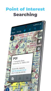
Imagine I am preparing a daytime trip to an airport I do not use often. I would begin by organizing the route and looking at the applicable VFR chart. Instead of relying only on a broad road-map view, I could study the aviation chart and identify the airport environment, nearby points of interest, and the general shape of the route. I would then look at the destination information and keep the relevant material available for later reference.
Before starting the engine, I would check that the tablet is ready, the planned material is accessible, and the information I intend to use is the information I actually reviewed. Once airborne, the geo-referenced view could help me confirm my progress and maintain awareness of the route. Near the destination, the airport and plate material would be more useful than a generic navigation map because it is written for aviation decisions rather than road travel.
In that scenario, the app is not doing one magical thing. It is reducing the number of context switches. I am less likely to jump between a general map, a separate PDF reader, and another aviation service simply to answer related questions. That continuity is the real strength of the design, especially for pilots who prefer a single organized workspace.
I would also use a backup mindset. A tablet can run out of power, become difficult to read in sunlight, lose connectivity, or simply become distracting at the wrong moment. I would keep the aircraft’s approved equipment and normal backup procedures in charge of the flight. DroidEFB can support my workflow, but it should not become the only thing I trust.
Where it fits beside ordinary alternatives
A general navigation app is usually better for driving to the airport, finding a business address, or handling everyday travel. It is not designed around VFR and IFR chart interpretation, geo-referenced plates, or pilot-specific flight plan tasks. A plain document reader can display a plate, but it does not provide the same sense of connection between the document and the aircraft’s position.
On the other hand, a highly specialized paid aviation platform may offer a broader ecosystem, deeper customization, or a more polished workflow for pilots who fly frequently and depend on advanced planning tools. I would not automatically choose DroidEFB over every established alternative. Its appeal is strongest when I want a dedicated aviation app without paying an upfront download price and when its particular combination of charts, plates, ADS-B support, and filing is enough for my operation.
The free price makes it approachable for a student, occasional pilot, or someone evaluating an electronic flight bag before committing to a larger service. That does not mean the complete experience is cost-free: optional in-app purchases range from one dollar to one hundred forty-nine dollars and ninety-nine cents per item. I would review what each purchase provides before building my workflow around it, because the value depends on which charts, services, or capabilities I actually need.
Important trade-offs before relying on it
The first trade-off is learning. An aviation app can look familiar because it runs on a phone or tablet, but charts, plates, flight plans, and traffic information require aviation knowledge. I would not recommend installing it and immediately treating it as a substitute for instruction. The app can organize information; it cannot teach me how to interpret a procedure safely or decide whether conditions are suitable for a flight.
The second is attention management. Geo-referencing is helpful precisely because it makes the screen more connected to the flight, but that can tempt me to watch the display too closely. I would use it in short, purposeful checks and keep my scan, communication, and aircraft control priorities intact. The feature is most valuable when it lowers uncertainty without becoming the center of attention.
The third is preparation discipline. A flight plan filing tool can make submission feel easy, but ease of submission should not shorten the planning process. I would verify the route and all required details separately, then use the app to carry out the administrative step. This is a small distinction, but it prevents a convenient interface from creating false confidence.
There is also the question of device suitability. The app supports devices running Android version eight or later, which makes it available to a wide range of users, but compatibility alone does not guarantee a good cockpit experience. Screen size, brightness, mounting position, battery condition, and the pilot’s ability to read the display comfortably all matter. A phone may be useful for backup reference, while a larger tablet may be easier for charts and plates; the right choice depends on the cockpit and the task.
Because this is a US-focused EFB, I would see it as a better fit for pilots whose flying and chart needs are centered on the United States. Someone flying internationally, or someone whose main requirement is a particular regional data service, should compare coverage and workflow carefully before making it central to flight operations. That is not a criticism of the app’s concept; it is simply a reminder that aviation information is highly dependent on location and purpose.
Who is likely to gain the most
I think the strongest audience is the pilot who wants a focused aviation workspace and values the relationship between a moving aircraft position and the chart or plate being viewed. Student pilots can use it as a way to become more comfortable with electronic chart organization, provided an instructor remains part of the learning process. Private pilots flying occasional trips may appreciate having planning and reference tools together instead of maintaining several unrelated apps.
It may also suit pilots who already use ADS-B equipment and want that information considered alongside their aviation charts. The advantage is not simply having another traffic display; it is having traffic-related awareness within the same general environment used for route and airport reference. I would still treat the traffic picture as supplementary and continue using the normal visual and procedural safeguards.
Frequent instrument pilots should judge it more critically. If my work depends on highly refined briefing, extensive customization, specialized weather services, or a particular subscription ecosystem, another EFB may be a better investment. DroidEFB is more compelling when its central workflow matches my needs than when I expect it to replace every aviation service I already use.
Likewise, a person looking only for a simple road-navigation app should skip it. The aviation terminology and chart-based presentation would add unnecessary complexity for ordinary commuting or travel. This is a tool for pilots, not a general-purpose map application with a few aircraft-themed extras.
What the current release tells me
The app was released on June twenty-fourth, two thousand fifteen, and the current version is 2.9.7. That history suggests a product with time behind it rather than a brand-new experiment. Its average rating is 4.0 from around seven hundred forty-five ratings, with roughly three hundred forty-eight written reviews, and it has passed one hundred thousand installs. Those figures point to a real user base, while also reminding me that it is not necessarily the dominant choice for every pilot.
The Everyone content rating is reassuring from an access standpoint, although the intended use is still specialized. The rating describes the app’s general content classification, not whether a particular pilot is qualified to use an electronic flight bag in a given operation. I would make that distinction clearly before putting it into a cockpit workflow.
My overall impression is that the app’s best reason to exist is not the number of tools it gathers, but the way geo-referenced aviation information can make a chart more immediately useful. When I prepare properly, it can help connect route planning, airport reference, procedure review, and position awareness. That is a meaningful benefit for pilots who want one practical workspace.
I would recommend trying it for planning and familiarization before depending on it in flight. Check how comfortably the charts read on the device, understand which optional purchases apply to your needs, test the ADS-B and filing workflow in a non-urgent setting, and establish a backup plan. If that process fits your flying, the free entry point makes DroidEFB worth exploring.
My final view is balanced: the geo-referenced chart workflow is genuinely useful when it supports preparation rather than replacing it. Pilots who want a US-oriented EFB with VFR and IFR material, plate awareness, ADS-B support, and flight plan filing may find a lot to like here. Pilots seeking a universal navigation app or a fully comprehensive premium ecosystem should look elsewhere. For the right user, though, DroidEFB offers a sensible way to keep important aviation information closer together and easier to relate to the flight in progress.
DroidEFB: EFB for Pilots (US) Frequently Asked Questions
Is DroidEFB free to download, and are there optional purchases?
DroidEFB is free to download, with in-app purchases ranging from $1.00 to $149.99 per item. Since those purchases may relate to features or services you want to use, check the app’s purchase options before depending on a particular capability. The app is rated for Everyone, and it is developed by DroidEFB, LLC - Aviation GPS.
What does DroidEFB offer for U.S. flight planning and navigation?
DroidEFB is a Maps & Navigation app for pilots, with a U.S. electronic flight bag that includes VFR and IFR charts, geo-referenced plates, ADS-B support, and flight plan filing. These tools can bring several planning and in-flight resources together on a mobile device. Before relying on any feature, make sure it fits your operation and confirm critical information using appropriate aviation sources.
What is DroidEFB: EFB for Pilots, and who is it designed for?
DroidEFB is an electronic flight bag application designed to help pilots organize and access important flight information on a mobile device. It may be useful for student pilots, private pilots, and aviation professionals who want digital access to documents, checklists, notes, aircraft information, and other flight-planning resources. Its usefulness depends on your aircraft, operating region, and the accuracy of the information you provide or import.
Can DroidEFB replace official charts, aircraft manuals, or required paper documents?
DroidEFB should not automatically be treated as a replacement for official navigation charts, aircraft flight manuals, operating handbooks, checklists, or documents required by your aviation authority or operator. Before relying on it during a flight, confirm that the app supports your operation and that its data is current. Pilots should always maintain appropriate backups and follow applicable FAA, airline, school, or local aviation procedures.
Does DroidEFB include current U.S. aviation charts, weather, or navigation data?
The availability of charts, weather information, airport data, and navigation resources can depend on the app version, subscriptions, regional coverage, and the data sources supported by DroidEFB. Before downloading, review the current store description and in-app options to confirm what is included for the United States. Always check update dates and compare critical information with official FAA or other authorized sources before departure.
Pros
- Conveniently organizes flight documents
- charts
- and reference material in one app.
- Offline access is useful when flying without reliable mobile data coverage.
- Designed around pilot workflows rather than general-purpose document viewing.
- Can reduce the need to carry printed manuals and navigation references.
- Helpful for keeping frequently used aviation resources readily available.
Cons
- Coverage and chart availability may vary depending on region and subscription plan.
- Users must verify that documents and charts are current before every flight.
- A large library of aviation files can require considerable device storage.
- Initial setup may take time when importing and organizing personal documents.
- Some advanced EFB features may depend on compatible devices or paid access.
- Category
- Maps & Navigation
- Version
- 2.9.7











