Detector Maps
- 52.00
- 4.5
- Installs
- 10.00K
- Price
- Free

Screenshots
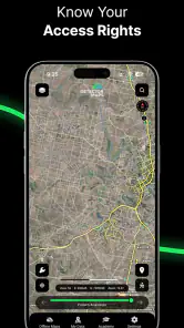
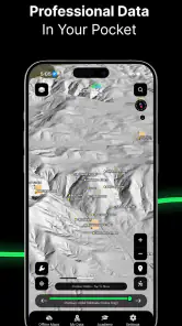
Analysis by Reviewed
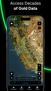
I approached Detector Maps as a practical navigation companion rather than another general-purpose map. Its focus is clear: it is built for people who use detector equipment and want map-based information to make their outings more deliberate. That narrow purpose is its biggest attraction. Instead of opening a standard map and trying to adapt it to a detecting trip, I can start with a tool designed around the places, planning decisions, and field habits that matter to detector users.
The app comes from Gold Discovery Solutions Pty Ltd and sits in the Maps & Navigation category. It is free to install, carries an Everyone age rating, and has reached over ten thousand installs. Its store summary, “Detect smarter, not harder,” is brief, but it captures the intended benefit better than a long feature list would: spend less time guessing where to begin and more time preparing a sensible route.
After using it, my view is that this is most useful as a planning layer for detectorists, not as a complete replacement for every map, research source, or safety tool. That distinction matters. If you want ordinary turn-by-turn driving directions, a familiar navigation app will usually be more comfortable. If you want a map experience shaped around detector-oriented exploration, this app has a much more relevant starting point.
How Detector Maps fits into a real detecting trip
A focused map instead of a general map with extra work
General map apps are excellent at roads, businesses, addresses, and live travel information, but they are not designed around the questions a detectorist asks before leaving home. I am less interested in the nearest coffee shop than in whether an area deserves research, how easily I can approach it, and whether the surrounding terrain makes a short visit realistic. Detector Maps is valuable because it puts that kind of thinking at the center.
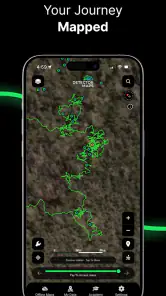
My preferred workflow is to use the app before I pack the detector. I begin by looking at the broader area, then narrow my attention to places that appear worth investigating. From there, I can think about access, distance, time available, and whether the trip should be a quick after-work outing or a longer weekend plan. This is a subtle but important change from simply dropping a pin on a conventional map: the map becomes part of the research process rather than only the final route.
That makes the app especially appealing to beginners. New users often waste time choosing locations randomly, then blame the equipment when the outing produces little. A dedicated detector map cannot guarantee useful finds, but it can encourage better preparation. I found that its greatest practical contribution is helping turn a vague idea—“I might try that area”—into a more organized decision about where to go and what to expect.
Useful for both quick outings and careful preparation
For a short session, the app can help me compare nearby possibilities without opening several unrelated tools. Imagine finishing work with two hours of daylight left. Rather than driving toward the first interesting-looking place, I can use Detector Maps to review candidate areas, estimate which one is easiest to reach, and choose a location that matches the limited time. That does not remove the need for judgment, but it reduces aimless travel.
More From Our News Desk

Clash of Clans Is Won Between the Battles

Android Auto Makes the Case for Quieter Car Software

MobiOffice: Transforming Mobile Productivity with Seamless Integration

EA SPORTS FC™ Mobile Soccer: Redefining Mobile Sports Gaming

How Microsoft OneDrive Became a Mobile Productivity Giant

How Google Translate Breaks Language Barriers Effortlessly
For a longer trip, the value is different. I can use the map as one part of a checklist: select an area, investigate the route separately if necessary, check local access rules, prepare suitable equipment, and keep a backup location in mind. The app is most effective when it helps me organize these decisions in advance. It is less useful if I expect to open it at the last minute and have every practical question answered automatically.
One tip I would give a new user is to avoid treating the most interesting-looking location as the only option. A better approach is to identify a primary area and at least one nearby alternative before setting out. Weather, access, crowds, poor ground conditions, or a simple change of plans can make the first choice inconvenient. Using the map for contingency planning is more valuable than using it only to chase a single promising point.
What the current version says about the product’s direction
The current release is version 5.7.0, which gives the app a more established feel than an early experiment. I see that version number as evidence of ongoing product development, but not as a reason to assume that every desired feature is already present. An app can progress through several releases while still leaving important specialist workflows to the user.
For existing users, the practical question is whether the current version remains useful in the way they already work. In my experience, the answer depends on expectations. Someone who mainly wants a focused map for researching detector-friendly destinations should find the app’s direction easy to understand. Someone expecting a complete expedition manager—with every research, legal, route, offline, and logging function in one place—may still need other tools beside it.
I also appreciate that the app is free to start. That lowers the barrier for someone who is curious but not yet ready to commit to a specialized service. At the same time, the presence of in-app purchases ranging from around eight dollars to around one hundred dollars per item means I would not assume that every useful capability is included without checking the purchase screen carefully. The free entry point is attractive, but the eventual cost can matter to a regular user.
How I would use it alongside ordinary navigation
I would not force Detector Maps to do the job of a standard navigation app. My preferred combination is simple: use Detector Maps to decide which area deserves attention, then use a trusted road-navigation tool for the actual drive when detailed directions, traffic awareness, or familiar route guidance are important. This division of labor plays to each app’s strengths.
That approach also avoids a common mistake: assuming that a point on a map automatically means there is a legal, safe, or convenient way to reach it. A map can support research, but it does not replace checking land access, local detecting restrictions, private property boundaries, protected areas, or current conditions. I would always verify those matters before carrying equipment onto a site. Responsible planning is not an optional extra in this hobby.
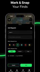
Another useful habit is to record the reasoning behind a chosen location outside the app if I am planning a multi-stop day. I might note why an area looked promising, what time I expect to arrive, and what alternative I will use if access fails. This keeps the app focused on visual exploration while giving me a clear trip plan that does not depend on remembering every detail later.
Where the app feels strongest
The strongest part of Detector Maps is its specialization. A conventional map can show almost anything, but that generality can make detector planning feel scattered. Here, the subject of the trip is already understood. I can approach the map with a detectorist’s mindset instead of translating a general map into one.
It is also a good fit for users who enjoy research before fieldwork. The app encourages me to pause and compare areas rather than drive until something looks interesting. That can make outings more efficient, especially when fuel, daylight, or travel time is limited. The benefit is not a promise of better finds; it is a better process for deciding where to spend my available time.
The app’s rating is around four and a half stars from over nine hundred ratings, with dozens of written reviews. I treat that reception as encouraging, but I would still judge the app against my own needs. A positive average can tell me that many users find value in it; it cannot tell me whether its map coverage, workflow, or paid options match the exact places and habits I have.
Important trade-offs before relying on it
The first trade-off is specialization versus completeness. Because Detector Maps is aimed at detecting, it may feel more relevant than a general map for the initial search. However, I would still keep another navigation option available for driving and a separate source for legal or historical research. The app should be viewed as a focused part of a toolkit, not automatically the entire toolkit.
The second is convenience versus verification. A location presented in a detector-oriented context can make a trip feel ready to go, but I still need to confirm whether detecting is permitted there. This is particularly important around public land, historical sites, beaches, reserves, and privately controlled areas. I would never interpret map visibility as permission.
The third is free access versus possible spending. Since the app is free but includes paid items, I would explore the basic experience first and only pay when I understand exactly which part of my workflow the purchase improves. A casual user who goes out occasionally may be satisfied with limited use, while a committed detectorist may consider a paid option worthwhile if it saves repeated research time. I would make that decision based on actual use rather than assuming every upgrade is necessary.
Who should give it a try
I would recommend Detector Maps to beginners who want a more relevant starting point than a standard map, hobbyists planning local outings, and experienced users who prefer a dedicated map for the discovery stage of a trip. It is particularly suitable for someone who enjoys comparing possible areas and wants one place to begin that process.
It may also suit people who often make spontaneous plans. If I have a free afternoon and do not want to spend most of it searching through unrelated map layers, a focused detector app can shorten the path from idea to destination. The app is also a reasonable choice for someone who wants to test a specialized tool before deciding whether it deserves a permanent place in their routine.
I would be more cautious about recommending it to someone who expects turn-by-turn navigation to be the central experience, needs a single application for every aspect of fieldwork, or does not want to check access rules independently. A user who rarely detects may gain more from the map app already on their phone. Likewise, anyone planning demanding trips should not rely on one app alone for route safety, communication, or local conditions.
Small workflow improvements that make a difference
My first practical suggestion is to plan by travel radius rather than by visual excitement. I would start with the time available, then look for locations that fit comfortably inside it. This prevents a promising point from consuming the entire outing through driving. Detector Maps becomes more useful when it helps me make realistic choices instead of encouraging an oversized plan.
Second, I would compare several nearby areas before committing. A location that looks ideal on the screen may be awkward in person, while a less obvious alternative may be easier to access or better suited to the day’s conditions. Keeping a backup is especially helpful when I am unfamiliar with the region.
Third, I would separate “interesting” from “permitted.” I can use the app to identify places worth researching, but I would then verify ownership, restrictions, and any relevant local guidance before detecting. This two-stage process is slower than simply following a pin, yet it protects the trip from an avoidable mistake and encourages responsible use.
Finally, I would review the app after several outings instead of judging it after one visit. The real test is whether it consistently helps me choose better destinations, reduce wasted travel, and prepare more confidently. If it does not improve those decisions, the specialized interface may not justify keeping it in my regular toolkit.
What I would like to see from its continued evolution
Because version 5.7.0 is the current release, I see Detector Maps as an actively maintained product whose direction is worth watching. I would be interested in how future updates improve the balance between map discovery and the practical realities of fieldwork. The most valuable progress would be anything that makes planning clearer without encouraging users to confuse map information with legal permission or guaranteed results.
I would also watch how the paid options affect the everyday experience. A good upgrade should solve a clear problem for a particular kind of user, while the free experience should remain useful enough for newcomers to understand the app’s purpose. Transparency at that point is important because detectorists range from occasional hobbyists to highly committed users with very different expectations.
For current users, updating is sensible when a new release addresses a problem they have encountered or improves a part of their routine they use often. I would not update merely because the version number changes, but I would pay attention to release notes and test the app after an update before relying on it for a planned trip. That is a small habit, yet it can prevent surprises when a map tool is part of an outdoor outing.
My recommendation after using it
Detector Maps is worth trying if you want a detector-focused way to begin planning where to go. I like its clear purpose, free starting point, and usefulness for turning an unstructured search into a more deliberate outing. It feels most convincing when I use it before leaving home, compare realistic options, and combine it with ordinary navigation and independent access checks.
I would not present it as a magic shortcut to valuable finds, nor would I replace every other map and research source with it. Its limitations are tied to its role: a focused map can make destination planning easier, but it cannot make local rules disappear or guarantee that a location will be productive. Users who understand that boundary are likely to get the most from it.
Overall, Gold Discovery Solutions Pty Ltd has created an app with a useful niche. The current version gives detectorists a practical place to start, while the free installation makes experimentation easy. If your main need is general navigation, choose the familiar tool that already handles that job well. If your main need is more thoughtful detector-trip planning, I think this app deserves a place on your phone.
Detector Maps Frequently Asked Questions
Who develops Detector Maps, and what devices can install it?
Detector Maps is a Maps & Navigation app developed by Gold Discovery Solutions Pty Ltd. It is available for Android and iOS, with the current version listed as 5.7.0 and a minimum operating-system requirement of 7.0. Check your device’s software version before downloading, and install it through the official app store so you get the legitimate app and its updates.
What is Detector Maps and what does it do?
Detector Maps is a location-based app designed to help users find and review places or points of interest marked on an interactive map. Its store summary is “Detect smarter, not harder.” Depending on the available data and your device settings, it may show nearby locations, provide basic details, and help you plan where to go. Map coverage and available features can vary by country or region.
Does Detector Maps require an internet connection or GPS access?
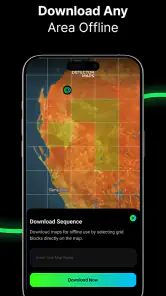
Most of the app’s main functions are likely to depend on an internet connection because map information, location markers, and updates may be loaded online. GPS or location permission can also be necessary to identify your position and display nearby results accurately. Review the permission request carefully and remember that disabling location access may limit navigation and proximity-based features.
Is Detector Maps free to download and use?
Detector Maps is free to download, but it also offers in-app purchases ranging from $7.99 to $99.00 per item. Free access does not always mean that every function is included, so review the pricing and purchase details shown in your app store before installing. Check carefully before confirming any purchase, particularly if you share a device or payment method.
How accurate and reliable is the information shown in Detector Maps?
The usefulness of Detector Maps depends on the quality, age, and coverage of its map database. Markers may be incomplete, outdated, incorrectly positioned, or unavailable in some areas, so the app should be treated as a reference rather than an unquestionable source. When visiting a location, verify important details independently and follow local laws, access rules, and safety recommendations.
Pros
- Quickly identifies nearby speed and red-light cameras.
- Clear map interface makes alerts easy to understand while driving.
- Useful distance warnings give drivers time to react safely.
- Supports route planning with camera locations visible in advance.
- Can help users stay more aware of changing road restrictions.
Cons
- Camera coverage may vary considerably by country or region.
- Some locations may be outdated or missing from the database.
- Requires location access and may reduce battery life during trips.
- Background alerts can be unreliable if GPS or mobile data is weak.
- Users should verify local laws before using camera-warning features.
- Category
- Maps & Navigation
- Version
- 5.7.0











