Citymapper
- 4.82K
- 4.8
- Installs
- 10.00M
- Price
- Free

Screenshots



Analysis by Reviewed
I usually open a city navigation app when I already have a destination in mind but not a reliable way to reach it. In that moment, the useful question is not just which road is shortest; it is whether I can combine a train, a bus, and a walk without turning the trip into a guessing game. Citymapper is built for that kind of urban journey, and I find it most helpful when public transport is part of the plan.
Citymapper is a free maps and navigation app from Citymapper Limited. It has a 4.8 average from around 351,000 ratings and over 10 million installs, a sign that it has found a substantial audience among people planning city trips. The app is rated for Everyone. Optional in-app purchases are available, but I would start with the free app and see whether its route planning suits your regular journeys before considering anything else.
From destination search to a workable trip
When I first downloaded Citymapper, I was skeptical. I mean, how much better could it be compared to the other navigation apps I’ve used? But boy, was I in for a surprise! The app's interface is sleek and intuitive, making it super easy to input your destination and get going. No more fiddling around with clunky menus or getting lost in a sea of unnecessary options.
Articles Related to Citymapper
Clash of Clans Is Won Between the Battles
Its raids are quick; its community is a long-term project of coordination, teaching, rivalry, and shared responsibility—with all the friction that entails.
Android Auto Makes the Case for Quieter Car Software
The car interface is no longer judged by how much it can do, but by how quietly it helps. Android Auto shows what drivers now expect—and what still gets in the way.
MobiOffice: Transforming Mobile Productivity with Seamless Integration
MobiOffice: Word, Sheets, PDF is redefining mobile productivity with a surprising blend of functionality and innovation.
EA SPORTS FC™ Mobile Soccer: Redefining Mobile Sports Gaming
Dive into EA SPORTS FC™ Mobile Soccer, where immersive gameplay and strategic depth transform mobile sports gaming.
Choosing a route, not just a line on a map
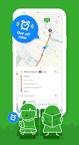
One of the first things that caught my eye was the real-time updates. Whether it’s a sudden delay in public transport or a road closure, the app keeps you in the loop. It’s like having a personal assistant whispering in your ear, "Hey, take the next bus, not this one!"
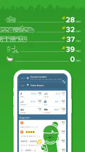
And let's talk about the integration of various modes of transportation. From buses and trains to bikes and even ferries, it covers a range of ways to move around. It even shows you the calories you'll burn if you decide to walk—talk about motivation to get those steps in!
For those of us who are perpetually late, the "Get Me Home" and "Get Me to Work" buttons are lifesavers. With just a tap, you get the quickest route home or to work, no matter where you are. It's like magic!
Making the handoffs easier
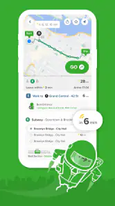
For a realistic commute, I would use those saved work and home destinations as starting points, then check the route options before leaving rather than waiting until I reach a crowded station. If a journey involves more than one kind of transport, the key benefit is seeing the legs together: I can judge whether a walk between stops feels manageable and whether a bus-to-train change is worth the time saved. I still check the actual stop names before moving, since a route is only useful if I board in the right place.
You May Like

How Microsoft OneDrive Became a Mobile Productivity Giant

How Google Translate Breaks Language Barriers Effortlessly

Why Google Sheets Is the Ultimate Mobile Productivity Tool

Unveiling the Dynamic World of My Talking Tom Friends

Free Fire MAX: Dominating the Battle Royale Arena

Free Fire: Winterlands – The Ultimate Winter Gaming Adventure
On an unfamiliar evening trip, I would compare the suggested route with a simpler alternative instead of automatically choosing the fastest one. A transfer can look efficient on screen but feel stressful when I have luggage, a child with me, or little confidence about the station. In that situation, a route with fewer changes may be the better choice even if it takes longer. That is where a journey planner is most useful as a decision aid, not as an instruction to follow blindly.
What it feels like on an ordinary day
Imagine leaving work in a neighborhood you do not know well just as the weather turns and your usual bus is delayed. I would enter the destination, compare the public-transport options with a walk-heavy route, and use the live updates to decide whether to wait or head toward another stop. If the trip changes, having the legs visible in one plan is less fiddly than switching between separate bus, subway, and walking searches. The practical win is not a guarantee of a perfect journey; it is getting enough context to make the next move with less uncertainty.
That workflow also explains who is likely to enjoy the app most. It makes sense for commuters who regularly use city transit, visitors who need help combining services, and residents who want to explore without driving every trip. If you mostly travel by car, need rural turn-by-turn driving directions, or rarely use public transportation, a conventional road-navigation app may be a better fit. I would also keep a local transit operator’s notices handy when a disruption is significant; a route planner can guide a trip, while the operator is the natural place to check service-specific announcements.
Where plans can still snag
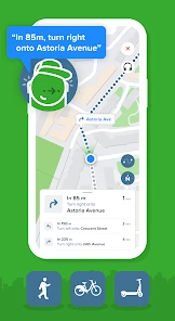
The app isn’t just about getting you from point A to B; it’s about making the journey feel more manageable. Its detailed instructions are useful when I am unfamiliar with a station or need to keep track of several legs. Plus, the offline maps feature is a godsend when you're in areas with spotty internet coverage.
Another useful touch is the ability to save favorite locations. Whether it’s a café or a friend’s house, saving a place makes it quicker to plan a familiar trip later. I would keep these shortcuts focused on destinations I actually use; a short list is easier to scan when I am in a hurry than a crowded collection of one-off stops.
There are trade-offs to keep in mind. Live guidance is most valuable when the app has current information and your phone can connect, so I would not rely on a live update as the only plan in a place with unreliable reception. Offline maps can help with coverage gaps, but I would prepare the route before losing service rather than assume every live detail will remain available. And while combining modes is a strength, a choice among several routes can be more decision-making than a simple point-to-point drive; if you want one clear road route, another navigation app may feel less busy.
For visitors, my small practical tip is to save the hotel or meeting point before setting out, then check the return journey as well as the outbound one. A route that is easy during the day can feel less obvious after a late event, especially when the last leg is on foot. For commuters, I would save only places I use often and still review the route each morning: a saved shortcut saves typing, not the need to notice a disruption or changed plan.
Who should make it their city companion?
In a world where navigating cities can be a daunting task, this app can make the decisions feel less intimidating. It’s particularly suited to daily commuters, tourists, and people who want to explore their city without depending on a car. Its emphasis on bringing public transport and walking into the same journey is what gives it a different feel from a navigation app focused mainly on driving.
Compared with a standard map app, I find this kind of planner more helpful when a trip depends on connections: I can weigh a bus-and-walk option against a rail journey without building each leg separately. A transit operator’s own app may be better for checking a particular service’s announcements, while a conventional driving app is usually the clearer choice for road-first directions. I would use each for the job it handles best rather than expect one tool to cover every kind of travel equally well.
A few choices that make planning smoother
When I am going somewhere important, I plan the outbound and return trips as separate decisions. The fastest route to an event may not be the easiest one back if the venue empties at once or I am leaving after dark. Checking both directions in advance helps me notice whether I will need to retrace my steps or use a different connection, and it gives me a calmer fallback if the first plan becomes inconvenient.
I also treat a route’s walking sections as real parts of the journey, not just gaps between vehicles. A short walk on the map can involve finding an unfamiliar entrance or crossing a busy area, so I look at the sequence and stop names before committing. If I am carrying bags or traveling with someone who needs an easier pace, fewer transfers can be worth more than a small time saving. That trade-off is easy to miss when choosing only by the headline journey time.
If I am new to a city, I use the app to learn the shape of a journey before I leave: which leg comes first, where I change, and what the final walk involves. I do not need to memorize every instruction, but having that outline makes it easier to notice when I am at the wrong stop or when a plan needs adjusting. For a familiar commute, the opposite approach works better: use saved destinations to get started quickly, then check that the suggested route still fits the day.
How I judge the outcome
What I value most is not a promise that every trip will be effortless. It is the way a connected itinerary reduces the number of separate decisions I have to make while moving through an unfamiliar place. Rather than searching for a bus, then a train, then a walking route in different places, I can consider the whole journey and decide whether the handoffs are reasonable. That is a meaningful advantage for a visitor, and a practical time-saver for someone who regularly mixes transit and walking.
The approach is less compelling when the trip is simple. If I already know the route, or just need road directions, opening a transit-focused planner may add options without adding much value. Likewise, if I cannot get a reliable connection, I would want to have checked the route beforehand and remain ready to use signs or local service information. It works best as a capable companion to ordinary judgment, not as a substitute for paying attention to the city around me.
My recommendation for city journeys
I would recommend Citymapper to someone who often needs to combine buses, trains, walking, and other ways of getting around town. Its strongest use is helping me compare a complete urban trip and handle changes without piecing together every leg by hand. The free starting point makes it easy to try on a route I already know, then see whether its suggestions are useful before relying on it for an unfamiliar journey.
If you mostly drive, travel outside the places its transit planning serves, or prefer a single uncomplicated road route, it may not be the right everyday choice. For city commuters and visitors, though, it can make the route from destination search to arrival feel more considered. I would use it to plan, check the handoffs, and keep a practical alternative in mind; that balance is what makes it worth having on my phone.
Citymapper Frequently Asked Questions
Can I use Citymapper to plan a trip before I arrive in a city?
Yes. You can enter a destination and explore route options before setting out, which is useful when preparing for a visit or comparing ways to get around. Citymapper is focused on urban navigation and transit, so the available choices depend on the city and the routes covered there. You can also plan a familiar journey in advance rather than waiting until you are on the move.
What kinds of journeys can I plan with Citymapper?
Citymapper is built around city navigation and brings together routes using options such as buses, trains, subways, walking, and bikes. That makes it useful for comparing different ways to reach a destination instead of relying on only one mode of travel. The choices shown depend on the area, so it is worth checking whether the app covers the places and services you expect to use.
Is Citymapper suitable for everyday commuting as well as occasional trips?
Citymapper is designed for navigating urban journeys, so it can be useful whether you are planning a familiar commute or finding your way around a city for the first time. It brings route options and transit details together in one place, making it easier to compare ways to reach a destination. Its usefulness depends on the routes and transit information available for the area you are visiting.
What is Citymapper and how does it work?
Citymapper is an advanced navigation app designed to help users navigate urban environments efficiently. It integrates various modes of transportation like buses, trains, subways, and even bikes and walking paths to provide the best route options. Users simply input their destination, and Citymapper suggests the fastest or most efficient routes, including real-time updates on transit schedules and any service disruptions.
Is Citymapper free, or does it require a subscription?
Citymapper is free to download and use, with in-app purchases available. The app offers core route-planning and transit features, while optional purchases may provide additional capabilities. You can start with the free app and decide whether any paid options suit your needs. Citymapper is categorized for everyone, making it accessible to a broad range of users.
Pros
- Comprehensive transit options
- Real-time updates
- User-friendly interface
- Integration with ride-sharing
- Offline maps available
Cons
- Limited coverage in smaller cities
- Requires data connection for updates
- Battery drain issues
- Occasional routing errors
- Subscription needed for some features

- Category
- Maps & Navigation
- Version
- Varies with device











