CalTopo
- 346.00
- 4.7
- Installs
- 100.00K
- Price
- Free

Screenshots
Analysis by Reviewed
I first looked at CalTopo as the kind of app that might sit on a shared household phone: one person planning a weekend hike, another checking a route, and someone else needing a dependable map when mobile coverage becomes unreliable. That is a useful way to judge it because this is not a casual city-navigation tool. It is a backcountry mapping app from CalTopo LLC, built for people who want to understand terrain rather than simply follow a turn-by-turn line.
My overall impression is positive, but it comes with an important qualification. The app rewards preparation and attention. If you take time to study the map, plan a route, and learn how its information is organized, it can become a serious companion for hiking and outdoor travel. If you want the simplest possible “take me to this address” experience, it may feel more demanding than the usual navigation alternatives.
How CalTopo fits into shared outdoor planning
A realistic household example is a Saturday trip where one person chooses the destination, another checks access roads, and a third wants to know what the walk will actually feel like. With a conventional road-navigation app, the group can usually find the trailhead. That is only the beginning. CalTopo is more useful when the questions become: Is the route steep? Does it cross open ground? Are there several possible approaches? Where would a turnaround point make sense?
I like this shared-use role because the app encourages conversation before anyone leaves home. Instead of passing around a vague pin, I can examine the route and explain why one option is more sensible than another. A household member who is not joining the trip can still understand the plan by looking at the same map, while the person going outdoors gets a more meaningful picture of the terrain.
That does not mean every family member needs to become a map enthusiast. In my experience, one person usually takes responsibility for the detailed planning, while others need a clear summary: the starting point, the intended route, the difficult section, and the likely decision points. CalTopo works well in that arrangement, but the planner should not assume that everyone else will interpret contour lines or map layers immediately.
The app is free, which makes it easier to place it on a household device without turning a trial outing into a purchase decision. Its Everyone content rating also makes it suitable for general family use from an age-label perspective. Still, an age rating is not the same thing as outdoor readiness. A young user may be perfectly able to look at a map, while route choice, weather judgment, and emergency planning remain adult responsibilities.
What I would do before leaving home
I would begin with the destination and then zoom out far enough to understand the surrounding area. Looking only at the endpoint is a common planning mistake. A trail can appear short while the approach road, elevation changes, or alternate paths create most of the difficulty. CalTopo is at its best when I use it to build a mental model of the whole outing rather than treating it as a digital replacement for a paper map.
More From Our News Desk

Clash of Clans Is Won Between the Battles

Android Auto Makes the Case for Quieter Car Software

MobiOffice: Transforming Mobile Productivity with Seamless Integration

EA SPORTS FC™ Mobile Soccer: Redefining Mobile Sports Gaming

How Microsoft OneDrive Became a Mobile Productivity Giant

How Google Translate Breaks Language Barriers Effortlessly
My next step would be to inspect more than one possible route. The shortest line is not automatically the best line, especially when the group includes different fitness levels or when a shared vehicle needs a practical access point. Comparing options also gives the household a backup plan. If the first route is crowded, blocked, too exposed, or simply more tiring than expected, everyone already knows what the second choice means.
A particularly useful habit is to discuss the map away from the trailhead. At home, the planner can point out where the route changes character and where the group might turn around. That is much better than trying to explain everything while standing beside a car, dealing with bags, poor reception, and impatient companions.
The strongest household use is not handing the phone to everyone; it is creating a shared understanding before the trip begins. One person can do the detailed map work, but the basic plan should be understandable to anyone who may need to make a decision later.
Setup boundaries on a shared device
CalTopo is more appropriate for a dedicated outdoor phone or the main planner’s device than for a phone that several people constantly reset and customize. Maps and route planning depend on continuity. If one household member changes the visible information, removes a planned route, or simply leaves the app in an unfamiliar view, the next person may not know what they are looking at.
I would establish a simple household rule: the person preparing the outing owns the plan, while others may review it without casually editing or replacing it. That is not a technical control; it is a practical boundary. The app can be shared as a planning reference, but the group should agree on who is responsible for the final route and who carries the backup information.
Account boundaries matter as well. A shared phone can blur who created a plan and who is expected to maintain it. For a household that regularly takes separate trips, individual use is easier to understand than one device becoming a communal archive. For an occasional family outing, a single planning device may be perfectly adequate, provided everyone knows which version of the route is current.
I would also avoid treating the app as the only copy of an important plan. Before leaving, I would note the destination, route choice, and meeting points in a form the group can still understand if the phone battery becomes a problem. CalTopo can improve preparation, but it does not remove the need for ordinary outdoor habits such as carrying enough power, telling someone where the group is going, and recognizing when conditions are beyond the plan.
The Android requirements are relatively approachable: the current version is listed as 1.28.1 and supports devices running Android 5.1 or later. That broad compatibility is useful for households with an older spare phone. However, an older device may still be less pleasant for detailed map work because screen size, battery health, and general responsiveness affect the experience. Compatibility gets the app installed; it does not guarantee an ideal planning setup.
Coordination is where careful planning pays off
When several people share an outing, the most useful map is the one that supports decisions. I would use CalTopo to identify obvious meeting points, alternative approaches, and sections where the group might naturally split or regroup. This is especially valuable when one person walks faster, a child needs more breaks, or part of the group wants a shorter version of the trip.
There is a subtle advantage to planning these choices in advance: the group avoids making every decision at the moment of stress. If someone becomes tired, the question is not “What do we do now?” but “Do we use the shorter option we already discussed?” That makes the app part of a coordination routine rather than just a moving dot on a screen.
I would be careful with the idea of live coordination, though. A map app should not be treated as proof that everyone is visible, reachable, or safe. Phones can lose power, reception can change, and people can misunderstand a location even when they are looking at the same screen. CalTopo is valuable for route context, but the group still needs verbal check-ins and a clear meeting plan.
For a household with one experienced hiker and several beginners, I would prepare a short explanation using landmarks and route sections instead of technical map language. “We follow the road until the bend, then stay together through the steep part” is more useful to a child or occasional walker than a dense discussion of layers. The planner can benefit from the app’s detail without forcing every participant to learn it all at once.
Another practical trade-off is screen attention. Detailed mapping can tempt people to stare at the phone while walking. I prefer using the app to confirm the plan at deliberate pauses, then putting the device away and observing the surroundings. In a shared group, one person checking the map is usually safer and less distracting than everyone navigating independently.
Age, trust, and responsibility
The Everyone rating makes CalTopo approachable for a broad audience, but I would still match responsibility to experience. A teenager might be capable of following a straightforward route and learning how terrain is represented. That does not automatically make them the right person to choose a remote route for a group, judge changing conditions, or decide whether a difficult section is safe.
I appreciate that the app can support teaching without turning the outing into a lesson. A parent or experienced friend can show how a route changes with terrain, why a shortcut may be misleading, and how a backup plan fits into the day. The young user gains useful map-reading skills, while the adult keeps responsibility for the decisions that carry greater consequences.
Trust also applies between adults. If one person plans a route, the others should be able to question it without treating the map as an unquestionable authority. A detailed map can still be interpreted incorrectly. I would ask practical questions: Does the route suit the slowest person? What happens if the weather changes? Is there a sensible stopping point? Can everyone recognize the planned route on the ground?
This is one area where CalTopo differs from ordinary navigation apps. A road app often hides complexity by giving a single recommended path. That convenience is excellent for driving and urban errands. In the backcountry, hidden complexity can be the problem. CalTopo gives the planner more material to think about, but that also means the user must accept more responsibility for interpretation.
Where it is stronger than familiar alternatives
For city walking, public transport, shopping, and everyday driving, I would normally choose a mainstream navigation app. Those tools are faster for addresses, businesses, live traffic, and simple directions. CalTopo is not the app I would open to find a restaurant or guide a visitor through a busy downtown area.
Its advantage appears when the destination is not just a place but a landscape. A backcountry route needs context: the shape of the ground, the relationship between paths, access points, and the possibility of changing plans. CalTopo makes that kind of thinking central. That is a meaningful difference from apps that are optimized around arrival time.
I also find it better suited to deliberate route study than to constant automated instruction. The app encourages me to look at the area and make a choice, rather than blindly accepting the first line a navigation engine presents. For experienced outdoor users, that can feel empowering. For newcomers, it can initially feel like extra work.
The trade-off is learning time. Someone who has never used a topographic-style map may wonder which visual details matter and which do not. I would not judge the app after a rushed first opening. I would spend a quiet session exploring a familiar area, comparing the map with places I already know, and practicing route interpretation before relying on it somewhere unfamiliar.
Small workflows that make the app more useful
One of my favorite practical workflows is to plan from the outside in. I first examine the wider region, then the access route, then the walking section, and only after that the exact destination. This order prevents the common mistake of choosing an attractive endpoint without understanding how the group will reach it.
A second useful approach is to create a “decision map” rather than merely a route map. I want to know where the group can pause, shorten the outing, reverse direction, or regroup. Those points are often more valuable than a perfectly drawn line because real trips rarely follow the original plan without adjustment.
Third, I would use a familiar local walk as practice. Open the app, identify a route you already know, and compare what the map suggests with what you remember from the ground. This builds confidence without making a new or remote destination the classroom. It also reveals whether the app’s level of detail suits your eyesight, phone screen, and preferred way of planning.
A fourth insight is to separate the planner’s view from the group’s instructions. The person who understands the map may keep a detailed mental picture, while everyone else needs three or four simple cues. Preparing both versions reduces confusion. It also means a child or less experienced companion can participate without being overwhelmed by information.
Finally, I would plan for a change in energy, not only a change in direction. In a household group, the route that looks manageable for the strongest walker may not be comfortable for everyone. CalTopo helps expose the structure of the outing, but the human judgment remains ours: leave room for breaks, avoid turning pride into pressure, and make the shorter option acceptable before anyone needs it.
Limitations I noticed in the overall experience
The biggest limitation is that CalTopo asks the user to think. That is a compliment in one context and a barrier in another. If I am tired, in a hurry, or helping someone who wants immediate instructions, the app may feel less welcoming than a simpler navigation product.
There is also a risk of false confidence. A polished digital map can make an outing appear fully controlled, even though terrain, weather, closures, visibility, and personal fitness still matter. I would never let a route line replace local judgment or a backup plan. The more remote the trip, the more important that distinction becomes.
On a shared device, clutter and responsibility can become friction points. A phone passed between several people is not automatically a coordinated system. Someone must decide which route is current, who checks the map, and how the group communicates when the screen is unavailable. These are manageable issues, but ignoring them can make a good tool less useful.
I would also skip CalTopo if my main need is turn-by-turn urban navigation, live commuting information, or effortless directions for occasional errands. Its strengths are too specialized for that job. A simpler alternative will be quicker and less mentally demanding in those situations.
On the other hand, I would strongly consider it for hikers, campers, outdoor educators, and households that regularly explore places where route context matters. It is especially appealing when one person enjoys planning and wants to help the rest of the group make safer, clearer choices without forcing everyone to become an expert.
My household verdict
CalTopo has earned a strong reputation with users, reflected in its 4.7 average from around 6.6 thousand ratings, and I can understand why. It is focused, thoughtful, and more useful than a basic navigation app when the real question is how a route fits into the landscape. The developer, CalTopo LLC, has kept the product centered on that outdoor planning purpose rather than trying to make it a universal map for every situation.
It has also passed the scale test for me: the app has reached over 100 thousand installs, yet it still feels like a tool for people who care about map detail rather than a generic phone utility. That focus is an advantage, provided the user is willing to learn the workflow.
I would recommend it to a friend who wants to prepare backcountry trips carefully, especially if their household shares responsibility for route choices. I would tell them to install it before the trip, practice on familiar ground, agree on who manages the plan, and explain the route in plain language to everyone joining. I would not recommend relying on it casually as though the phone itself guarantees safety.
For a family or shared household, the best arrangement is simple: one prepared planner, clear boundaries around the current route, a group conversation before departure, and realistic expectations about age and experience. Used that way, CalTopo becomes more than a map on a screen. It becomes a common reference point for deciding where to go, when to slow down, and when changing the plan is the smartest choice.
My final recommendation is clear: choose CalTopo when you want to understand and prepare for backcountry terrain, not when you merely want the fastest route from one address to another. It takes more involvement than familiar navigation apps, but that extra involvement is exactly what makes it valuable for thoughtful outdoor planning.
CalTopo Frequently Asked Questions
What devices and operating systems can run CalTopo?
CalTopo is a Maps & Navigation app from CalTopo LLC for people who want detailed mapping and trip-planning tools on a mobile device. On Android, it requires version 5.1 or later, so check your device’s software before downloading. The app is free to download, and its age rating is Everyone. It has a 4.7 average from around 6,600 ratings.
What is CalTopo used for?
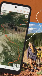
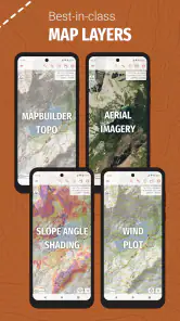
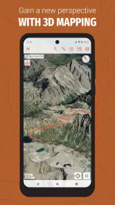
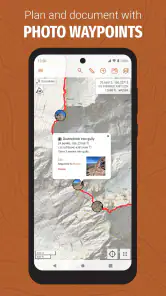
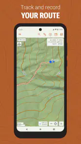
CalTopo is a detailed mapping and trip-planning app designed for outdoor activities such as hiking, backpacking, mountaineering, hunting, search and rescue, and backcountry skiing. It provides topographic maps, satellite imagery, terrain information, route planning tools, and location tracking. It is especially useful for users who need more detail and planning control than a standard navigation app usually offers.
Does CalTopo work without an internet connection?
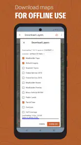
Yes, CalTopo supports offline use when maps and relevant areas are downloaded in advance. This is important for remote trips where mobile data may be unavailable or unreliable. Before leaving, users should save the required map layers and confirm that the downloaded content is accessible offline. GPS positioning can still work without cellular service, although the phone’s battery and location settings must be properly managed.
Is CalTopo suitable for beginners?
CalTopo can be used by beginners, but its extensive mapping layers and planning features may feel more complicated than simpler hiking applications. New users may need some time to understand map types, overlays, route tools, saved areas, and offline downloads. Once the interface becomes familiar, it offers a powerful way to prepare trips and follow terrain. Beginners should practice at home before relying on it in remote areas.
Does CalTopo require a subscription?
CalTopo offers access to core mapping and navigation functions, but some advanced features, map sources, collaboration tools, and specialized planning options may depend on the selected account or subscription level. Because available features and pricing can change, users should review the current plan details in the official app listing or CalTopo website before downloading. Checking the subscription terms is especially important for users who only need basic offline maps.
Pros
- Detailed topographic maps with excellent backcountry coverage.
- Powerful route planning
- layering
- and terrain analysis tools.
- Supports offline maps for areas with limited cellular service.
- Useful for hiking
- search and rescue
- and outdoor trip planning.
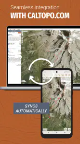
- Syncs maps and data across supported devices and platforms.
Cons
- Many advanced features require a paid subscription.
- The interface can feel complex for casual outdoor users.
- Offline map downloads may consume considerable storage space.
- Some map layers and imagery depend on regional availability.
- Learning all planning and navigation tools takes time.
- Category
- Maps & Navigation
- Version
- 1.28.1











