Avenza Maps: Offline Mapping
- 10.12K
- 4.7
- Installs
- 5.00M
- Price
- Free

Screenshots
Analysis by Reviewed
I tend to judge a navigation app by what happens after the first exciting trip: does it still earn a place on my phone when I’m doing ordinary planning, or does it become another app I open once and forget? Avenza Maps is most compelling when a particular journey depends on a map that remains usable away from mobile coverage. That makes it less of an all-purpose replacement for familiar turn-by-turn navigation and more of a practical tool I would keep for outdoor plans, fieldwork, and places where losing the signal matters.
The first trip makes the case
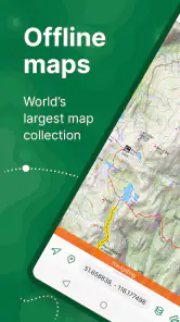
My first-week appeal is straightforward: find a suitable map before setting out, download it while connected, and then use the device’s GPS to check my position when a data connection is unavailable. That sequence is worth making a habit of. An offline map is useful only if it is already on the phone, and checking the right coverage area before leaving is more reassuring than discovering a gap on the trail.
For a realistic day out, I might save a map for a local walking area at home, then use it to orient myself at a junction where the marked path is less obvious than expected. A pin can help me mark the turn or a meeting point, while a note can preserve a detail I would otherwise forget. I would still carry the usual sensible backup for a demanding route; a phone app is a helpful navigation aid, not a reason to ignore preparation or battery life.
Where it fits among map apps
Avenza Maps is a Maps & Navigation app from Avenza Systems Inc., and its strongest distinction is its emphasis on using downloaded maps with GPS rather than relying on a live connection. That makes it a different proposition from the typical map app I reach for to find a nearby shop or get routine driving directions. Those familiar options are often more convenient for live searches and everyday routing; Avenza makes more sense when I want to consult a chosen map in an area where a connection may not be dependable.
The map itself matters as much as the app. Before relying on a download, I would check that it covers the full area I intend to visit and that its detail suits the task. A broad overview can help with orientation, but it may not answer every on-the-ground question. This is one of the useful trade-offs: I get control over which maps I bring along, but I also have to choose them thoughtfully instead of assuming one universal map will suit every outing.
Mapping Your Way Anywhere
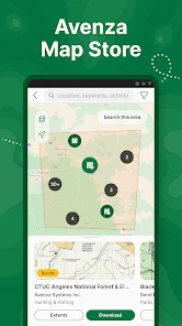
Here’s the deal: Avenza Maps gives you access to thousands of maps right on your smartphone. What sets it apart is its ability to let you download maps for offline use, which is a game-changer for those off-the-grid adventures. You can find maps for hiking, biking, skiing, and even historical maps if that's your jam. The app's versatility is impressive, and it's all thanks to its massive map library. Whether you're trekking through a national park or navigating city streets, Avenza has got you covered.
User-Friendly Interface
One of the first things you'll notice about Avenza Maps is its clean and intuitive interface. It's designed to make navigation a breeze, even for the not-so-tech-savvy among us. The app lets you search for maps by location or keyword, and downloading them is as simple as a few taps. Plus, once you've got your map, you can drop pins, measure distances, and even plot routes with ease. It's like having a personal cartographer in your pocket.
More From Our News Desk

Clash of Clans Is Won Between the Battles

Android Auto Makes the Case for Quieter Car Software

MobiOffice: Transforming Mobile Productivity with Seamless Integration

EA SPORTS FC™ Mobile Soccer: Redefining Mobile Sports Gaming

How Microsoft OneDrive Became a Mobile Productivity Giant

How Google Translate Breaks Language Barriers Effortlessly
Features That Stand Out
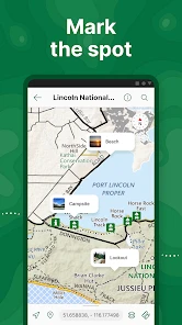
What’s cool about Avenza is how it lets you customize your maps. You can add place markers, notes, and even photos to your maps, making it super handy for planning trips or marking spots you’d like to revisit. And if you're someone who loves sharing their adventures, the app lets you export your map data to share with friends or on social media. Pretty neat, right?
A practical way to use those annotations is to separate what I know from what I want to check: a marker can record a useful location, while a note can capture why it matters. On a return visit, that small bit of context is more valuable than a collection of unexplained pins. Exporting map data can also help when I want to share marked locations, though I would check the exported result before relying on someone else to navigate from it.
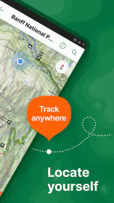
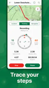
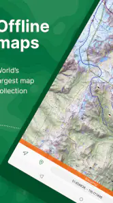
Another standout feature is the GPS capability. Even without internet access, the app uses your device’s built-in GPS to show your location on the map. It’s a reassuring feature that ensures you always know where you are, which is crucial when you're out in the wild.
Keeping it useful from month to month
The recurring value depends on whether I have places to revisit or new outings to prepare for. A saved collection of relevant maps and carefully labelled markers can make repeat trips easier to plan, and distance measurement is handy when comparing possible walks or checking how far apart two points appear on a map. For occasional users, the app may be most useful as a trip-specific tool rather than something to open every day. That is not a flaw, but it does mean its value comes from preparation, not constant notifications or routine use.
The app is free to install, is rated for Everyone, and has a 4.7 average from around 103,000 ratings. It has passed five million installs, and its current version is 5.5. Those figures suggest a well-established audience, but they do not tell me whether a particular map will suit my route. I would treat map selection and preparation as part of using the app, not as a detail I can leave until I reach the trailhead.
The upkeep and the points of friction
There is some maintenance involved: I need to download maps before going offline, keep track of which areas they cover, and avoid letting saved material become a confusing pile. If my plans change, I should check that the maps already on the device still match the new destination. Offline access removes dependence on a signal, but it does not remove the need to plan ahead or make the phone’s battery last.
Cost can also shape how far I take the app. The app itself is free, while in-app purchases range from $0.99 to $249.99 per item. I would begin by checking whether the maps I need are available in a form that works for my plans, rather than assuming every useful map is included at no cost. That range makes it sensible to review an individual purchase carefully before committing, especially if I only need a map for one occasional outing.
Planning beyond the trailhead
A useful habit is to prepare for the whole outing rather than just the destination. I would save the area around the start, the route, and any likely alternatives, then inspect the map at a comfortable scale before leaving. That simple check can catch an awkward edge case: a downloaded map may cover the main route but not the place where I expect to park, meet someone, or change plans. Looking at the boundary while I still have a connection is easier than trying to solve the gap outside.
For fieldwork, the same approach can turn a map into a record of a visit. I might add a marker at each inspection point and attach a short note explaining what needs a second look. The benefit is not merely seeing where I stood; it is being able to distinguish one point from another later. I would keep labels concise and consistent, since a crowded map of vague pins can become harder to use than a clean one.
Travelers can use the app differently from hikers. Before arriving somewhere unfamiliar, I could save a suitable map and use it to understand the layout while walking without relying on mobile data. It is better for orienting myself against that selected map than for finding an open café or receiving changing directions. If my day depends on live opening details, traffic, or frequent destination searches, I would keep a conventional map app available as well.
When the usual alternative is better
The app is less suitable if my main need is live traffic, quick business searches, or effortless door-to-door directions. A conventional navigation app is usually a better fit for those tasks. Avenza’s advantage is more specific: it can keep a selected map available when connectivity is not part of the plan. For fieldwork or outdoor trips, that focus is useful; for an urban commute, it may feel like extra preparation without enough everyday payoff.
There is also a difference in how much responsibility I take on. Turn-by-turn apps generally guide me through a route they calculate, while Avenza is centered on my reading and using the map I chose. That can be a strength when I need to interpret a specialized or familiar map, but it is not automatically easier. Anyone who wants the phone to make route decisions with minimal input may be happier with a standard navigation app.
Who I would keep it for
I would recommend it to hikers, cyclists, skiers, travelers, and people doing fieldwork who are willing to choose and save maps before they need them. It is especially helpful when a paper-style map is useful but I also want to see my position and add my own reference points. I would skip it as my only navigation app if I depend on live route changes, traffic information, or frequent searches for nearby places. The best choice depends on the job: offline map consultation here, fast connected navigation elsewhere.
It is also a sensible fit for someone who already thinks in terms of maps and locations rather than expecting a voice to guide every turn. A casual walker who sticks to familiar, well-connected streets may get little from keeping another map collection organized. By contrast, a person who repeats the same outdoor routes can build a small, useful set of maps and notes over time. The deciding question is not how adventurous I hope to be, but whether I will actually prepare maps for the trips I take.
Why You’ll Love It
So, why should you give Avenza Maps a shot? In a nutshell, it’s reliable, versatile, and packed with features that make outdoor navigation a breeze. Whether you’re an avid hiker, a casual biker, or just someone who loves exploring new places, this app is a must-have. The peace of mind knowing you won’t get lost, even when the signal disappears, is honestly priceless.
Does it earn a lasting place?
For me, the best long-term routine is modest: save only maps I expect to use, give markers names that will make sense later, and remove or set aside material that no longer matches my plans. That keeps preparation from turning into a project of its own. I would also check the phone before a longer outing, not just for the map but for charge and screen readiness; using GPS without a data connection still depends on the device being available and powered.
There is a learning curve in deciding which map is appropriate and how much detail I need. A map with extensive information can be useful for careful planning, but it can also make quick orientation feel busy. I would take a moment to zoom in and out before the trip and identify a few recognizable reference points. That small bit of familiarity makes it easier to interpret the screen when I am standing at a junction instead of sitting at home.
My long-term verdict is that Avenza Maps can earn lasting space on a phone when offline maps are a recurring need, even if I do not open it daily. Its markers, notes, distance tools, and GPS position give me reasons to return to it beyond the novelty of a first download. The habit that makes it worthwhile is simple: choose the map, save it, and check it before leaving. If that preparation suits the way you travel, it is a useful companion; if you want navigation to handle everything automatically, a more conventional option will likely feel easier.
In conclusion, Avenza Maps is more than just a mapping app; it's a gateway to adventure. With its extensive map library, user-friendly interface, and offline capabilities, it’s designed to enhance your outdoor experiences. So, next time you’re planning an adventure, make sure Avenza is on your list of essentials. Trust me, once you start using it, you'll wonder how you ever managed without it!
Avenza Maps: Offline Mapping Frequently Asked Questions
Is Avenza Maps useful for travel as well as hiking and outdoor adventures?
Yes. Avenza Maps is intended for offline mapping in a range of situations, including hiking, travel, fieldwork, and outdoor adventures. You can prepare maps on your device before setting out, then refer to them while exploring or working in places where you may not have internet access. The app is in the Maps & Navigation category.
Can I import maps I already have instead of finding them in the app?
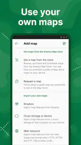
Yes, Avenza Maps supports importing custom maps, so you are not limited to looking for maps in its store. Maps in formats such as GeoPDF and GeoTIFF can be imported from your device, which can be helpful when you already have a map for a particular region, project, or activity. Prepare and import the map before you need to use it offline.
Can I use Avenza Maps for outdoor activities when I have no internet connection?
Avenza Maps is designed for offline mapping and navigation, with a store summary focused on hiking, travel, fieldwork, and outdoor adventures. Its offline use is built around maps saved to your device, so you can consult those maps without relying on an internet connection while you are out. Download the maps you need before heading into an area with limited connectivity.
What is Avenza Maps and how does it work offline?
Avenza Maps is a mobile app designed for offline mapping and navigation, ideal for outdoor enthusiasts. It allows users to download maps directly to their device, ensuring they can access detailed geographic information without needing an internet connection. This offline functionality makes it perfect for hiking, camping, and other activities in areas where connectivity is limited.
Is Avenza Maps free to use, or are there any premium features?
Avenza Maps is free to download, and it also offers in-app purchases for users who want additional options. The available purchase prices range from $0.99 to $249.99 per item, so costs can vary depending on what you choose. Consider what you need from the app before making a purchase, and review the options shown in the app.
Pros
- Easy offline map access
- User-friendly interface
- Wide variety of maps
- GPS tracking feature
- Customizable map layers
Cons
- Limited free map options
- Occasional app crashes
- Slow map downloads
- Requires device storage
- Some features need payment

- Category
- Maps & Navigation
- Version
- 5.5