Argo - Boat Navigation App
- 431.00
- 4.2
- Installs
- 100.00K
- Price
- Free
Screenshots
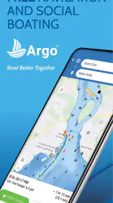
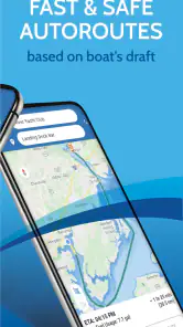
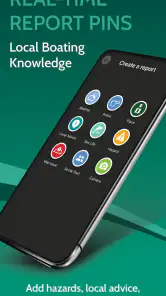

Analysis by Reviewed
Planning a day on the water is different from planning a road trip. A route is only one part of the decision; weather, tides, chart detail, boat information, and what happened during the trip all matter. I spent time with Argo - Boat Navigation App as a marine navigation tool, and I found its main appeal in bringing those separate jobs into one practical workspace instead of making me jump between a chart app, a weather service, a tide table, and a notebook.
Developed by Argo Technologies, LLC, this free Maps & Navigation app is aimed at boaters who want more than a moving position marker. Its average rating is 4.2 from around a thousand ratings, and it has passed 100K installs. Those figures suggest a useful level of adoption without making it feel like an overwhelming, all-purpose platform. The app is rated Everyone, runs on Android 7.0 and later, and the current version is 3.10.0. Optional in-app purchases range from $2.99 to $39.99 per item, so the free starting point is attractive, but serious users should think about which paid tools they actually need.
From an idea for a trip to a usable plan
Starting with the situation on the dock
My most useful way to approach Argo is not to open it while already moving and expect it to solve everything. The better workflow begins before departure. I first decide what kind of outing I am planning: a short coastal run, a fishing trip, a return to a familiar anchorage, or a longer route where conditions may change. That choice determines whether I need the chart, weather and tide information, a saved route, or the logbook most.
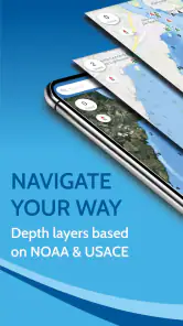
The app’s marine focus is immediately more relevant than a normal road-navigation app. A car map can show roads and traffic, but it is not designed around water, chart reading, or nautical planning. Argo brings together marine GPS, NOAA charts and map information, weather, tides, trip planning, a logbook, and NMEA support. That combination is the reason I would consider it instead of using a general map application as the center of a boating workflow.
Before relying on it, I would still make the basic preparation part of my routine. I would check the device battery, confirm that the phone or tablet has a dependable position signal, and review the route while stationary. A screen is easier to interpret at the dock than in glare, spray, or vibration. I would also keep the boat’s normal safety equipment and navigation backup in place. Argo is a planning and navigation aid, not a substitute for seamanship or situational awareness.
Building the route instead of merely following a line
The boat trip planner is most valuable when I use it to think through the journey in stages. I can treat the departure point, turning points, destination, and return as separate decisions rather than drawing one line and assuming the day will unfold exactly as expected. That helps expose practical questions: Where might I pause? Which section deserves closer chart attention? What will the return look like if the weather changes?
This is one of the app’s less obvious strengths. A route is not only a direction to follow; it is a shared reference for the people involved in the trip. If another person is handling the boat, checking fuel, watching the weather, or keeping notes, the planned route gives everyone a common structure. I find that more useful than relying on memory or a collection of loosely marked places.
More From Our News Desk

Clash of Clans Is Won Between the Battles

Android Auto Makes the Case for Quieter Car Software

MobiOffice: Transforming Mobile Productivity with Seamless Integration

EA SPORTS FC™ Mobile Soccer: Redefining Mobile Sports Gaming

How Microsoft OneDrive Became a Mobile Productivity Giant

How Google Translate Breaks Language Barriers Effortlessly
For a short afternoon outing, I would keep the plan simple and readable. For a longer trip, I would break the route into meaningful sections and inspect the chart around each one. The trade-off is that digital planning can encourage false confidence. A neat line on a screen does not remove the need to understand local conditions, visibility, traffic, or the difference between a broad overview and the detail needed near hazards.
Using charts, weather, and tides together
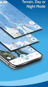
Argo’s chart and map functions become more useful when I read them alongside the weather and tide information rather than treating each feature as a separate tab to glance at once. A route that looks comfortable on a chart may feel very different with changing wind or tide. Likewise, a convenient departure time may create an inconvenient arrival condition. The app’s combined approach encourages me to ask whether the route, timing, and conditions make sense together.
My practical habit would be to review these elements in a fixed order: chart first, weather second, tides third, and then the route again. The chart gives the geographic shape of the plan. Weather changes the comfort and difficulty of the trip. Tide information can affect timing and local water conditions. Returning to the route at the end helps me notice whether the original plan still fits the day.
This workflow is particularly useful for a boater who normally checks several unrelated services. Argo can reduce that mental switching. It does not mean every source becomes equally detailed or that one screen should replace local knowledge. Instead, its value is the handoff between information types: the chart informs the route, the weather challenges the timing, and the tide information helps decide whether the planned sequence remains sensible.
Turning the plan into a live navigation task
Once underway, the GPS view has a different job from the planning screen. I want it to answer simple questions quickly: Where am I, which way am I moving, and how does that relate to the route I prepared? A useful navigation display should reduce unnecessary decisions, especially when I am also watching the water, steering, and communicating with passengers.
I would use the app as a confirmation tool rather than stare continuously at it. That means checking the position at sensible intervals, comparing what I see on the screen with the actual surroundings, and treating unexpected differences as a reason to slow down and reassess. The route remains useful, but it should not become an excuse to ignore landmarks, traffic, visibility, or changes around the boat.
The NMEA support is important for users who already have marine electronics in their setup. It points toward a more connected workflow in which navigation information can participate in the boat’s existing data environment instead of living entirely on a phone. That is a meaningful distinction from a basic recreational map app. At the same time, NMEA-related workflows are only as smooth as the equipment, configuration, and user understanding behind them. I would test the connection at the dock, not for the first time during a trip.
Making the handoffs work
The strongest part of Argo is not any single feature; it is the handoff from one task to the next. I can begin with a route idea, inspect the relevant chart, consider weather and tides, use GPS while moving, and then preserve the trip in the logbook. Each stage gives the next one context. That is more efficient than starting from scratch every time I leave the dock.
A realistic example would be a weekend boat trip to a familiar destination. Before leaving, I would open the chart and shape the route around the intended departure and return. I would then check weather and tides, adjusting the timing if the conditions made the original plan less comfortable. At the dock, I would review the route once more and make sure the navigation setup was behaving as expected. During the trip, I would use the GPS view for position awareness while keeping my attention on the water. After returning, I would use the logbook to record what actually happened.
That final handoff matters more than it may seem. A logbook can turn a one-off outing into accumulated knowledge. I can remember which timing worked well, where the route felt awkward, or how the real trip differed from the plan. The app therefore has value not only during navigation but also between trips, when I am deciding whether to repeat, refine, or abandon a route.
What the logbook adds after the boat is back
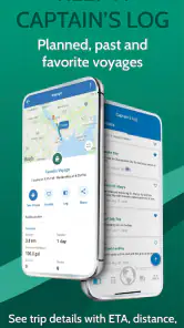
The logbook is a practical feature for anyone who wants continuity. Paper notes can be perfectly adequate, but they are easy to misplace and often lack the connection to the route that produced them. Keeping trip information alongside the navigation workflow makes it easier for me to review the outing as a whole instead of remembering isolated details.
I would use the logbook deliberately rather than treating it as an automatic diary. After a trip, I would note the route I followed, the timing that mattered, and any difference between expectations and reality. I would also record decisions that I would want to revisit later, such as leaving earlier, taking a different section of the route, or allowing more time for changing conditions.
This creates a useful feedback loop: plan, navigate, record, improve. It is a more advanced use of the app than simply watching a position dot move. For a casual user who goes out only once in a while, the logbook may feel unnecessary. For someone building familiarity with regular trips, it can become the feature that gives the rest of the app lasting value.
Where the workflow becomes uncomfortable
The first point of friction is complexity. Putting charts, weather, tides, planning, logging, GPS, and NMEA into one app makes it more capable, but it also gives the user more to understand. A beginner may open it expecting a simple “start navigation” button and instead need to decide which information matters first. I would not recommend learning every part of it five minutes before departure.
The second issue is the difference between free access and a more complete setup. The app is free to install, but optional purchases run from $2.99 to $39.99 per item. That does not automatically make it poor value, especially for a regular boater, but it means the buying decision should follow the workflow. I would start with the free experience, identify the exact limitation affecting my trips, and only then consider paying. Buying features before understanding the app is an easy way to spend money on tools I may rarely use.
The third limitation is that a phone-based navigation workflow depends heavily on the device and the environment. Bright sunlight, wet fingers, movement, and battery concerns can make any mobile chart less comfortable than dedicated marine hardware. The app’s NMEA support may make it a better fit for an integrated setup, but users without compatible equipment should not assume that support alone will create a complete onboard system.
There is also a judgment issue. Because Argo combines so much information, it can feel authoritative even when the real situation is changing faster than the screen. Weather and tide details are most useful when interpreted with local knowledge and direct observation. I would be especially cautious about treating a planned route as permission to continue when visibility, traffic, or conditions no longer match the plan.
Who should use it, and who should choose something else?
I think Argo suits recreational boaters who want one place for route preparation, marine charts, weather and tides, GPS navigation, trip records, and possible connection with onboard data. It is also a good fit for people who repeat similar outings and want to learn from previous trips rather than recreate every plan from memory. The combination feels more purposeful than a general-purpose map app.
It is less suitable for someone who only wants a very simple location display. If all I need is a quick view of where I am, the wider planning and logging workflow may feel like unnecessary overhead. It may also be the wrong primary tool for a professional or highly technical operation that requires specialized equipment, formal procedures, or a dedicated chartplotter as the central navigation system.
Compared with ordinary map applications, Argo is better aligned with boating because its workflow starts with marine navigation rather than adapting a road map to water. Compared with a dedicated onboard chartplotter, its strengths are flexibility and the convenience of a mobile device, while the dedicated system may remain more comfortable and dependable as the boat’s main display. I see the app as especially compelling between those two extremes: more focused than a generic map, but more accessible than a full electronics installation.
My final assessment after following the complete workflow
Argo - Boat Navigation App works best when I treat it as a complete preparation-to-review system rather than a single navigation screen. Its route planner gives the trip structure, charts provide the marine context, weather and tides influence the timing, GPS supports awareness underway, NMEA opens the door to connected equipment, and the logbook preserves what I learned afterward.
The result is a coherent workflow for recreational boating, with enough depth to reward users who prepare carefully. Its weaknesses are equally clear: the broader feature set can take time to learn, optional purchases require a thoughtful decision, and a mobile device should not be treated as the only safety layer on the water.
I would recommend trying the free version at the dock, using it to plan a familiar trip, and checking whether its sequence from route to conditions to logbook matches the way you actually boat. If it does, Argo can become a useful companion for repeat outings and more organized preparation. If you want only the simplest possible map, or if your boat already revolves around specialized navigation hardware, a different option may be a better center for your workflow.
Argo - Boat Navigation App Frequently Asked Questions
Can I use Argo for weather, tides, and trip preparation?
Argo’s marine-focused tools include weather and tide information alongside a boat trip planner, making it useful for preparing before departure and checking conditions as a trip unfolds. These features can help you consider timing and route choices, but conditions on the water can change quickly. Use current local forecasts and official marine guidance as well, and make your own safety decisions rather than relying on an app alone.
Does Argo support boat logs or connections to onboard equipment?
Argo’s feature set includes a logbook and NMEA support, which can make it relevant to boaters who want to record trips or connect navigation information with compatible onboard equipment. What you can use depends on your device, setup, and the features available in the app. If either function is essential to your plans, check that it suits your equipment and workflow before relying on it on the water.
What is Argo – Boat Navigation, and who is it designed for?
Argo – Boat Navigation is a marine navigation app designed for boaters who want chart-based route planning, GPS positioning, and useful information while cruising. It can be helpful for recreational sailors, motorboat owners, anglers, and occasional coastal travelers. The app is most suitable for users who want a simpler digital navigation companion, although it should complement—not replace—official nautical charts, local regulations, and proper onboard safety equipment.
Does Argo require an internet connection to navigate?
Argo may use an internet connection to download chart data, update map information, search locations, and access certain online features. Depending on the region and the content saved in advance, some navigation functions may remain available offline. Before leaving shore, it is important to download the required charts and verify that they are accessible without mobile coverage. GPS positioning can work without internet, but map availability and app features may vary by area.
Can I use Argo for planning routes and tracking my boat’s position?
Yes, Argo is intended to help users plan boating routes and monitor their position through the device’s GPS. During testing, this type of functionality is particularly useful for checking progress, estimating direction, and reviewing a planned trip before departure. However, route suggestions and digital positioning should always be checked against real conditions, including tides, weather, shallow water, restricted zones, traffic, and obstacles that may not be fully represented in the app.
Pros
- Accurate charts help plan routes across many coastal and inland waterways.
- Offline map access is useful when mobile coverage is weak or unavailable.
- Clear navigation tools make tracking position and heading straightforward.
- Supports route planning before departure
- reducing time spent on the water.
- Useful for sailors
- boaters
- and anglers exploring unfamiliar areas.
Cons
- Some advanced charts or features may require a paid subscription.
- Chart coverage and detail can vary significantly by region.
- Continuous GPS use may drain the phone battery during long trips.
- A larger screen is preferable for reviewing complex routes and charts.
- Users should not rely on the app alone in poor weather or emergencies.
- Category
- Maps & Navigation
- Version
- 3.10.0











