All-In-One Offline Maps
- 1.49K
- 4.3
- Installs
- 5.00M
- Price
- Free

Screenshots
Analysis by Reviewed
I tend to judge an offline map by one practical question: will it still help me make a decision when my connection disappears? All-In-One Offline Maps is built for people who want more than a single road map on their phone. I’d consider it for hikes, rural trips, and other outings where having a map available matters more than getting the most polished turn-by-turn guidance. It is a free maps and navigation app from Psyberia, with optional in-app purchases, and its appeal is the freedom to work with a range of map views.
The Treasure Trove of Maps
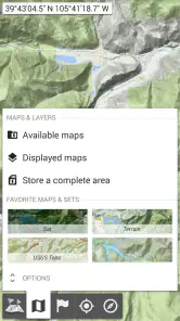
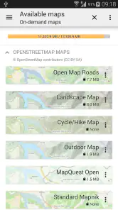
The first thing that caught my eye was the sheer variety of maps available. Unlike other apps that offer limited map types, All-In-One Offline Maps provides a vast selection. You can choose from classic maps, satellite views, and even topographical maps, which are my personal favorite for hiking. It’s like having a map library in your pocket!
What’s even better is that you can download these maps for offline use. Whether you’re deep in the woods or in a remote area with no cell service, you’ll have access to detailed maps. Say goodbye to getting lost and hello to endless exploration!
User-Friendly Interface
I was pleasantly surprised by how intuitive the app is. Sometimes, apps with a lot of features can feel overwhelming, but not this one. The user interface is clean, straightforward, and easy to navigate. You don’t need a degree in cartography to figure out how to use it, which is a huge plus in my book.
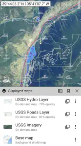
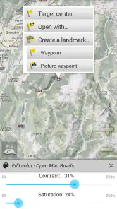
It’s also highly customizable. You can adjust the map’s opacity, layer different maps for a more detailed view, and even import your own data. This level of flexibility is perfect for users who like to have control over their navigation tools.
Features That Make a Difference
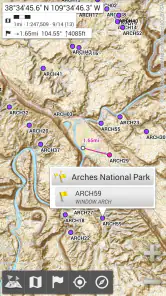
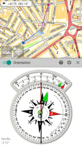
One feature I found particularly useful is the GPS tracking. Even without internet, the app uses your phone’s GPS to track your location. This means you can always see where you are on the map, which is incredibly reassuring when you’re venturing into unknown territory.
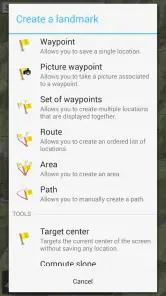
Another standout feature is the ability to mark waypoints and create routes. Planning a hiking trip? You can plot your route in advance and follow it easily once you’re on the trail. It’s like having a personal guide at your fingertips.
You May Like

Clash of Clans Is Won Between the Battles

Android Auto Makes the Case for Quieter Car Software

MobiOffice: Transforming Mobile Productivity with Seamless Integration

EA SPORTS FC™ Mobile Soccer: Redefining Mobile Sports Gaming

How Microsoft OneDrive Became a Mobile Productivity Giant

How Google Translate Breaks Language Barriers Effortlessly
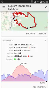
For those who like to keep a record of their adventures, the app lets you save your paths and export them for future reference. It's a great way to track your progress and revisit your favorite spots.
A Better Fit for Some Trips Than Others
Offline maps are useful only when the area you need has been saved ahead of time, so I’d make downloading the map part of trip preparation rather than something to sort out at the trailhead. Check the coverage while you still have a connection, then open the saved area before leaving. That simple routine helps avoid the frustrating possibility of arriving somewhere remote and discovering you saved the wrong place or too little of it.
For a day hike, I’d use a topographical view to understand the terrain, then mark a few decision points such as a trail junction, a planned rest stop, or the place where I intend to turn back. A satellite view can add useful visual context, but it shouldn’t replace checking the route itself. If I were navigating a city by street names and live traffic, I’d reach first for a mainstream navigation app; this one makes more sense when map choice and offline access are the priority.
That distinction matters on an ordinary weekend outing. Imagine driving beyond reliable service to reach a trailhead: before setting off, I’d save the map covering both the approach road and the walk, not just the destination pin. Once out there, GPS can show my position without mobile data, but it cannot tell me that a path is safe, open, or the best choice. I’d treat the map as a planning and orientation aid, and keep a sensible backup plan rather than trusting any phone as the sole source of safety.
Practical Trade-Offs Before You Switch
The flexibility has a learning curve. Layers and imported data can be valuable if you already know what information you want to see, but they may be unnecessary friction for someone who simply wants an app to announce the next turn. I’d begin with one map style and a small route plan, then add layers only when they answer a specific question. That keeps the screen readable and makes it easier to understand what each visual detail is showing.
Offline access also asks for a little more preparation than relying on a connected map service. Downloading an area takes storage, and a saved map can become less useful if your plans change beyond its coverage. Before a longer trip, I’d check the full route area and avoid assuming that a pin or route automatically means every surrounding map is stored. For spontaneous navigation, a connected alternative may feel more convenient; for a trip where service is doubtful, preparing in advance is a worthwhile exchange.
The app’s Google Play audience suggests it has found a substantial group of users: it has a 4.3 average from around 57,000 ratings and over 5 million installs. It is free to start, rated for everyone, and offers in-app purchases ranging from $4.49 to $29.99 per item. I’d try the free experience against a real route before paying for anything, especially if I wasn’t yet sure I needed its more flexible mapping approach. Its long-running presence, with a release dating to April 19, 2013, and current version 3.18, may also make it more appealing to people using older Android devices; the stated minimum is Android 2.1.
Who I’d Recommend It To
I’d recommend this app to hikers, cyclists, and travelers who like to prepare their own maps and want their location visible even when they’re offline. It also suits people who enjoy choosing between map styles instead of accepting one default view. The ability to mark waypoints, plan routes, and export saved paths gives an outing a useful record-keeping side, not just a way to find the next turn.
I’d skip it if I wanted a completely hands-off city navigator, depended on live traffic updates, or had no interest in downloading and organizing maps before a journey. Those are not flaws so much as a mismatch: a conventional navigation app may be quicker for everyday commutes, while a dedicated printed map or another prepared backup can be more appropriate when a trip has serious safety stakes. I’d also test the app at home, when there’s time to learn the controls, rather than making the first attempt in poor reception.
Making an Offline Plan That Holds Up
A useful habit is to prepare for the journey in two passes. First, choose the map view that answers the question you expect to have: street detail for reaching a trailhead, or terrain context for understanding the walk. Then check the saved area against the whole outing, including the return leg and any likely detour. A map centered neatly on the starting point can still leave the part you need next outside its coverage.
I’d also give the phone a quick offline check before leaving: switch off mobile data temporarily and confirm the saved map remains available and your position appears. This is not a substitute for real navigation practice, but it can expose a missed download while you still have time to fix it. GPS positioning and map availability are separate pieces of the plan; having one does not guarantee the other is ready.
For a family walk or a ride with friends, saved waypoints can serve as shared reference points even if everyone is not following the same screen. I’d use them for simple landmarks—a meeting place, a turn, or the intended endpoint—rather than cluttering the map with every possible stop. The practical benefit is less about making a perfect itinerary and more about agreeing on a few points that matter if the group gets separated or changes pace.
Choosing Between Map Styles and Alternatives
The choice of map view is more than cosmetic. A road-focused map is easier to read when the immediate task is finding a street or access road, while a topographical view is more informative when elevation and land shape affect the route. Satellite imagery can help identify visible features, but a familiar-looking image is not proof that a route is public or passable. I’d switch views to answer a specific question, then return to the clearest one for following the route.
Compared with a standard navigation app, this is a better fit when I want to prepare for gaps in coverage and inspect different kinds of map information. A typical connected service is usually the simpler choice for a routine drive where current traffic and spoken directions matter more than layers or saved terrain. A dedicated outdoor mapping tool may suit someone whose trips depend on specialized route information, while a paper map remains a valuable fallback because it does not depend on a charged phone. The right choice depends on the trip, not on which option claims to do everything.
Offline use raises a practical question: can I rely on GPS without a mobile connection? In my planning, I’d separate location from online services. The app can use the phone’s GPS to show where I am on a saved map, but that does not turn it into a live traffic guide or tell me whether conditions have changed. I’d download the area first and use another source for time-sensitive road or trail information before setting out.
What to Expect Before Spending
Because the app is free to try and has optional purchases, I’d make the decision based on a trip I actually take rather than buying features on the strength of a long feature list. Test whether the available map choice, offline preparation, and route tools solve a real problem for you. The listed purchase range is broad enough that I would check the specific item and its value in the app before committing; I wouldn’t assume every user needs a paid option.
Storage is another cost that can be easy to overlook. Offline coverage means keeping map files on the device, so downloading every region “just in case” is not a sensible approach if space is limited. I’d save the places I’m likely to visit, remove areas I no longer need when appropriate, and make a fresh coverage check when plans change. This keeps offline preparation deliberate instead of turning the phone into an unorganized cache of maps.
There is also a small attention cost: a flexible map rewards curiosity, but it asks you to make choices. If you are new to route planning, start with a short familiar outing and learn how the map, saved route, and location indicator work together. Once those basics feel comfortable, experimenting with layers or imported information is less likely to distract you from the journey itself.
My Recommendation for the Right Kind of Traveler
My recommendation is straightforward: choose this app if offline access and map variety are central to how you travel, and you are willing to prepare before leaving. It is especially appealing to people who like to inspect a route, save a few key points, and keep a record of where they went. The combination is more useful for independent exploration than for a commute where the phone is expected to make every navigation decision automatically.
I would not make it my only navigation plan for a demanding trip. A saved map can help with orientation, but it does not replace local knowledge, checking conditions, carrying suitable supplies, or having a backup. Likewise, if you mainly need effortless live directions through town, the extra preparation may feel like work without much payoff. That is the clearest test: consider what goes wrong on your usual journeys, then decide whether offline maps address that problem.
In conclusion, All-In-One Offline Maps is more than just a map app; it’s a comprehensive tool for explorers of all kinds. Whether you’re a hiker, biker, or just someone who loves to wander off the beaten path, this app will enhance your adventures. With its offline capabilities, variety of maps, and user-friendly design, it’s definitely worth a spot on your phone. Happy exploring!
All-In-One Offline Maps Frequently Asked Questions
Can I plan a trip in advance with All-In-One Offline Maps?
Yes. You can prepare for a trip by downloading the map areas you expect to visit while you have an internet connection. Saving maps ahead of time is especially useful for routes through places with unreliable coverage, such as remote outdoor areas. Before setting off, open the saved maps and make sure they cover the places you intend to explore.
Which devices can run All-In-One Offline Maps?
All-In-One Offline Maps is an Android app that supports devices running Android 2.1 or later. Its compatibility with older Android versions may make it an option for people using devices that cannot run many newer apps. Check your device’s Android version before downloading, and remember that the app is free to install, with optional purchases available within it.
Is All-In-One Offline Maps suitable for hiking and other outdoor trips?
All-In-One Offline Maps is designed for outdoor enthusiasts who want map access when they are away from reliable network coverage. Its topographic maps can be useful for hiking and camping, while road maps and satellite views suit other kinds of trips. Download the areas you plan to use while you have an internet connection, then open those saved maps offline.
What should I know about the app before downloading it?
All-In-One Offline Maps is a Maps & Navigation app developed by Psyberia, with a short description of “All-In-One Maps.” It is free to download, is rated for Everyone, and offers optional in-app purchases. The app is available for Android devices running version 2.1 or later, so it may suit users with older compatible devices as well as those looking for offline map access.
What is All-In-One Offline Maps and how does it work?
All-In-One Offline Maps is a versatile application designed for outdoor enthusiasts who need reliable maps without an internet connection. It allows users to download maps directly to their device, ensuring they have access to detailed topographic maps, road maps, and satellite views even when offline. This app is particularly useful for hiking, camping, and other outdoor activities where network coverage might be unreliable.
Pros
- Comprehensive offline maps access
- User-friendly interface
- High detail in topographic maps
- Customizable map layers
- Efficient GPS integration
Cons
- Limited POI information
- Occasional map loading issues
- No real-time traffic updates
- Large app size
- Requires frequent updates

- Category
- Maps & Navigation
- Version
- 3.18












