GeoBallistics
- 233.00
- 3.5
- Installs
- 100.00K
- Price
- Free

Screenshots
Analysis by Reviewed
When I head to a range, the difficult part is rarely doing one calculation. The real challenge is moving from a rifle, ammunition, and changing conditions to a usable firing solution without juggling several separate tools. GeoBallistics is built around that exact moment. It is a free sports app from Sheltered Wings, Inc. that brings ballistic calculation and GPS rangefinding into one mobile workflow.
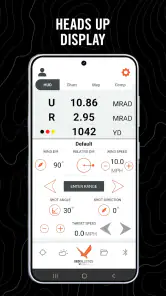
I found the idea more useful than a simple store summary suggests. The app is not merely a calculator where I enter a few figures and read a result. Its value comes from connecting location-based range work with ballistic information, so I can begin with the place I am shooting, prepare the relevant inputs, and keep the process together on one screen instead of switching between a calculator, a map, and notes.
That convenience does not make the app effortless. A ballistic tool is only as trustworthy as the information entered into it, and GeoBallistics expects the user to understand what those inputs mean. In my experience, it is best suited to shooters who already know their equipment and want a practical field companion, rather than someone looking for an automatic answer with no setup.
From rifle and range conditions to a usable firing solution
Starting with the situation rather than the calculation
A useful way to approach this app is to imagine a normal range day. I arrive with a rifle that has already been sighted in, ammunition I know, and a target area whose distance or position needs to be established. The first decision is not “what number does the app give me?” It is “what information do I actually know, and what still needs to be measured?”
That distinction matters. If I already have a confirmed distance and a stable set of ammunition details, I can focus on the ballistic side. If I am working at an unfamiliar outdoor location, the GPS rangefinder part becomes more important because it helps connect the physical place with the calculation. The app is strongest when I treat those as two parts of one workflow, not as unrelated buttons.
I would prepare the rifle and ammunition details before standing at the firing point. That means having the relevant projectile and rifle information available, knowing the sight setup, and being honest about which values are estimates. Entering a precise-looking number that I do not really know can create more confidence than accuracy. This is one of the first practical lessons GeoBallistics makes clear: the screen may be neat, but the responsibility for the inputs remains with me.
The application is classified as a sports app and is available at no charge, with an Everyone content rating. That makes it easy to try without committing money first. It is also an older, established product rather than a brand-new experiment: it was released in April 2016, and the current version is 7.4.0. In the store, it has passed 100K installs and carries a 3.5 average from 493 ratings, with 233 written reviews. Those figures suggest a real user base, but they also tell me to approach it as a specialized tool with mixed experiences, not as a universally polished utility.
More From Our News Desk

Clash of Clans Is Won Between the Battles

Android Auto Makes the Case for Quieter Car Software

MobiOffice: Transforming Mobile Productivity with Seamless Integration

EA SPORTS FC™ Mobile Soccer: Redefining Mobile Sports Gaming

How Microsoft OneDrive Became a Mobile Productivity Giant

How Google Translate Breaks Language Barriers Effortlessly
Building the input carefully
My next step would be to create or select the rifle-and-ammunition setup I intend to use. This is where a casual user may feel the most friction. Ballistic calculators often expose more technical choices than ordinary sports apps, and that is appropriate here, but it means I cannot rush through the setup just to reach the result.
I would check each value against the equipment in front of me. The bullet type, muzzle information, sight relationship, and environmental assumptions all influence the calculation. Even when the app makes entry convenient, I would not copy a profile from one rifle to another simply because the cartridges look similar. A small difference in setup can make the output unsuitable for the new rifle.
A useful habit is to keep one profile for each meaningful combination of rifle, load, and optic arrangement. That prevents a common handoff error: arriving at the range, selecting the wrong saved setup, and then blaming the calculation for a mismatch. If I change ammunition or alter the sight mounting, I would treat that as a reason to review the profile rather than assuming the old one remains valid.
This is also where GeoBallistics differs from a basic range card or a pocket calculator. A paper card is fast once it has been prepared, but it does not help me assemble a new solution at an unfamiliar location. A simple calculator may offer fewer fields and feel friendlier, yet it usually leaves the rangefinding and record-keeping to separate tools. GeoBallistics asks for more attention up front in exchange for keeping those tasks closer together.
Using the GPS rangefinder in the field
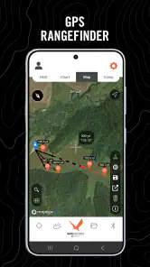
Once the equipment profile is ready, I can turn to the location side of the workflow. The GPS rangefinder is most useful when I need to relate my position to a target or range point without estimating distance by eye. In a real outing, I would use it before firing, while standing in a stable location and allowing the phone to establish a sensible position.
I would not treat a phone-derived distance as automatically perfect. Outdoor terrain, obstructions, and the way the target point is selected can all affect the practical result. The important advantage is not that the phone replaces every measuring instrument; it is that the app gives me a convenient way to include location and distance in the same preparation process.
One non-obvious benefit is the reduction in transcription. Without an integrated tool, I might read a distance from one device, type it into a calculator, write the result on paper, and then remember which rifle profile I used. Each transfer creates an opportunity for a typo or a mix-up. With GeoBallistics, the distance can remain part of the same mobile session. That does not remove the need to verify it, but it reduces the number of places where an error can enter.
I would still confirm the practical direction and target relationship myself. A GPS-assisted workflow is not a substitute for safe range procedure, a clear target, or a proper backstop. The app can organize information; it cannot judge whether a shot is safe or whether the target has been correctly identified.
Reading the calculation without overtrusting it
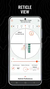
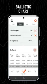
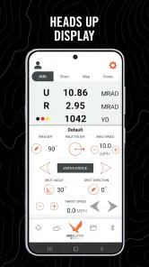
After the profile and distance are in place, the app’s central job is to turn those inputs into a ballistic solution. This is the point where I would slow down rather than immediately adjust the rifle. I would review the selected setup, distance, and environmental assumptions, then compare the displayed result with what I expect from my sight and ammunition.
The practical outcome is not simply a number to copy. It is a reference for making an adjustment and then checking that adjustment on paper. If the first group does not behave as expected, I would investigate the assumptions before making several additional corrections. That approach is especially important when moving between a known range and a new outdoor location.
GeoBallistics works best for this kind of iterative process because it keeps the calculator available after the first result. I can use the initial solution as a starting point, observe the group, and decide whether the issue is distance, environmental change, rifle setup, or an inaccurate input. The app supports the reasoning process, but it does not replace the shooter’s judgment.
Where the handoffs matter most
The handoff from the physical rifle to the digital profile is the first place I would be careful. I need to make sure the app profile represents the rifle actually on the bench, not the one I used last weekend. The handoff from the GPS rangefinder to the ballistic calculator is the second: distance must be associated with the correct target and shooting position.
The third handoff is from the phone to the rifle. The result has to be interpreted correctly and applied in a controlled way. I would keep the phone visible but protected, make one change at a time, and use a confirmation group rather than assuming the first calculated adjustment is final. This is a more reliable workflow than treating the app as an authority whose output needs no testing.
A fourth handoff occurs when conditions change. If I move, change the target distance, switch loads, or notice a meaningful environmental difference, I would revisit the relevant inputs. Reusing a previous result without checking what has changed is faster, but it defeats the purpose of using a calculator designed to account for the current situation.
These handoffs explain why the app can feel excellent to an experienced shooter and demanding to a beginner. Someone familiar with ballistic terminology will understand why the setup deserves care. A newcomer may expect the GPS feature to do most of the work and may be surprised by the amount of equipment knowledge still required.
A realistic range-day example
Imagine I am visiting a new outdoor range with one rifle and a load I have already tested. I begin by selecting the correct rifle profile and checking it against the equipment in my case. I then use the location function to establish the relevant range information instead of relying on a rough visual estimate.
Before firing, I review the calculation and make sure the selected profile matches the rifle and ammunition. I apply the suggested correction conservatively, fire a group at a suitable confirmation target, and compare the result with the expected point of impact. If the group is consistently offset, I look first at the profile, distance, and sight setup rather than repeatedly changing the rifle.
Now suppose I move to another firing point. The workflow starts again at the location handoff, because the new position and target relationship may change the solution. If I change ammunition as well, I would not merely edit the distance; I would select or prepare the matching load information. This is a small discipline, but it is one of the most useful ways to avoid carrying an old assumption into a new shot.
In that scenario, the app saves time mainly by reducing tool switching. It does not eliminate preparation, and it does not guarantee that every result will match the first group. Its real contribution is keeping the chain from location to calculation to verification in one place.
What the result is good for
The result is most valuable as a field reference and preparation aid. It can help me organize the relationship between distance, equipment, and the correction I need to investigate on the range. That makes it more useful than a calculator I open only after I have already measured everything elsewhere.
It is also helpful when I want a repeatable process. By using the same profile-checking routine each time, I reduce the chance of forgetting an important input. The app encourages me to think in terms of a complete setup rather than a single isolated number, which is a meaningful advantage for practical range work.
However, I would not use the output as a replacement for confirmed zeroing, safe handling, or observation through the optic. A calculated solution can be mathematically consistent and still be wrong for my rifle if the underlying data is wrong. That limitation belongs to the entire category, but the integrated design can make users forget it because the workflow feels so complete.
Where the flow breaks down
The first weak point is setup complexity. GeoBallistics is not the kind of app I would hand to someone who has never dealt with ballistic inputs and expect immediate confidence. The technical nature of the task means that the app’s convenience arrives after I understand the vocabulary and collect the equipment information.
The second weak point is dependence on the phone and the field environment. A GPS-based workflow is less attractive when the location is difficult to establish, the device is awkward to use outdoors, or I need a result without spending time looking down at a screen. For a familiar range with fixed distances, a printed dope card or a simple reference may be faster.
The third issue is verification. The app can combine rangefinding and calculation, but it cannot verify that my rifle is mechanically consistent, that the ammunition matches the profile, or that the target point was selected correctly. I still need a disciplined confirmation step. Shooters who want a fully automated experience may find that frustrating.
There is also a financial detail worth noticing. The app itself is free, while in-app purchases are listed at $14.99 per item. That means I can test the basic experience without paying at the start, but I would review any purchase screen carefully and decide whether an optional paid item actually fits my workflow. For occasional range visits, the free entry point may be enough to evaluate the concept; for regular use, the extra cost should be judged against how often the integrated workflow replaces other tools.
Who should use it, and who should choose something else?
I would recommend GeoBallistics to an intermediate or experienced shooter who wants a single mobile workspace for ballistic calculation and GPS-assisted range preparation. It is particularly appealing if I visit different outdoor locations, maintain more than one rifle setup, or dislike transferring distance and calculation results between separate apps.
I would also consider it useful for someone building a careful pre-shot routine. The app encourages me to confirm the rifle, load, distance, and conditions before acting on the result. That structure can be more valuable than a flashy interface because it highlights the places where a field mistake usually begins.
I would skip it if I only shoot at a familiar range with known distances and already have reliable printed data. In that case, the phone may add more steps than it removes. I would also look for a simpler alternative if I am new to ballistics and want guided explanations rather than a technical calculator. A dedicated rangefinder may be better when precise distance measurement is the main need, while a basic calculator may be preferable when I already have distance and only want a quick correction.
Device compatibility is another practical checkpoint. The listed minimum operating system is Android 7.0, so I would check the phone before planning a trip, especially if it is older. The app’s free availability and Everyone rating make trying it straightforward, but compatibility and comfort in the field matter more than the download decision itself.
My final take after following the complete workflow
GeoBallistics succeeds because it connects two jobs that are often separated: figuring out where the target is in relation to me and turning that range information into a ballistic reference. In my hands, the biggest benefit is not a single calculation. It is the shorter path between arriving at a location, selecting the right equipment profile, checking the distance, reviewing the assumptions, and reaching a result I can verify on paper.
The trade-off is that the app expects me to participate intelligently. I have to maintain accurate profiles, understand the inputs, check the handoffs, and confirm the result rather than treating the phone as a substitute for experience. That makes it less welcoming than a basic calculator, but more useful for a shooter who wants a connected field workflow.
With a 3.5 average and a substantial installed audience, it is clearly worth evaluating rather than dismissing, although the rating also fits my impression that this is a specialized tool with some friction. Sheltered Wings, Inc. has made a practical free starting point for people who want ballistic and GPS functions together, but the app is not the right answer for every range day.
My recommendation is simple: try it if you regularly move between locations or rifle setups and are willing to verify every important input. If your needs are limited to familiar distances and quick reference cards, a simpler option may serve you better. For the right user, though, the app turns a scattered preparation process into one repeatable chain from starting condition to checked result, and that is its most convincing strength.
GeoBallistics Frequently Asked Questions
What devices and operating systems can run GeoBallistics?
GeoBallistics is a sports app from Sheltered Wings, Inc. Before downloading, check that your device runs Android 7.0 or later, the stated minimum operating-system requirement. The app is available for Android and iOS, though device compatibility can vary by platform. If you plan to use it outdoors, it is also worth checking that your phone remains comfortable to operate and read in your usual shooting environment.
What is GeoBallistics used for?
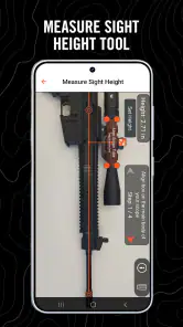
GeoBallistics is a ballistic calculator designed to help shooters estimate bullet trajectories and make more informed adjustments in the field. It can account for factors such as ammunition, rifle setup, distance, atmospheric conditions, wind, and sight height. It is mainly intended for long-range shooting, hunting, and target practice rather than casual firearm use.
Is GeoBallistics suitable for beginners?
GeoBallistics can be useful for beginners, but it is not necessarily a simple point-and-click application. New users need to understand basic ballistic terms, enter accurate rifle and ammunition data, and interpret the results correctly. The app may help explain trajectory calculations, but it should be treated as a supporting tool, not a replacement for proper training, safe range practice, or advice from an experienced shooter.
How accurate are GeoBallistics calculations?
The quality of GeoBallistics results depends heavily on the information entered by the user. Accurate bullet specifications, muzzle velocity, sight height, zero distance, environmental readings, and wind estimates can produce useful predictions. However, real-world results may differ because of ammunition variation, barrel condition, measurement errors, and changing weather. Users should always confirm calculations through safe, legal testing at an appropriate range.
Does GeoBallistics require an internet connection?
Some GeoBallistics functions may work without a continuous internet connection once the necessary data has been downloaded or entered, which is helpful when shooting in remote locations. Nevertheless, certain features, updates, account services, maps, weather information, or cloud-based tools may require connectivity depending on the version and platform. It is a good idea to open the app before leaving and verify that the required tools work offline.
Pros
- Detailed ballistic calculations for long-range shooting.
- Supports custom firearm
- ammunition
- and projectile profiles.
- Weather and atmospheric data improve shot estimates.
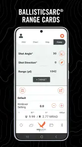
- Useful range cards help organize multiple shooting setups.
- Works well for shooters who want data-driven adjustments.
Cons
- Many advanced features require a paid subscription.
- The interface can feel overwhelming for beginners.
- Accurate results depend on carefully entered rifle data.
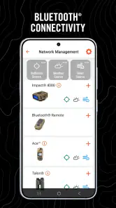
- Some features may require compatible sensors or devices.
- Frequent updates may change menus and configuration steps.
- Category
- Sports
- Version
- 7.4.0