Salt Strong: Fishing Spots App
- 466.00
- 3.5
- Installs
- 50.00K
- Price
- Free

Screenshots
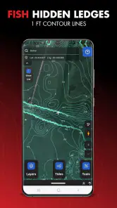
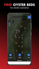
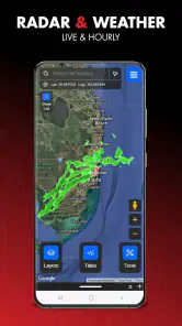
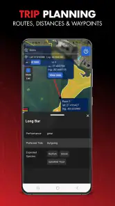
Analysis by Reviewed
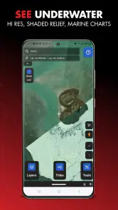
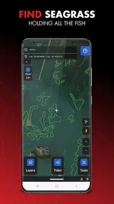
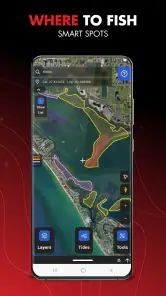
I spend enough time planning fishing trips to know that a map can be more useful than a long list of species tips. Salt Strong: Fishing Spots App takes that approach for inshore and saltwater anglers, bringing fishing maps, forecasts, and tide information into one sports app. I found the idea immediately practical: instead of jumping between a general weather app, a tide website, and scattered map searches, I can begin with the water and work outward from there.
That convenience does not make it a universal replacement for every fishing tool. The app is most appealing when I want a focused planning companion for coastal trips, especially when timing, location, and changing conditions matter more than broad fishing entertainment. My overall impression is positive but measured: it can simplify preparation, yet its value depends heavily on how much I fish inshore or saltwater areas and whether I am comfortable with features connected to optional purchases.
How the app feels when planning a trip
The first thing I notice with a fishing-planning app is whether it gets me to useful information quickly. Salt Strong is built around that expectation. Its central appeal is not a social feed or a complicated logbook; it is the ability to look at fishing locations alongside forecasts and tides. That focused structure should feel faster than manually collecting the same pieces of information from unrelated apps.
In practical use, I would open it before leaving home, choose the area I am considering, and compare the tide timing with the broader forecast. That workflow is more valuable than simply looking at a map by itself. A spot may be familiar, but the right tide window can change how worthwhile a short trip feels. The app encourages me to think in terms of location plus conditions rather than treating a pin on a map as a guarantee.
The biggest speed advantage is reduced switching between sources. I do not have to keep one app open for weather, another for tide tables, and a browser tab for fishing locations. That does not mean every screen will load instantly in every situation, but the design goal is clear: get the planning essentials closer together so the decision takes less effort.
I also like that this is a dedicated sports app rather than a general navigation product trying to serve every outdoor activity. A broad map app may be better for driving directions or terrain, while a tide-focused utility may offer more specialized timing information. Salt Strong sits between those choices, aiming to make the fishing decision itself easier.
Useful preparation before leaving home
A good routine is to check the app before packing rather than waiting until I am already at the launch point. I can use the map to narrow down possible areas, then look at the forecast and tide pattern before deciding how ambitious the trip should be. If the conditions look unappealing, I have saved time, fuel, and preparation effort.
More From Our News Desk

Clash of Clans Is Won Between the Battles

Android Auto Makes the Case for Quieter Car Software

MobiOffice: Transforming Mobile Productivity with Seamless Integration

EA SPORTS FC™ Mobile Soccer: Redefining Mobile Sports Gaming

How Microsoft OneDrive Became a Mobile Productivity Giant

How Google Translate Breaks Language Barriers Effortlessly
One less obvious benefit is that this process helps me compare several nearby options without committing too early. Instead of asking, “Where is the closest spot?” I can ask, “Which accessible area matches the tide and forecast during the hours I actually have?” That is a more realistic question for someone fitting fishing around work, family, or a limited weekend window.
The app is free to install, which makes that initial trial easy. It is available to an Everyone audience, so the presentation is approachable rather than built only for experienced tournament anglers. Salt Strong LLC is the developer, and the app has reached over fifty thousand installs. Its average rating is three and a half, based on over five hundred ratings, which suggests a mixed but substantial body of user experience rather than a completely untested product.
What happens during heavier use
The most demanding moment is likely to be when I am actively comparing several locations while also checking changing conditions. That is when a fishing map stops being a quick glance and becomes a working planning surface. I may zoom, move across the coast, revisit a previous area, and switch between map and forecast information in one session.
For that kind of use, perceived speed matters more than decorative detail. If the app responds promptly, it can support a last-minute decision at the kitchen table or in the truck before departure. If screens take too long to refresh, the convenience advantage over separate tools becomes much smaller. I would therefore judge it by how quickly it helps me answer practical questions: where to go, when to arrive, and whether the conditions justify the trip.
I would avoid treating the map as something to stare at continuously while moving around. A phone screen is not a substitute for safe navigation, local knowledge, or attention to the water. The app is better used in deliberate checks: plan at home, review again before launching, and consult it only when safely stopped. That workflow also reduces battery and data pressure compared with leaving a map open for an entire outing.
Another useful habit is to make the decision in stages. First, identify a small group of possible areas. Next, compare tide timing and forecast conditions. Finally, choose one primary destination and one backup. This avoids repeatedly scanning the entire coastline when conditions change. It also gives the app a clear role: helping me make a plan, not replacing judgment once I am on the water.
Stability and recovery when plans change
Fishing plans rarely stay fixed. Wind, rain, access, traffic, and a late start can all force a change. A reliable planning app should let me recover quickly from that change instead of making me rebuild the whole search from the beginning. Salt Strong’s combined map-and-conditions concept is useful here because I can move from the original area to another nearby option without abandoning the same planning method.
I see the app as most dependable when used as a reference before the trip. That is also where I can tolerate a little friction, because I have time to compare information and try again if a screen needs another moment. On the water, expectations are different. Poor reception, a wet screen, bright sunlight, or a low battery can make any phone-based tool frustrating, so I would not rely on it as my only source of orientation or timing.
A sensible recovery plan is to review the likely area before leaving and remember the basic timing that matters for the trip. If the app becomes inconvenient later, I still have a working plan rather than being completely dependent on a live screen. This is not a criticism unique to Salt Strong; it is an important limitation of using a phone for outdoor information in general.
Its current version is 1.3.60, and the app was released on September 8, 2023. Those details place it in the category of a relatively recent dedicated tool rather than a decades-old reference product. I would still keep the app updated through the normal store process, particularly because map and forecast tools benefit from ongoing maintenance. The version number itself is less important to me than whether the app remains responsive on my phone during the specific planning routine I use.
Phone requirements and resource trade-offs
The minimum operating system is Android 7.1, so the compatibility threshold is not especially demanding for Android users with older devices that still function well. That is helpful for anglers who keep a previous phone as a backup or use a less expensive handset near the water. Compatibility, however, is only one part of the experience. A phone with a brighter display, stronger battery, and dependable connectivity will still be more comfortable for outdoor use.
Maps and forecasts naturally involve screen time and network activity, especially when moving around a large coastal area. I would expect the heaviest resource demand during active browsing rather than during a quick check of one location. To keep the experience manageable, I would plan the route and shortlist locations before heading out, lower screen brightness when safe, and carry a power bank for longer sessions.
That advice also clarifies who should skip the app. If I mainly fish freshwater lakes, want a general navigation app, or need a full offline charting system, this may not be the best first choice. Likewise, someone who only fishes once or twice a year may find separate free weather and tide resources sufficient. The app makes more sense for a person who regularly fishes saltwater and wants a repeatable planning workflow.
There is also a financial point to consider. The app is free, but in-app purchases range from $12.97 to $97.00 per item. I would begin with the free experience and decide whether the planning value justifies any optional spending. That is especially important for casual anglers, because a paid feature can be worthwhile for frequent use but unnecessary when a basic forecast-and-tide check already answers the question.
Where it beats ordinary alternatives
The usual alternative is a collection of separate tools: a general weather app, a tide table, a standard map, and perhaps advice from local fishing groups. That combination can work, and each individual tool may be stronger in its own specialty. The drawback is the mental work of matching the information yourself. Salt Strong’s advantage is the connection between fishing locations and the conditions that influence when those locations are worth trying.
Compared with a generic map, it is more relevant to the fishing decision. Compared with a tide-only app, it gives the tide a geographic context. Compared with browsing random online advice, it offers a more repeatable way to prepare. Those are meaningful advantages, but they do not eliminate the need for local knowledge. A map can help me choose where to investigate; it cannot promise that a spot will suit my boat, access point, tackle, skill level, or safety conditions.
I would also be cautious about expecting it to replace detailed navigation equipment. If I am planning a technically demanding offshore trip, I want tools designed specifically for navigation and safety, along with current local guidance. Salt Strong appears better suited to deciding where and when to fish than to serving as the sole system for every decision on the water.
A realistic weekend use case
Imagine I have a free Saturday morning but only a few hours available. I open the app the evening before and inspect several inshore areas within a reasonable travel distance. I compare the forecast and tide timing, then choose the location that gives me the most practical window rather than automatically driving to the closest familiar place.
In the morning, I check the plan once more. If the weather has become less attractive, I can compare the backup area instead of starting from zero. I pack for the selected conditions, leave with a clearer arrival target, and avoid spending the first part of the trip searching through unrelated apps. That is the kind of everyday value I think Salt Strong can deliver.
The trade-off is that I still need to make the final call. A favorable forecast does not guarantee fish, and a promising map view does not remove questions about access, regulations, boat traffic, or personal safety. The app improves preparation; it does not turn uncertain fishing into a predictable activity.
My performance verdict
After considering speed, heavier map use, recovery from changing plans, and device limits, I see Salt Strong as a focused planning assistant rather than an all-purpose fishing command center. Its strongest quality is the way it brings fishing locations, forecasts, and tides into one decision-making routine. That can feel faster and less tiring than assembling the same picture from several unrelated services.
I would recommend trying it if you regularly fish inshore or saltwater, often plan around tide windows, and want a single starting point before heading out. The free entry point lowers the risk of testing it, while the Everyone rating and modest Android requirement make it approachable for a broad audience. I would be more cautious if I rarely fish, need advanced navigation, depend on offline access, or prefer to keep every information source completely free.
My final view is that the app earns its place through convenience, not magic. It can shorten the path from “I want to fish” to “this is the area and time I should investigate,” which is a meaningful improvement for regular anglers. I would use it as part of a layered routine: plan with the app, verify practical conditions locally, carry a backup plan, and never confuse a digital suggestion with a guarantee. Used that way, Salt Strong: Fishing Spots App is a sensible sports companion for coastal anglers who value organized preparation more than a generic map alone.
Salt Strong: Fishing Spots App Frequently Asked Questions
Is Salt Strong: Fishing Spots available for my device?
Salt Strong: Fishing Spots is an app for anglers, and its current version is 1.3.60. Before downloading, check that your device meets the minimum operating system requirement of 7.1. The app is developed by Salt Strong LLC and is listed for everyone, so it is intended for a general audience interested in saltwater fishing.
What does Salt Strong offer for planning a fishing trip?
The app brings together smart fishing maps, forecasts, and tide information to help users find inshore and saltwater fish and prepare for a trip. These tools can support decisions about where and when to fish, while still leaving room for local judgment. Conditions can shift, so it is sensible to check the latest forecast and tide details before setting out.
What is the Salt Strong: Fishing Spots app used for?
Salt Strong: Fishing Spots is designed to help saltwater anglers discover productive fishing locations and plan trips more effectively. The app provides access to fishing-related information, spot recommendations, maps, and educational resources focused on inshore saltwater fishing. It is intended for anglers who want practical guidance before heading out, although local conditions and personal experience should always be considered.
Does Salt Strong provide exact fishing spots and guaranteed catches?
The app may offer useful location guidance, maps, and information about areas where anglers commonly fish, but it should not be treated as a guarantee of success. Fish move according to tides, weather, water temperature, bait activity, season, and fishing pressure. Spot information can also change over time. Use the recommendations as a planning aid and combine them with current local knowledge.
Is Salt Strong: Fishing Spots free to download and use?
The app is free to download, but some features may involve in-app purchases. Available options can include paid content or tools, so check the purchase details shown in the app before committing to anything. The price of an individual purchase can range from $12.97 to $97.00. Consider what you want from the app and review any subscription or purchase terms carefully.
Pros
- Interactive maps help identify promising fishing spots quickly.
- Weather and tide data support better trip planning.
- Useful for both beginners and experienced saltwater anglers.
- Community reports can provide timely local fishing insights.
- Educational content helps improve techniques and lure selection.
Cons
- Coverage and report quality may vary significantly by location.
- Some advanced features require a paid membership.
- Accurate results depend on users sharing current information.
- The app can use considerable battery during extended outdoor trips.
- A stable internet connection may be needed for maps and updates.
- Category
- Sports
- Version
- 1.3.60