 About Google Earth
Google Earth’s 3D Flyover Makes Trip Planning More Grounded
Before I decide whether a place belongs on an itinerary, I want to know what it feels like to approach it: whether the landmark is tucked behind a ridge, how the streets gather around it, and what lies just beyond the photograph everyone shares. Google Earth’s 3D flyover answers that better than a pin on a flat map. Its real value is not spectacle for its own sake; it is the ability to build a rough sense of place before you arrive.
The feature is easy to mistake for a digital globe to spin when you have a spare minute. But the more useful habit is to search for a real destination, tilt the view, and move through its surrounding terrain. That small shift—from looking at a location to looking around it—is where the app earns a place in travel planning.
Seeing the approach, not just the pin
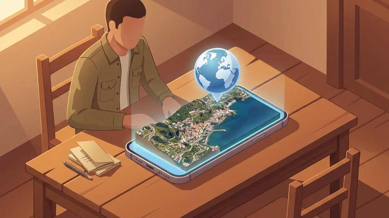
In supported locations, Google Earth combines satellite and aerial imagery into a textured 3D view. Search for a city, a mountain, or a famous site, then drag, zoom, and tilt to inspect its contours and nearby buildings. The view can sweep from a broad regional perspective down toward streets and landmarks, making a destination legible as part of a larger landscape rather than an isolated dot.
That distinction matters. A conventional map is excellent at answering where and how far. The 3D view helps answer what is between here and there. A steep slope, a river bend, a tightly packed district, or an exposed stretch of coastline becomes easier to grasp when the landscape has depth. The imagery is not live, and it is not a street-level substitute, but it offers a kind of visual context that a route line cannot.


On a phone, navigation through the scene is direct: pinch to change scale, drag to move, and tilt to change the angle. Searching gives the exploration a starting point, while the globe makes it easy to keep following a ridge or coastline after the original destination slips out of view. It is a preview of spatial relationships, not a promise of on-the-ground certainty. Keeping that boundary clear makes the feature more useful, not less.
Why a flyover matters more than it seems
Travel plans often rely on images chosen to make a place look inviting. A landmark photograph can show a temple, viewpoint, or old town at its most flattering angle; it rarely shows the slope leading up to it or the dense development around the edges. A 3D flyover is less polished and, for planning, often more revealing. It lets you ask practical questions before committing time: Is the attraction isolated? Is the terrain steep? Does the neighborhood extend far beyond the central square?
These are modest questions, but they affect how a day feels. A viewpoint that looks close on a map may sit high above a winding road. A coastal hotel may be separated from the waterfront by a bluff. A historic center may be compact enough to explore on foot, while the places you also want to see are scattered across a broad valley. Google Earth cannot tell you how tiring a walk will feel or whether a footpath is open, but it can flag the geography that deserves a closer check.
Latest News



That is the feature’s quiet advantage: it helps you replace a vague mental picture with a more grounded one. You may still change your plans after checking current directions, local transport, or recent visitor information. But you start that research with a better idea of what you need to verify.
The best use: getting a feel for a destination before arrival
Imagine planning a first visit to a city built around hills. Start at the hotel area, tilt the view, and trace the route toward the old town. Then look outward: where does the street grid flatten, where does it climb, and which major landmarks sit on the skyline? In a few minutes, the destination becomes more than a list of names. You can picture how its districts fit together and decide whether a day’s plan is geographically sensible.
The same approach works for a national park or a mountain region, where elevation and distance are hard to judge from a list of attractions. A flyover can reveal the shape of a valley, the bends in a river, and the relationship between a trailhead and the terrain beyond it. It is especially valuable for choosing what to investigate next. If a route looks more demanding than expected, you can check official trail information; if a landmark seems isolated, you can look into transport and access.
This is not turn-by-turn navigation, and treating it as such would be a mistake. Imagery can be old, coverage varies, and a visually clear route may not be public or walkable. For final logistics, current maps and local sources still matter. Earth is strongest earlier in the process, when you are deciding what a place might involve.
How the feature changes the way you plan
Flat maps encourage a checklist mindset: pin the museum, pin the market, draw a line between them. The 3D view encourages a more exploratory sequence. You inspect the neighborhood, notice a hill or river, follow the terrain, and reconsider how much fits into one afternoon. Instead of planning only around attractions, you begin to plan around the shape of the place.
That shift can make planning more curious, too. A quick search for a famous landmark often leads to an adjacent district, a bend in the coast, or a mountain pass you had not considered. The globe invites detours without demanding that every detour become a booking. Used this way, the app is less a trip organizer than a visual research tool: a way to notice what you did not know to search for.
I find that stickiness more compelling than the novelty of the flyover itself. The feature rewards open-ended browsing, but it also has a practical exit: once you understand the terrain, you can move on to current directions, opening hours, and transport details elsewhere. It helps answer the early question of whether a destination makes sense for you; it does not pretend to handle every later question.
Where the design is smart—and where it falls short
The interface makes the globe feel approachable without turning every visit into a guided tour. Search gets you close to a place, and direct gestures let you explore from there. The camera movement is intuitive enough that a newcomer can discover the tilt-and-orbit view without a tutorial. Better still, the visual payoff has a reason to exist: changing angle can clarify elevation and layout, not merely make buildings look impressive.
There is a useful restraint in this design. The scene is not crowded with directions, reviews, and planning prompts competing for attention. You can look. That simplicity gives the landscape room to do its job, though it also means the app will not turn what you discover into a complete itinerary. For a full trip workflow, you will still need other tools.
The main limitation is unevenness. Some places have detailed 3D coverage; others look flatter or less current. The difference can be startling if you move from a richly modeled city to a rural area with less visual detail. Buildings may appear softened or distorted, and imagery that looks precise can create a false sense of freshness. A convincing view is not proof that roads, paths, construction, or access conditions match what you will find today.
Small-screen exploration has its own friction. It is easy to zoom past the scale you wanted or lose your orientation while orbiting around a landmark. People with a specific accessibility need may also find that visual inspection does not answer the practical questions they need answered, such as step-free access or reliable path conditions. The feature gives you a clearer picture, but not a complete account of being there.
What other travel tools do differently
Most map and weather apps solve narrower problems. Google Maps is more direct for current routes and street-level decisions; a weather app is better for checking conditions that might affect a day outdoors. Those tools can tell you what to do next or what to expect now. Google Earth’s 3D exploration is better at helping you understand a destination’s physical setting before those immediate decisions matter.
That contrast is important because the flyover is not a replacement for live mapping. Even the most detailed terrain view cannot tell you whether a bus is running, a trail is closed, or a road has changed since the image was captured. Earth is the better tool for forming a mental map; live services are the better tools for acting on current facts. Used together, they cover different stages of the same trip rather than competing for the same job.
Google’s own mapping tools can overlap in familiar ways, but the globe-first perspective gives Earth a distinct role. It encourages inspection without putting a route at the center of the screen. That makes it a natural companion to practical navigation, especially for destinations where landscape and elevation shape the experience.
Who gets the most from it
The feature is most useful to curious planners: travelers choosing between neighborhoods, hikers researching the broad shape of a region, and anyone who likes to understand a destination before building a schedule around it. It also suits armchair explorers, but its strongest case is practical. A few minutes of looking around can help you spot a distance, slope, or geographic barrier that a list of attractions would hide.
It is less essential for someone who only needs a quick route across a familiar city. It is also not enough for travelers who need authoritative, current details about accessibility, road conditions, or trail safety. Those needs call for information designed to be checked and updated for the task.
For everyone else, Google Earth is at its best when you treat it as a first look, not a final verdict. Its 3D flyover makes geography tangible and gives planning a welcome dose of discovery. The images can be inconsistent, the interface can lose you at close range, and the app cannot replace live local information. Still, when the question is what a place is actually like around the landmark, the feature delivers something a flat pin simply cannot: a sense of how the destination fits together before you set foot there.